Location listing filters
Map for Canoeing and Kayaking in Massachusetts
Note for screen reader users, we suggest skip the following interactive map and go to the location listing for a better user experience.
Currently, the map is not accessible yet for a comprehensive experience.
skip to the location listing
Location Listing
Showing 33 - 40 of 55 results for Canoeing and Kayaking in Massachusetts Locations
-

Moore State Park
1 Sawmill Road, Paxton, MA 01612 DirectionsMoore State Park spans 400 acres and is located in the heart of Massachusetts. Between the 18th and early 20th centuries, it was home to grist and saw mills. Today, visitors come to glimpse its popular waterfalls and cascades of flower blooms. Other attractions include the stone mill foundations, a restored sawmill, and networks of wooded paths.
Phone(508) 792-3969 -

Mount Tom State Reservation
- Wheelchair Accessible
125 Reservation Road, Holyoke, MA 01040 DirectionsMount Tom features wonderful views of the Pioneer Valley in west-central Massachusetts. The area is also a great place to bird watch--especially for hawks.Phone(413) 534-1186 -

Myles Standish State Forest
- Accessible
194 Cranberry Rd., Carver, MA 02330 DirectionsMyles Standish State Forest offers plenty of year-round activities for the entire family. If you’re looking for a place to camp, swim, or explore the outdoors, this southeastern park is for you.Phone(508) 866-2526 -
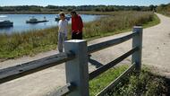
Neponset River Reservation
76 Hill Top St., Boston, MA 02124 DirectionsThe Neponset River Reservation extends from Milton, MA to the Boston Harbor. The Neponset is a natural inlet, and you'll find marshlands and freshwater wetlands all along its length. In addition to hiking and boating, you can also find playgrounds and spray decks throughout the reservation.Phone(617) 727-5290 -

Nickerson State Park
- Accessible
3488 Main St., Brewster, MA 02631 Directions1,900-acre Nickerson State Park is located in Brewster, MA on Cape Cod. There's plenty of wooded trails and ponds to explore, and Nickerson also offers more than 400 campsites.Phone(508) 896-3491 -

October Mountain State Forest
317 Woodland Road, Lee, MA 01238 DirectionsAt 16,500 acres, October Mountain is the largest state forest in Massachusetts. You'll find trails for any level of hiking experience, and you can also visit nearby Tanglewood, popular music venue and home to the Boston Symphony Orchestra.
Phone(413) 243-1778 -

Pittsfield State Forest
- Accessible
1041 Cascade St., Pittsfield, MA 01201 DirectionsThis sprawling, 11,000-acre forest includes Berry Pond and 30 miles of trails. Whether hiking, mountain biking, horseback riding, or exploring the mountain range to Berry Pond, you're sure to find the perfect outdoor adventure.Phone(413) 442-8992 -
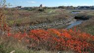
Pope John Paul II Park Reservation
- Wheelchair Accessible
Hallet Street, Boston, MA 02124 DirectionsOnce a landfill, Pope John Paul II Park now offers picnicking, trails, athletic fields, and more. This is also a good place to look for birds and wildlife, which have also benefited from the restoration.Phone(617) 727-6034