Location listing filters
Map for Canoeing and Kayaking in Massachusetts
Note for screen reader users, we suggest skip the following interactive map and go to the location listing for a better user experience.
Currently, the map is not accessible yet for a comprehensive experience.
skip to the location listing
Location Listing
Showing 49 - 55 of 55 results for Canoeing and Kayaking in Massachusetts Locations
-

Upper Charles River Reservation
- Wheelchair Accessible
96 Forest Grove Road, Waltham, MA 02453 DirectionsThe Upper Charles River Reservation extends from the Watertown Dam to Riverdale Park in West Roxbury, MA. Now that native plants have been restored to the riverbanks, birds and wildlife have returned. You can follow paths that wind along the Charles River, through the towns of Watertown, Waltham, Newton and Weston.Phone(617) 727-1058 -

Walden Pond State Reservation
- Wheelchair Accessible
915 Walden St., Concord, MA 01742 DirectionsLet a visit to Walden Pond bring you back in time to the mid-1800's. Experience the connection with nature that inspired Henry David Thoreau's Walden. Enjoy a day of swimming, walking around the famous pond or boating out on the water. Also be sure to visit the replica of Thoreau's single-room cabin.
Organized groups must call in advance to make a reservation. Park hours vary seasonally. ph. 978-405-2082
email. Walden.programs@mass.govPhone(978) 369-3254-
Sunday - Saturday:7:00 am-7:00 pm
-
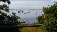
Waquoit Bay National Estuarine Research Reserve
131 Waquoit, East Falmouth, MA 02536 DirectionsWaquoit Bay has 2,700 acres of open waters, barrier beaches, marshlands, and uplands. The reserve is representative of typical shallow bay environment. Enjoy discovering the bay, by land or water.Phone(508) 457-0495 -
Webb Memorial State Park
- Wheelchair Accessible
371 River St., North Weymouth, MA 02191 DirectionsWebb Memorial State Park is a peninsula that extends half a mile into Hingham Bay. Visitors are treated to scenic views of Boston's harbor and skyline, and groups can rent a pavilion for special events from May - October. Available activities include fishing, picnicking, and walking.Phone(781) 337-8624 -
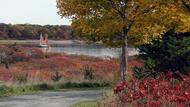
Wells State Park
- Accessible
159 Walker Pond Road, Sturbridge, MA 01566 DirectionsWells State Park was, established in 1968, is a 1400 acre public recreation area located off Route 49 in Sturbridge, Massachusetts. The park offers 12 miles of trails for hiking, mountain biking, horseback riding, and cross-county skiing. The woodlands are made up of an oak-hickory forest and northern hardwood forest types with groves of eastern white pine. Terrain is rugged with ledges interspersed between wetlands.
A notable trail leads to the cliffs of Carpenter Rocks, named after John Carpenter, who built and operated a sawmill nearby. Scenic views include the eastern section of Walker Pond and surrounding wooded valley.
Walker Pond's 104 acres provide opportunities for boating and fishing. The fish population is made up of largemouth bass, chain pickerel, yellow perch, white perch, bluegill, pumpkin-seed, brown bullhead, white suckers, golden and bridled shiners.Phone(508) 347-9257 -

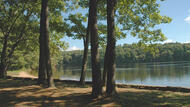
Wendell State Forest
- Accessible
392 Wendell Rd, Millers Falls, MA 01349 DirectionsWendell State Forest is 7,566 acres of rolling forested hills, streams, ponds, trails, a baseball diamond, and a picnic area. You can visit Wendell any time of year.Phone(413) 659-3797 -
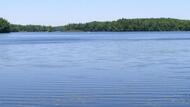
Whitehall State Park
300 Wood St., Hopkinton, MA 01748 DirectionsWhitehall State Park's main feature is the Whitehall Reservoir, where visitors can boat (boat ramp available) and fish. The reservoir is a popular icefishing spot, too. Hikers will find trails along the reservoir's edges.Phone(508) 435-4303