Location listing filters
Map for Mountain Biking Trails in Massachusetts
Note for screen reader users, we suggest skip the following interactive map and go to the location listing for a better user experience.
Currently, the map is not accessible yet for a comprehensive experience.
skip to the location listing
Location Listing
Showing 25 - 32 of 37 results for Mountain Biking Trails in Massachusetts Locations
-
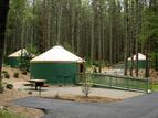
Otter River State Forest
86 Winchendon Road, Baldwinville, MA 01436 DirectionsOtter River State Forest is a popular summer destination for a day trips and camping. You can hike, mountain bike, and swim.
Due to recent weather conditions, snowmobile trails are closed until further notice.Phone(978) 939-8962-
Sunrise to sunset
-
-

Pearl Hill State Park
105 New Fitchburg Road, West Townsend, MA 01474 DirectionsCamp beneath a stately pine canopy in this 1000-acre park. Visitors can also hike, bike, and swim.Phone(978) 597-8802-
Sunrise to sunset
-
-

Pittsfield State Forest
- Wheelchair Accessible
1041 Cascade St., Pittsfield, MA 01201 DirectionsThis sprawling, 11,000-acre forest includes Berry Pond and 30 miles of trails. Whether hiking, mountain biking, horseback riding, or exploring the mountain range to Berry Pond, you're sure to find the perfect outdoor adventure.Phone(413) 442-8992-
Sunrise to sunset
-

Robinson State Park
- Wheelchair Accessible
428 North St., Feeding Hills, MA 01030 DirectionsCome and see the abundance of wildlife this park has to offer, including rare dragonflies and turtles.
You might also visit the historical Civilian Conservation Corps (CCC) buildings or take a hike along a portion of the Metacomet-Monadnock trail.
Phone(413) 786-2877-
Sunday - Saturday:9:00 am-8:00 pm
-

Savoy Mountain State Forest
- Wheelchair Accessible
260 Central Shaft Road, Florida, MA 01247 DirectionsSavoy Mountain State Forest offers more than 50 miles of trails. You can also camp at one our tent sites, or reserve a log cabin.Phone(413) 663-8469-
Sunrise to sunset
-

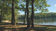
Tolland State Forest
410 Tolland Road, East Otis, MA 01029 DirectionsAt the center of Tolland State Forest sits the 1,065-acre Otis Reservoir, which offers a variety of recreational activities. A boat launch is available for boats up to 24 feet in length. No watercraft, except pontoon or sail powered boats, may exceed 24 feet in length. No boats with bathrooms are allowed on the Otis Reservoir.Phone(413) 269-6002-
Sunrise to sunset
-
-

Upton State Forest
205 Westboro Road, Upton, MA 01568 DirectionsThis 2,660-acre forest offers a mix of nature and history. Explore some of the historic structures built by the Civilian Conservation Corps, a program that provided employment during the Great Depression, located here. Visitors can also hike, cross-country ski, and more.Phone(508) 278-7604-
Sunrise to sunset
-
-
Wells State Park
- Wheelchair Accessible
159 Walker Pond Road, Sturbridge, MA 01566 DirectionsWells State Park was, established in 1968, is a 1400 acre public recreation area located off Route 49 in Sturbridge, Massachusetts. The park offers 12 miles of trails for hiking, mountain biking, horseback riding, and cross-county skiing. The woodlands are made up of an oak-hickory forest and northern hardwood forest types with groves of eastern white pine. Terrain is rugged with ledges interspersed between wetlands.
A notable trail leads to the cliffs of Carpenter Rocks, named after John Carpenter, who built and operated a sawmill nearby. Scenic views include the eastern section of Walker Pond and surrounding wooded valley.
Walker Pond's 104 acres provide opportunities for boating and fishing. The fish population is made up of largemouth bass, chain pickerel, yellow perch, white perch, bluegill, pumpkin-seed, brown bullhead, white suckers, golden and bridled shiners.Phone(508) 347-9257