Overview
The Massachusetts Interactive Property Map, developed by MassGIS, enables developers, banks, realtors, businesses, and homeowners to view seamless property information across the Commonwealth.
One of a handful of such state-sponsored tools in the country, the ongoing effort is the product of MassGIS working with community assessors, their mapping consultants, and other stakeholders. 1
Feature Highlights
Below are some of the features of the application:
Assessment Data
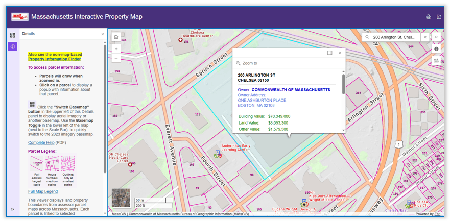
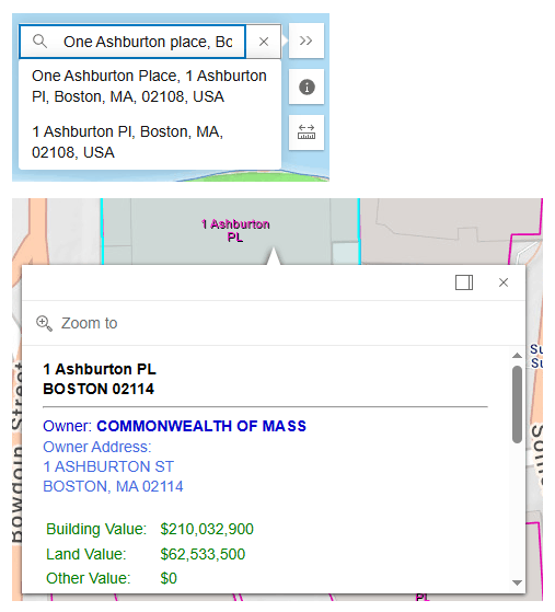
- Type an address or a place to zoom to that location. The first popup bubble is merely the address finder result. Then you must:
- Click on the parcel to view property information such as land valuation and owner. 2, 3
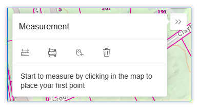
Distance Measurements
- Draw a line between points
- Measure the distance in miles, feet, yards, meters, kilometers, nautical miles
- Find geographic coordinates in a variety of units where you click on the map
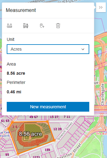
Area Measurements
- Draw a shape to measure a location, region, or land segment
- Show measurements in square feet/yards/meters/miles/kilometers, acres and hectares. 4
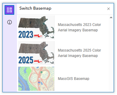
Switch Background
- Click the “Basemap” button to change the background map.
- Aerial photography is available from several years, as are USGS Topo maps and others.
Export or Print, Share
- Click the “Export or Print” button to print the map or save the map as a PDF file or image (in JPG or PNG formats). You can enter a title and choose to include a popup.
- Click the Share button to copy links to the app for social media or embedding on a web page.

Non-Map Property Information
The assessment data are also available in accessible format in the Property Information Finder, which meets 508 Compliance Requirements and allows you to search for property assessment data by address only. It does not include a map or the other features provided by the Interactive Property Map.
End Notes
1. Parcel Mapping
For full details about the statewide parcel mapping project and to download these free data for use in GIS software, see:
- MassGIS Standard for Digital Parcels and Related Data Sets
- Standardized Assessors' Parcels data layer (AKA Property Tax Parcels)
2. Property Assessments
MassGIS attempts to display annual updates of property information for each community. This, however, requires all communities to maintain and submit standardized assessor maps and assessor information. Until this effort is fully implemented, some of the assessor data may not be entirely current. The fiscal year of the information is displayed in a pop-up when you click a particular parcel.
The most up-to-date assessing information is available directly from each municipality, typically through the assessing department. Many municipal web sites have an online property lookup feature, usually on the assessor's page.
3. Data Sources
The Massachusetts Interactive Property Map displays property boundaries from assessor parcel maps for all 351 cities and towns in the Commonwealth. Each parcel is linked to selected descriptive information from the municipalities' assessor databases. Data are provided to MassGIS from each city or town or their GIS mapping contractors.
All data are served from MassGIS' ArcGIS Online organizational account. Boundaries (magenta lines) on the map are stored as a tile cache for fast display. Popup information is stored in a feature layer.
4. Property Boundaries
Assessor’s parcel mapping is a representation of property boundaries, not an authoritative source.
- The authoritative record of property boundaries is recorded at the registries of deeds.
- A legally authoritative map of property boundaries can only be produced by a professional land surveyor.
Contact
Online
Address
| Last updated: | April 6, 2026 |
|---|