The Viewer helps you find and learn about Wildlife Management Areas, Wildlife Conservation Easements, and other open space in Massachusetts. MassWildlife's WMAs and WCEs are all open to fishing, hunting, hiking, bird watching, and more!
- This page, MassWildlife Lands Viewer, is offered by
- Division of Fisheries and Wildlife
MassWildlife Lands Viewer
The Details
What you need
To get started:
- Open the Lands Viewer
- Use the search option to look for a town or specific property or zoom to a region on the map to explore
- Click on a property to get more information
- Click on the “P” for parking information and driving directions
- Use the Basemap Toggle feature (see image below) to switch to areal photo or topography base layer

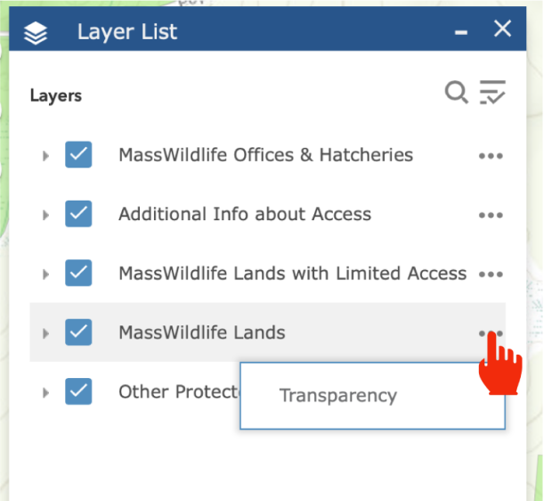
How to change the transparency in the Viewer
When zoomed in close, you may want to make the WMA or WCE shapes lighter to see property details. To adjust the transparency:
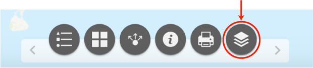
- Click on the “Layer List” icon
- After the list opens, click the three dots next to “MassWildlife Lands” and then click on “Transparency”
How to share and print
Once you have zoomed into an area of the map, you can share that zoom extent with a friend. Click on the "Share" icon (see image below) and a link will be generated that you can copy and send. To print, click the "Print" icon and follow the prompts.