The DCR Stewardship Council adopted the Charles River Esplanade-New Basin Complex Resource Management Plan on February 6, 2015.
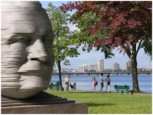
The Charles River Esplanade-New Basin Complex is located at the mouth of the Charles River in the municipalities of Boston and Cambridge. This designed landscape includes parkways, parks, historic structures, and natural areas along a three-mile-long portion of the Charles River Basin extending from the Boston University Bridge to Boston Harbor. DCR facilities located in the North End and Charlestown are also included in this Complex.
The Charles River Esplanade is well known for its Independence Day celebrations at the Hatch Shell. DCR staff assigned to the Complex manage the Cambridge and Boston Esplanades, New Basin Parks, City Square Park, Memorial and Storrow Drives, two indoor skating rinks, two dams, and six pedestrian bridges connecting adjacent neighborhoods to the parks. Eight boathouses, a yacht club, a food concession and the Museum of Science are operated by private organizations on DCR property within the Complex.
RMP documents
Charles River Esplanade - New Basin Complex RMP
Charles River Esplanade - New Basin Complex RMP Appendices
Charles River Basin - New Basin Complex RMP Executive Summary
Public process
Public input is an important component of the RMP process. It enhances communication and cooperation among DCR, park visitors, stakeholders, partners, and the surrounding communities. Comments and suggestions received by DCR in the course of the public process surrounding the preparation of the RMP served to highlight issues for our attention and were an important component in our planning. DCR hosted public meetings for this RMP on October 10, 2013 and September 18, 2014.
Contact
Online
Phone
Open M-F 9am-5pm