Quick facts
ILF Funding: $205,491
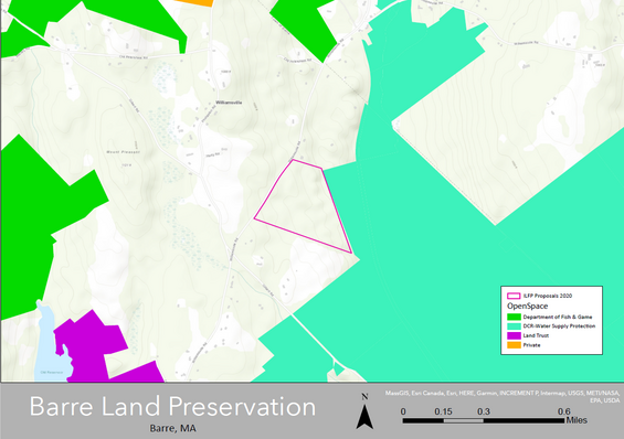
ILF Service Area: Quabbin Reservoir / Worcester Plateau
Project Location: Williamsville Road, Barre, MA (latitude: 42.464978, longitude: -72.083215)
Property size: 40 acres
Project summary
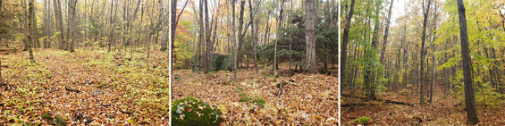
Mount Grace Land Conservation Trust is using ILF Program funds to buy a 40-acre parcel of land. The parcel includes 0.9 acres of forested wetlands, a certified vernal pool, 3,900 feet of stream, and 36.1 acres of forest. It drains into the Burnshirt River. The Burnshirt River is part of the Ware River Watershed Protection Area. The Ware River provides water to the Quabbin Reservoir. The Reservoir supplies drinking water to the Metro-Boston area. This designation extends across the adjacent Ware River Watershed Protection Area. Because the property boundary follows Williamsville Road for 1,400 feet, it could have been cleared to build as many as eight houses. Conserving this land also protects it from potential logging or solar power installation. Mount Grace Land Trust will donate a watershed protection restriction to the Massachusetts Department of Conservation and Recreation's Office of Watershed Management (DWSP). Mount Grace Land Trust will manage the property, and DWSP will monitor it.
Ecological attributes
- Zone C Water Supply Protection Area as designated by Massachusetts Department of Environmental Protection
- BioMap 2 Critical Natural Landscape and Core habitat—southeast corner of subject parcel
- High integrity designated by the CAPS Index of Ecological Integrity