Quick facts
ILF Funding: $260,000
ILF Service Area: Coastal (Coastal-South Subarea)
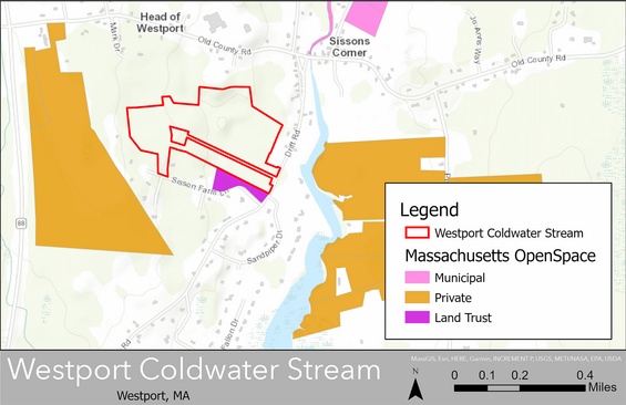
Project Location: 0 Drift Road, Westport, MA (latitude: 41.618276; longitude: -71.066200)
Property size: 50 acres
Project summary
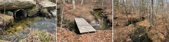
The Buzzards Bay Coalition (BBC) Watershed Protection program requested In Lieu Fee (ILF) Program funds to protect a parcel of land in Westport, MA. The parcel contains approximately 46.4 acres of upland and 3.6 acres of forested wetlands. About 6,600 linear feet of stream run through it as well. The parcel includes most of the watershed for Lyons Brook. Lyons Brook is a coldwater tributary of the Westport Rivers Estuary—East Branch. Native eastern brook trout spawn here, indicating the high quality of the stream. The Westport Rivers Estuary is the only known location in southern New England where several streams that have sea-run brook trout flow into the same estuary. This feature makes this a key site for supporting sea-run brook trout populations. If BBC and the Westport Land Trust had not bought this parcel, a developer could have built housing here. The property also borders BioMap2 Core Habitat and Critical Natural Landscape along the Westport River Estuary – East Branch. This coastal ecosystem is valuable for reducing water pollution and providing wildlife habitat.
Ecological attributes
- Borders BioMap2 Core Habitat along Westport River Estuary—East Branch
- Borders Critical Natural Landscape along Westport River Estuary—East Branch
- Reducing water pollution
- Providing wildlife habitat