Air permit applicants should use MassDEP processed AERMET files when using AERMOD; applicants should not process their own meteorological data.
The zipped files include processed surface and upper air meteorological data. MassDEP recommends that you consult with the air modeling staff in the MassDEP Boston office on which meteorological data set is most appropriate for your permit modeling needs.
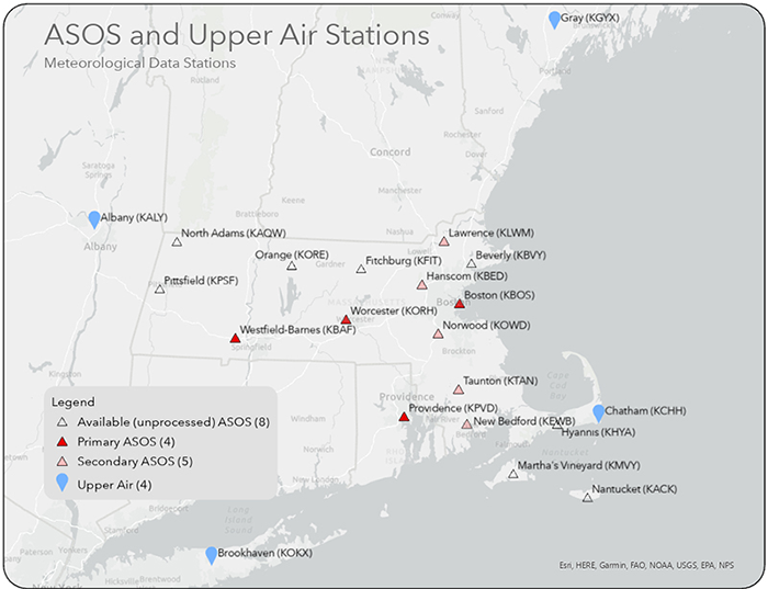
The map below shows the locations for which data are available, including the 9 meteorological stations with AERMOD-ready meteorological data (i.e., *.sfc and *.pfl files) available for download. These are processed with the ADJ_U* option. Select individual meteorological stations under Latest Available Data (below) to download the individual station zip files.
The meteorological data sets are suitable to use for modeling required by the Environmental Results Program (ERP) and Air Plan Applications.
Latest Available Data 2019 - 2023
Primary ASOS
Providence Green Airport (KPVD)
Worcester Regional Airport (KORH) Due to insufficient data capture at the Albany upper air station in 2022 and 2023, the Worcester (KORH) 5-year dataset is not updated. Please continue to use this 2017-2021 dataset.
Westfield-Barnes Regional Airport (KBAF) Due to insufficient data capture at the Albany upper air station in 2022 and 2023, the Westfield (KBAF) 5-year dataset is not updated. Please continue to use this 2017-2021 dataset.
Secondary ASOS
Lawrence Municipal Airport (KLWM)
New Bedford Regional Airport (KEWB)