Quick facts
ILF Funding: $234,500
ILF Service Area: Coastal (Coastal-North sub area)
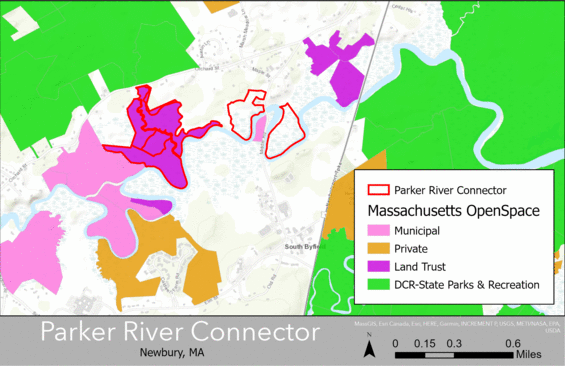
Project Location: Middle Road / Orchard Street, Newbury, MA (14-acre parcel latitude: 42.759170, longitude: -70.903322; 20-acre parcel latitude: 42.757445, longitude: -70.899149; 66-acre parcel latitude: 42.756310, longitude: -70.911830)
Project summary
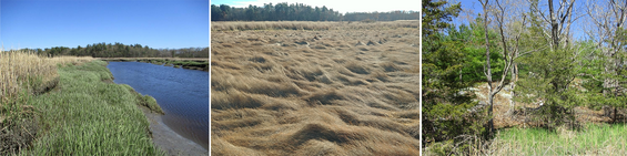
The Department of Fish and Game / Division of Fisheries and Wildlife (DFG/DFW) Land Protection Program requested In Lieu Fee Program funds to permanently protect land in Newbury, MA. The land includes three properties along the Parker River. DFG bought the two smaller properties. Essex County Greenbelt Association (Greenbelt) owns the third property. They donated a conservation restriction on the land to DFG. Greenbelt's property includes salt marsh on either side of Cart Creek. Salt marsh dominates all three properties, occupying more than 75 acres of the land. The land DFG purchased includes 4 acres of freshwater wetlands. The remaining 15 acres of protected land are upland. A developer could have built houses here if not for this project. The properties are within the Great Marsh Area of Critical Environmental Concern. They provide an important connection for wildlife movement. DFG's Martin Burns Wildlife Management Area (WMA) and William Forward WMA protect large areas of land nearby. The Massachusetts Natural Heritage and Endangered Species Program (NHESP) values these properties for species of concern. NHESP also designated these properties as important for aquatic habitat and climate change.