Rivers and Roads
Our Rivers & Roads Training Program aims to improve project design and resource management, to build long lasting roadways while also protect rivers and streams. Attendees learn about fluvial geomorphology (river process and form), and how we can use this field of study to supplement traditional highway engineering practices. Training courses explain how to avoid future damage by using new design practices where river-road conflicts exist. The training includes three tiers:
- Tier 1: 2-Hour Online Course to Introduce Fluvial Geomorphology
- Tier 2: Course to Advance understanding of Fluvial Geomorphology
- Tier 2A: 1-Day Classroom and River Flume Activity
- Tier 2B: 1-Day Field Trip
- Tier 3: 1-Day Subject Matter Courses to Support Project Review and Implementation
The course is offered in all six MassDOT Highway Division Districts so it can be tailored to local conditions and concerns. Participating Cities and Towns use the course information to help design and build projects that last longer, cost less, and have la friendlier environmental impact.
Over 300 trainees have attended the courses including: MassDOT designers, construction engineers, hydraulics engineers, and environmental personnel, consulting engineers, scientists, and planners; municipalities; environmental agency staff; and members of non-governmental organizations.
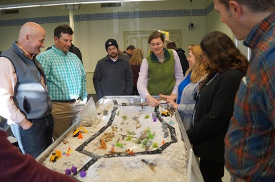
Fluvial Geomorphology training: Classroom and River Flume activity
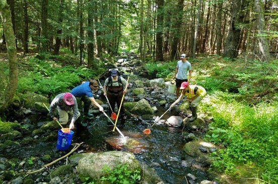
Fluvial Geomorphology training: Day field trip
Additional Resources
- Rivers and Roads Training: Introduction
- Rivers and Roads Training: River and Floodplain Cross Section
- River and Roads Training: Profile Measurement and Application
- Rivers and Roads Training: Aquatic Habitat
-
Open PDF file, 175.17 KB, Rivers and Roads Training: Bankfull field form (English, PDF 175.17 KB)
2020 EPA Environmental Merit Award
MassDOT's Rivers and Roads training earned an Environmental Protection Agency (EPA) Environmental Merit Award in 2020.
The program is part of the Department's Fluvial Geomorphology Program and has brought about a culture change at MassDOT. Those who attend the training learn how to reduce future damage through innovative design practices at locations of river-road conflicts. The program promotes flood resiliency planning that helps save money, keeps the public safer and reduces flooding and erosion. It also protects rivers and water quality while improving river habitat. This program has helped reinforce the proper sizing of bridges and culverts. The program has brought together trainees from many disciplines and sectors to change the way business is done at MassDOT and across the Commonwealth's transportation sector.
Case Study: Streambed & Bank Restoration, Ireland Street Bridge over West Branch Bronson Brook, Chesterfield.
In June 2019 MassDOT replaced a bridge over a high-priority cold water stream, which provided habitat for a rare species, that met the Massachusetts River and Stream Crossing standards. The National Park Service and the other environmental agencies are very happy with the outcome. This project demonstrates how including fluvial geomorphology into early project planning can improve habitat, aesthetics, and resiliency, and can lead to a better project outcome.
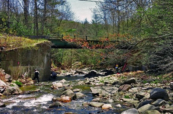
Before: Pre-existing bridge with north abutment located within the stream channel thalweg (deepest part of the channel.)
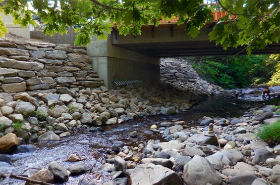
After: Implementing New Stream Crossing Standards. New bridge with abutments with channel dimensions set to 1.2 times bankfull width, natural streambed/bank material over riprap, and stacked riprap walls.
Case Study: Restored South River Retaining Wall Project, South River Route 116, Conway.
By replicating the natural bank, the river is unlikely to flood past the retaining wall and street.
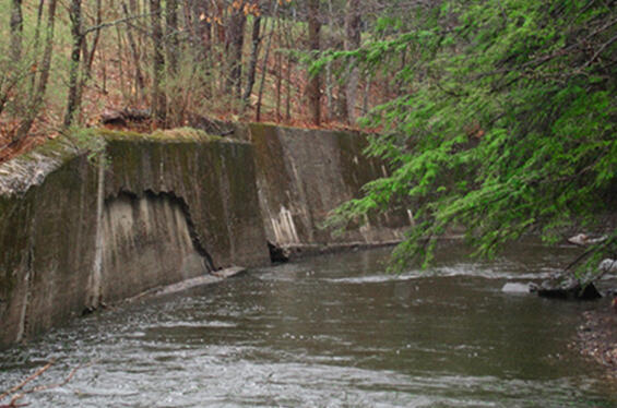
Before, 2014: The retaining wall has failed due to the South River head-cutting the riverbank.
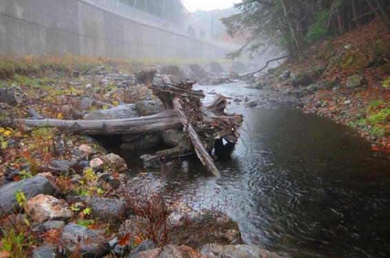
After, 2016: Added vegetation, large rocks and sediment for armoring, and log jams to create a controlled flow that is a risk of eroding the riverbank.