
About the project
Project background
The Route 28 corridor has a history of crashes, leading to public safety concerns raised by the Milton community. To address this issue, MassDOT conducted a Road Safety Audit (RSA) and hired a consultant to conduct a Corridor Study. The RSA and the Corridor Study found that the roadway has a lot of congestion from both neighbors using this as an arterial and cut-through traffic at peak periods. Travel speeds are high when there is less congestion during off-peak periods. Residents and businesses have difficulties entering and exiting driveways from the roadway.
A road diet pilot was selected as an appropriate solution because of the corridor’s crash history, ongoing safety concerns, and community advocacy. The goals of the pilot are to reduce fatalities and serious injuries, speeds, and conflict points along Route 28. The pilot allows MassDOT to provide immediate changes to the roadway and utilize the results to aid in long-term planning efforts for full corridor reconstruction.
Pilot duration
The Route 28 Road Diet Pilot was fully implemented on Sunday, October 12. The pilot will be in place from Fall 2025 through Spring 2026. During this time, MassDOT will be monitoring traffic patterns, analyzing safety data, and listening to community feedback. Once the pilot is complete, an evaluation period will begin to assess the effectiveness and overall impact of the design. MassDOT will review all the necessary information before determining next steps.
Any questions, comments, or concerns can be shared directly with the project team via the project email found under the Contact section at the bottom of this page.
Pilot design
Originally, the Route 28 corridor had four travel lanes, minimal shoulders and sidewalks, and no bicycle facilities. The current pilot design has two travel lanes with wider shoulders, two-way left-turn lanes (TWLTL), and painted medians with flex posts. The roadway design differs along the segments of the roadway to respond to the needs of the surrounding land-use.
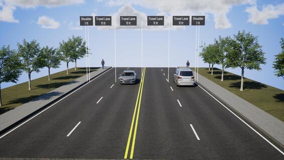
Previous cross-section on Route 28
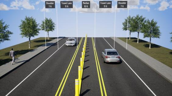
Painted medians with flexible delineator posts mounted on raised curbing were installed along the segments of Route 28 where access needs are reduced and alternative routes are available.
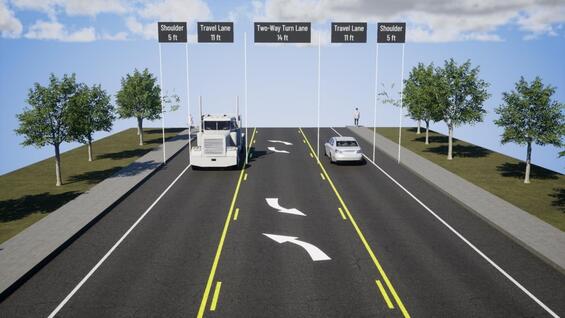
Two-way left-turn lanes were installed along sections of Route 28 with higher land-use density and greater access needs.
Data Collection, Observations, and Modifications
The project team conducted roadway and intersection traffic counts at several locations to help inform the pilot’s design.
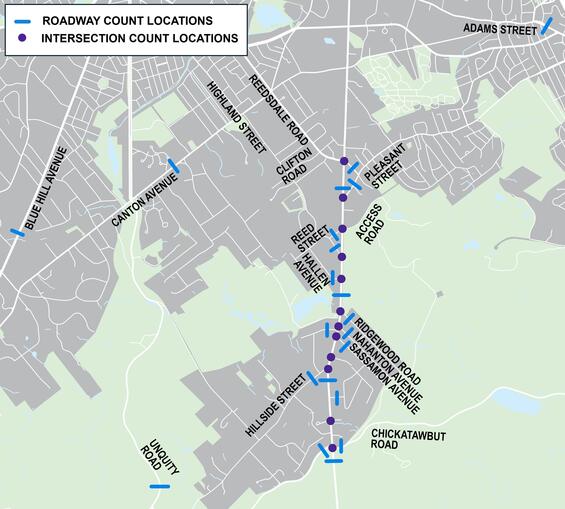
The project team will continue to conduct observations and collect data on traffic patterns, travel times, safety data, and community feedback throughout the duration of the pilot to assess its effectiveness and overall impact.
Next steps
The pilot will be in place from October 2025 through Spring 2026. At this point, MassDOT will evaluate the project based on the four pillars of the Road Diet Pilot: improves safety, maintains operations, maintains or strengthens access, and easy implementation. There will be opportunities for the public to provide feedback to the project team while the Pilot is active.
Pilot photos
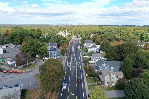
Facing north on Route 28 at Milton DPW

Facing south on Route 28 at Pleasant Street

Facing south on Route 28 at Nahanton Avenue
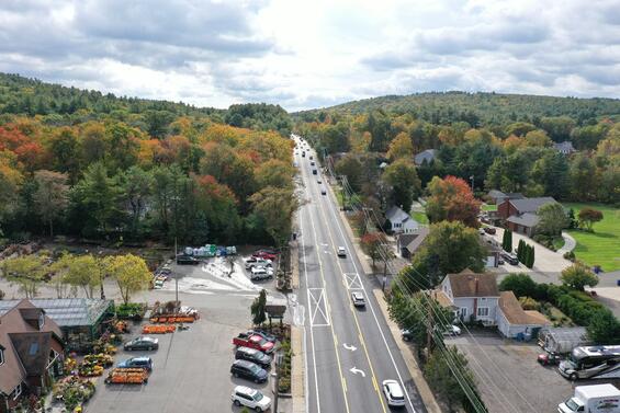
Facing south on Route 28 at Eagle Farms/Newcomb Farms
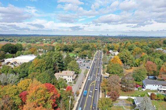
Facing north on Route 28 at Eager Road

Facing north on Route 28 at Chickatawbut Road
Local examples
Tactical medians
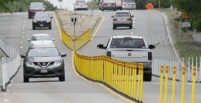
Route 3A Road Diet in Hingham, MA
Two-way left-turn lanes
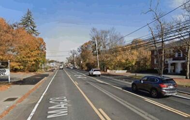
Route 28 in Reading, MA
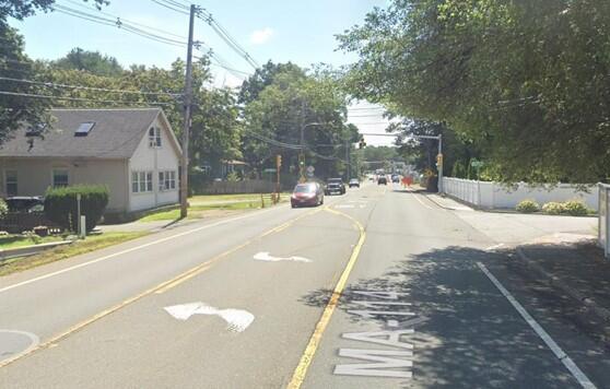
Route 114 in Middleton, MA
Additional resources
-
Open PDF file, 410.6 KB, Milton Route 28 Road Diet Pilot - fact sheet 2025 (English, PDF 410.6 KB)