Overview
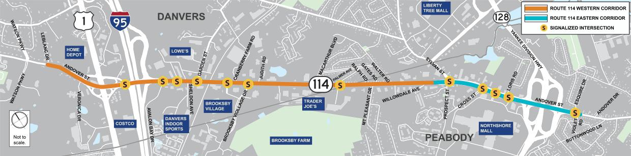
In response to fatal crashes between 2019 and 2021 along the Route 114 corridor, MassDOT, in collaboration with the City of Peabody, Town of Danvers, Representative Tom Walsh's Office, Representative Sally Kerans’ Office, and Senator Lovely 's Office, conducted a Road Safety Audit (RSA) of Route 114 from Sylvan Street in Peabody to Leblanc Drive at the Peabody/Danvers town line. This section will be called the Western Corridor throughout this website. The purpose of an RSA is to identify contributing factors to safety issues along a road and at intersections to identify possible opportunities for safety improvements for all roadway users.
Access Management
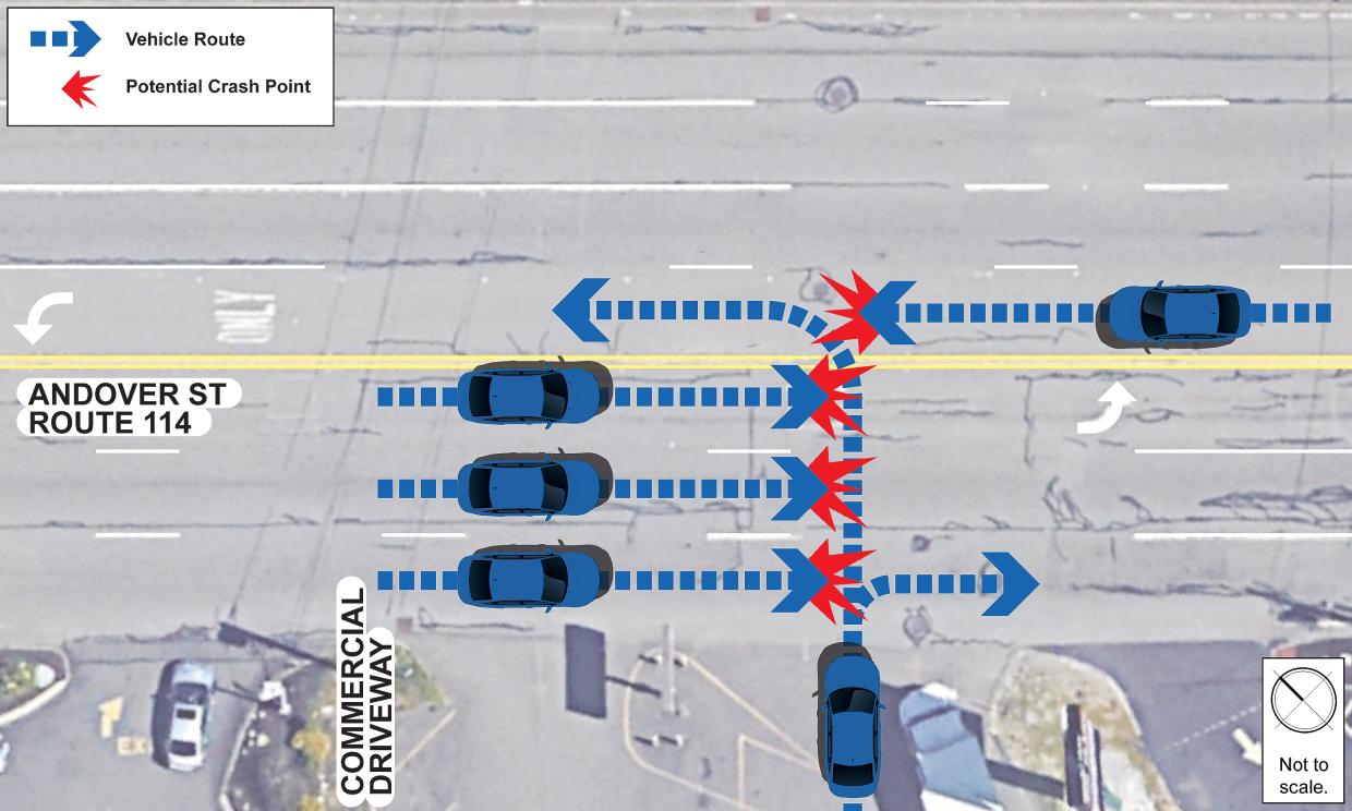
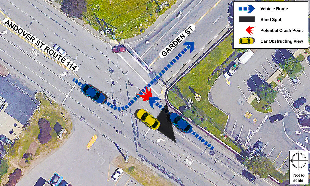
44% of crashes that occurred between 2019 - 2021 were angled crashes. These crashes generally occur with vehicles traveling along Route 114 and other vehicles either entering or exiting businesses or side streets. With traffic volumes, speed of travel, number of lanes, and proximity of driveways/side streets, entering and exiting the corridor presents safety hazards for drivers.
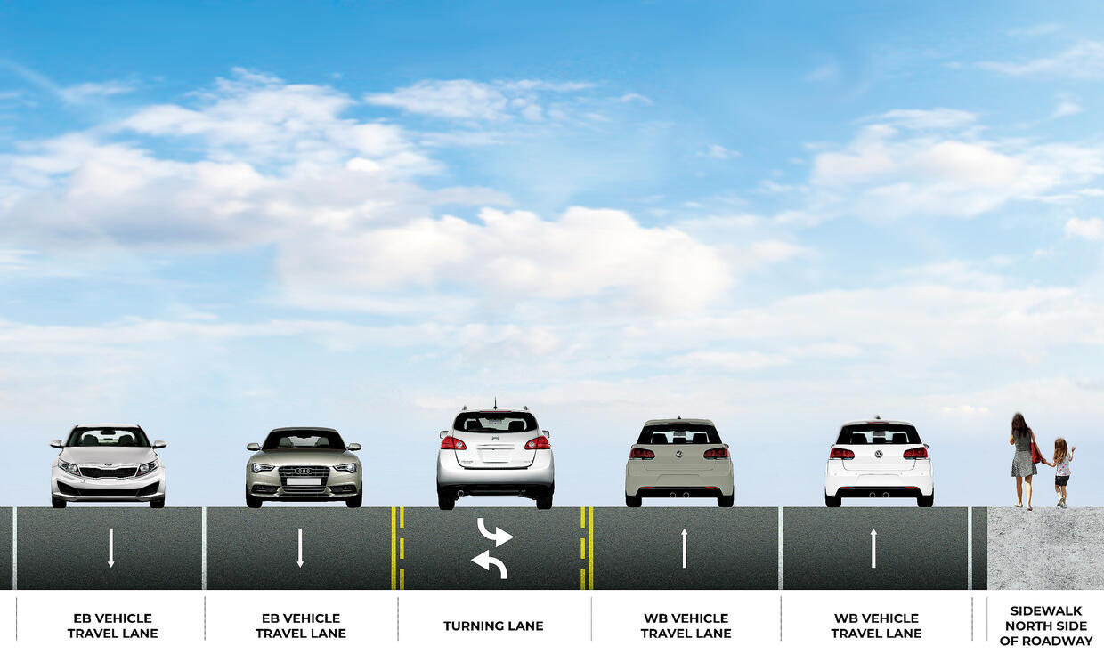
Route 114 Corridor Cross Section
5+ wide lanes of travel with narrow, sometimes non-existent, shoulders contribute to speeding and weaving. Vehicles traveling at excessive speeds on Route 114 make it harder for turning vehicles to enter or exit driveways or side streets and create more severe crashes when they occur. The speed limit generally varies from 30mph to 40mph along different sections of the corridor; however. 85th percentile speeds have been measured around 45mph.
Two-Way Left Turn Lane Issues
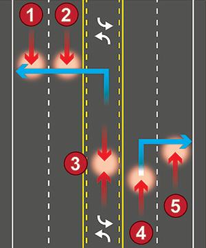
Inappropriate use of the corridor's two-way left-turn lane is also a major issue.
19 of the crashes recorded between 2019 - 2021 occurred with a vehicle traveling in the two-way left-turn lane. Drivers have been observed to enter the turn lane much earlier than needed to make their turn, using it instead as a third travel lane in order to avoid traffic in the travel lanes. This can lend itself to dangerous head-on collisions.
Signalized Intersection Safety Issues
Lack of Protected Left Turn Phase: The Flashing Yellow Turn-Signals provide unsafe conditions for left-turning vehicles, as a driver must find an appropriate gap between multiple lanes of fast-moving traffic.
Emergency vehicle pre-emption (EVP): These provide a green light to emergency vehicles that are enroute to a scene of an emergency. Along the Route 114 corridor, none of the intersections provide EVP. Lack of EVP can delay the arrival time of emergency vehicles and lead to potential collisions.
Retroreflective backplates: These assist with driver visibility of traffic signals during the day and night. The lack of these backplates on some traffic signals may contribute to solar glare during the day and lack of visibility in dark conditions, which can then lead to rear end crashes.
Lack of Pedestrian and Bicycle Accommodations
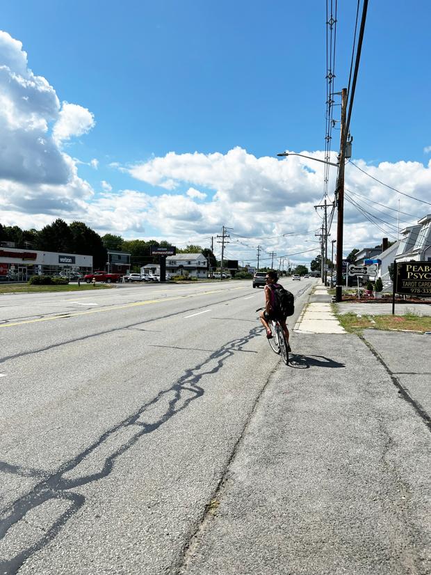
Sidewalk is generally only present on the north side of the roadway, is narrow and is close to vehicular traffic. Although there are no bicycle accommodations along the corridor, cyclists have been observed to still use the corridor. The lack of separate bicycle facilities provides an unsafe shared condition for cycling through the Route 114 corridor.
Lack of Crossing Opportunities: With destinations on both the north and south side, pedestrians and cyclists have been observed crossing Route 114 at uncontrolled locations. There are only three crosswalks across Route 114 along these 3 miles of roadway. In 2019, a fatal crash occurred when a cyclist crossing Route 114 from north to south near Willowdale Avenue under dark-lightened conditions was struck by a vehicle traveling eastbound on Route 114 stuck the cyclist. There was also a crash involving a pedestrian near the Walmart Driveway where the pedestrian was in the middle of the road in a flush, corrugated concrete divider. Traffic data collected indicates that there are pedestrians crossing at intersections which currently do not have crosswalks or pedestrian phases. In addition, the pavement markings for pedestrian crossings that do exist are generally faded or do not provide pedestrian signalization
Interchange Safety
The RSA noted safety issues with the Route 1 and I-95 interchanges which are discussed in detail in the report but are not the focus of the Safety Improvements project. Improvements to interchanges have requirements that push it out of a “quick-build” implementation process.