Coast Guide Online is an interactive map developed by CZM for use on mobile phones and tablets, as well as desktop computers. It includes more than 1,900 sites along the Massachusetts coast that are owned by government agencies and nonprofits and open to the public—from long, sandy beaches and rocky shores to small rights-of-way and public landings.
Launch and Go
Start off by opening Coast Guide Online to display the “Intro” tab, which includes a description of the online mapping tool and details on how to use it. Coast Guide Online also includes the following tabs:
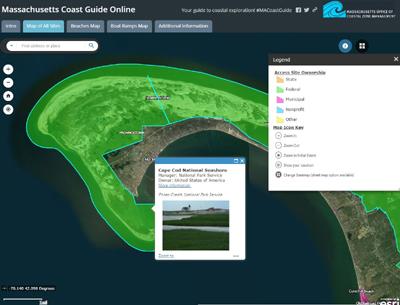
- Map of All Sites - The complete Coast Guide Online map with more than 1,900 sites that can be zoomed to and clicked for pop-up boxes displaying the site name, manager/owner, link to additional information, and photo (if available).
- Beaches Map - A map of more than 400 public beaches.
- Boat Ramps Map - A map of public boat ramps suitable for launching a boat from a trailer.
- Trails and Harbor Walks Map - A map of public access sites that contain trails, walkways, or harbor walks.
- Additional Information - Contact information for providing updates or revisions to Coast Guide Online; a listing of the data sources and information on data limitations; and links to information on public access rights along the Massachusetts coast and tips for getting to, protecting, and enjoying these areas.
What Places Are Included?
The Massachusetts shore offers much more than large, public beaches. Coast Guide Online highlights this diversity by including smaller and lesser known beaches, along with rocky coasts, shore-side parks, public boat ramps, local harbor walks, secluded coves, marshes and creeks, scenic overlooks, islands (some that are only accessible by boat), small rights-of-way, and much more. Many of these sites have no parking, or restricted parking, particularly in peak season. They are included for people who travel by public transportation, bike, or on foot, or who live in the area or stay in a local motel or bed & breakfast.
Coast Guide Online identifies coastal access points and properties owned by government agencies or land conservation organizations. State agencies include the Department of Conservation and Recreation, Department of Fish and Game, Massachusetts Water Resources Authority, and University of Massachusetts. Federal agencies include the U.S. Fish and Wildlife Service, National Park Service, U.S. Coast Guard, and U.S. Army Corps of Engineers. Example nonprofit owners include The Trustees of Reservations, Massachusetts Audubon Society, and Wildlands Trust. All municipalities from Salisbury to Rehoboth also own coastal access sites. Coast Guide Online does not include properties with conservation restrictions or unknown or contested ownership or boundaries, or any landlocked areas that can only be accessed over private property.
How Was the Information Collected and Checked?
The sites in Coast Guide Online were mapped using the Massachusetts Office of Geographic Information (MassGIS) Level 3 Assessors' Parcel Mapping data layer, which contains property boundaries from each community's assessor. Published documents and websites from government and nonprofit sources were used to confirm and update the information.
Ownership Verification
Despite extensive quality control efforts, neither on-the-ground property boundaries nor individual ownership of all parcels has been independently verified. CZM makes no representations or warranties with respect to the definitiveness of the private or public ownership data presented in Coast Guide Online. All issues related to questions of ownership of coastal property should be investigated at the local Registry of Deeds.
Help Improve Coast Guide Online
If you discover errors or have other useful information, please email your comments to CZM’s Dan Sampson at daniel.sampson@mass.gov.


