
Strategic Plan Updates
AppGeo crafted the State’s geospatial strategy based on the survey and workshops input from the community. AppGeo was also asked to develop an implementation plan for one of the strategic objectives. That implementation plan will be used as a model to develop implementation plans for the other three to four strategic objectives. Those implementation plans will help ensure that the strategic plan is implemented over the next several years. The strategy will also include a methodology for periodic touchpoints during the time period covered by the plan, to see how things are going and to update or modify the direction as conditions warrant.
Now that the stakeholder input has been gathered via the survey and the workshops, AppGeo is working over the next few months to distill the engagement feedback and write the Plan, which will be published by the end of June. Review the workshop presentation.
Strategic Plan Regional Workshops
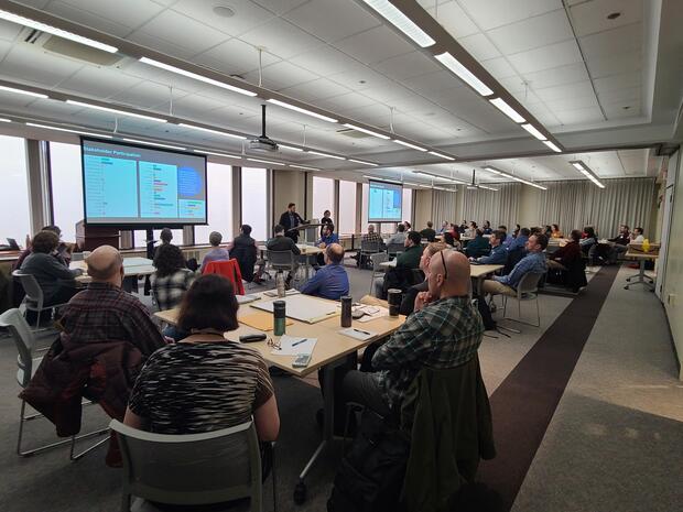
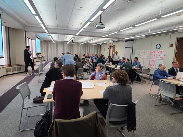
Close to 200 people attended a series of six workshops, which were held around the state to engage participants in dialogue regarding the strategic direction of geospatial technology, data development, and collaboration in the Commonwealth.
Read the Workshop Summary Documentation. This report summarizes the workshop findings that will be used in developing strategic plan elements.
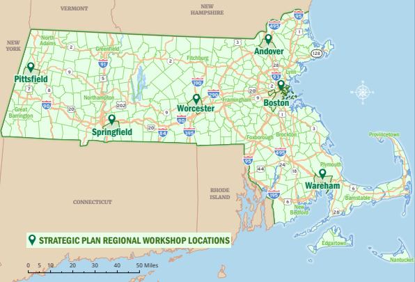
Regional stakeholder workshops were held in the following communities in Feb.-March 2024:
- Pittsfield - 70 Allen St, Pittsfield MA 01201 | Tuesday, Feb. 20, 9:00 AM - Noon
- Springfield - One Armory Square Springfield Technical Community College, Scibelli Hall of Building 2 | Wednesday, Feb. 21, 9:00 AM - Noon
- Wareham - 59 Marion Road, Wareham MA 02571 | Tuesday, Feb. 27, 9:30 AM - 12:30PM
- Worcester - 499 Plantation Parkway, Worcester MA 01605 | Wednesday, Feb. 28, 9:00 AM - Noon
- Boston - 1 Ashburton Place, Boston MA 02108 21st floor | Tuesday, March 5, 9:00 AM - Noon
- Andover - 32 North Main Street, Andover MA 01810 | Thursday, March 7, 9:00 AM - Noon
MassGIS Director and State Geospatial Information Officer Cy Smith participated in each of the six workshops and met many users from the geospatial community.
“There are opportunities right now to take the next steps forward with geospatial data and technology in Massachusetts. This strategic planning initiative gives us a chance to align our thinking across the Commonwealth. That common perspective will enable us to make the case that geospatial data and technology are critical and indispensable tools for solving all the wicked problems we share”
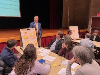
The Springfield workshop on February 21, 2024

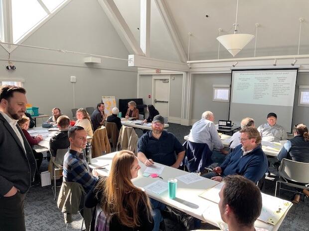
The Wareham workshop on February 27, 2024
The Worcester workshop on February 28, 2024
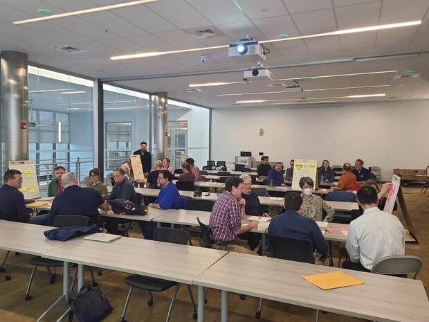
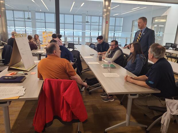
The Boston workshop on March 5, 2024

Strategic Plan Survey
The strategic planning initiative began with a survey seeking initial feedback on direction and improvements from all geospatial data users and providers. The survey helped to guide the Strategic Plan process. Below are some of the survey results.
The survey reached stakeholders across the state, with a few responses coming from neighboring states and elsewhere in the U.S.
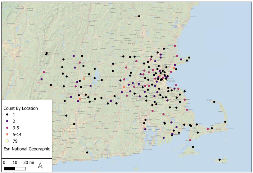
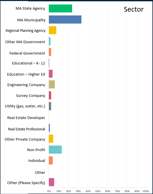
427 responses were received from these sectors:
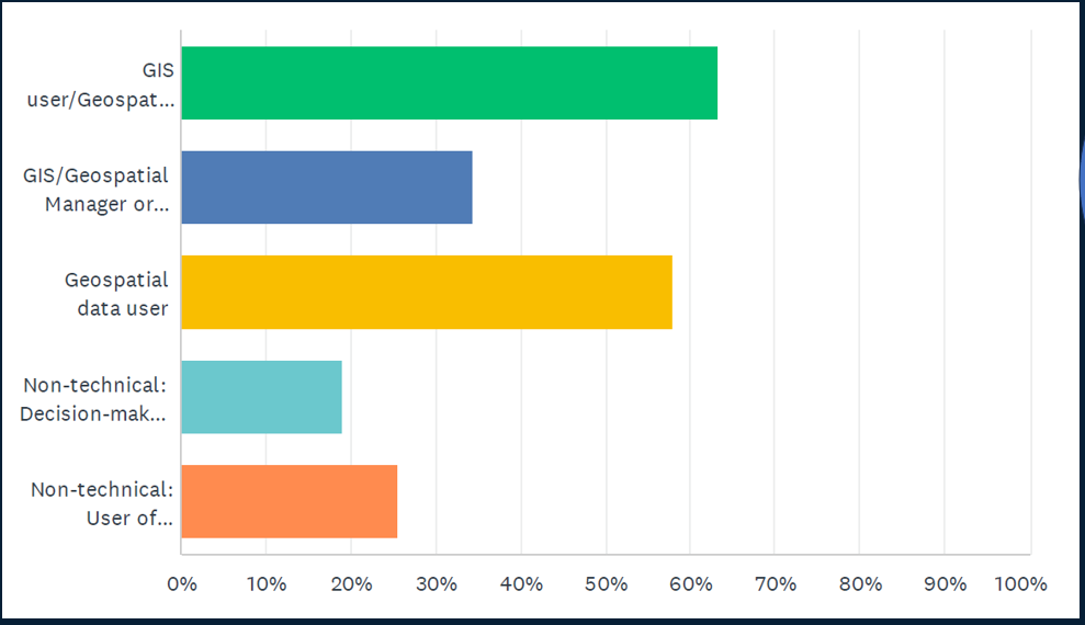
Participant Roles & Relationship to Geospatial Data/Tech. Most participants were geospatial data and technology users, with 88% describing GIS as essential to their work.
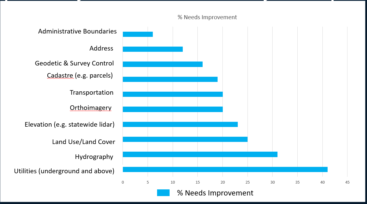
We asked what data are important and if it needs improvement. All data themes were important – above 90%. However, responses differed about needs for improvement.
| Date published: | April 24, 2025 |
|---|---|
| Last updated: | April 24, 2025 |