

Massachusetts State Seal An official website of the Commonwealth of Massachusetts Here's how you know

Official websites use .mass.gov

A .mass.gov website belongs to an official government organization in Massachusetts.

Secure websites use HTTPS

A lock icon or https:// means you've safely connected to the official website. Share sensitive information only on official, secure websites.

Sculpin Ledge

Sculpin ledge reef resides in Boston Harbor. It was created as part of the "Big Dig" project.

About the reef

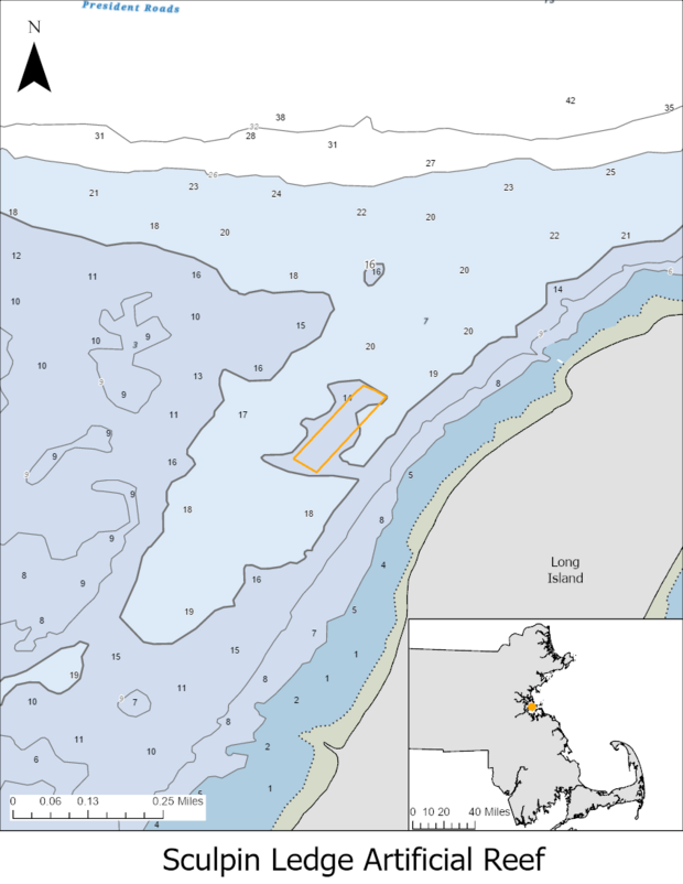
Map of the artificial reef called Sculpin Ledge.
Location of the Sculpin Ledge Artificial Reef in Boston Harbor, Massachusetts. The orange polygon indicates the reef boundaries, with the inset showing its location relative to the Massachusetts coastline. Central Coordinates (decimal degrees): 42.32402, -70.97085

In 1999, the Massachusetts Turnpike Authority (MTA) constructed Sculpin Ledge reef in Boston Harbor. This construction was part of Massachusetts’ “Big Dig” Project. MTA built the reef to provide mitigation for marine habitat impacts resulting from the restoration of Spectacle Island, where fill from the Big Dig was used to create a public park. The artificial reef serves as a habitat for blue mussels, lobster, and other fish and shellfish. The reef site consists of 17 terrace-type modules and 6 boulder patch reefs. 

Current status of the reef 

DMF maintains an acoustic receiver at this site that detects and records any fish previously fitted with an acoustic tag when they are present near the reef. Data is recovered during annual visits to the site.

Today, you can find a variety of fish species on the reef, including; 

  • Blue Mussel  
  • Cunner  
  • Jonah Crab 
  • Lobster 
  • Skates 
  • Winter flounder 
  • Striped Bass 

Help Us Improve Mass.gov  with your feedback

Please do not include personal or contact information.
Feedback