Location listing filters
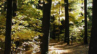
Map for Bash Bish Falls State Park
Note for screen reader users, we suggest skip the following interactive map and go to the location listing for a better user experience.
Currently, the map is not accessible yet for a comprehensive experience.
skip to the location listing
Location Listing
Showing 1 - 4 of 4 results for Other locations related to Bash Bish Falls State Park
-

Beartown State Forest
- Wheelchair Accessible
69 Blue Hill Road, Monterey, MA 01245 DirectionsThis 12,000 acre forest is the perfect place to visit no matter the season. Swim, boat, or fish in Benedict Pond. In the winter, you can cross-country ski and snowmobile.Phone(413) 528-0904-
Sunrise to sunset
-

Jug End State Reservation & Wildlife Management Area
Jug End Road, Egremont, MA 01230 Directions1,158-acre Jug End offers some of the best scenic views of the Berkshires. In addition to having its own trails, Jug End also offers access to and parking for the Appalachian Trail.Phone(413) 528-0330-
Sunrise to sunset
-
-
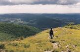
Mount Everett State Reservation
143 East St., Mt. Washington, MA 01258 DirectionsMt. Everett offers fantastic views and hiking trails for all levels of experience.Phone(413) 528-0330-
Open year-round, sunrise to sunset
-
-
Mount Washington State Forest
545 East St., Mount Washington, MA 01258 DirectionsThe re-grown red oak northern hardwood forest of Mt. Washington State Forest offers more than 30 miles of trails for hiking and mountain biking. Hike the South Taconic Trail to the 2,250 ft. elev. summit of Alander Mountain for a breathtaking view.
Phone(413) 528-0330-
Sunrise to sunset
-