- Division of Marine Fisheries

Beginning in 2023, one of the biggest blind spots in the assessment and management of commercial fisheries will be resolved. Precise location of lobster fishing effort, especially in federal waters, has been absent from the collection of statistics for this important fishery. Over the past two decades nearly all other important offshore commercial fisheries (such as scallops, groundfish, and surf clams) have been required under federal regulations to deploy vessel monitoring systems that reveal and archive fishing locations. A new coastwide requirement for tracking devices to be placed on lobster vessels operating in federal waters will soon address this deficiency.
Why is it critical for lobster fishery vessels to reveal more specific fishing locations? The lobster fishery must establish its footprint in the face of competing uses of the ocean: offshore wind development, aquaculture, and divergent conservation objectives including protection of North Atlantic right whales. These challenges require detailed data that can show which fishing grounds are vitally important to the commercial lobster fishery. Zoning of the ocean is a new management challenge for fishery managers as these new users and interconnected management objectives might impinge on lobstermen’s ability to fish their traditional fishing grounds.
This rule change will not affect commercially permitted vessels that only have a state permit and are therefore eligible to fish only in state waters. Lobster fishing activity in state waters close to shore has been sufficiently documented through DMF’s historic and current catch reporting requirements. Trip-level reporting with state level statistical sub-areas (i.e., state waters divided into 14 smaller geographical zones) has been required since 2010, and for many decades prior to that, lobstermen submitted an annual catch report summarizing catch and landings by state statistical area as well.
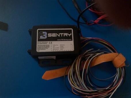
The Atlantic States Marine Fisheries Commission approved the management plan (Addendum XXIX) in March that mandates all states—by the end of 2023—require vessels in their state with federal lobster permits to deploy an electronic tracker to collect and transmit spatial data. ASMFC staff working with DMF and other states’ staff biologists have successfully tested trackers over the past few years. Vessel location will be collected every minute when not docked or moored; this will allow for the distinction between fishing activity and transit. Additionally in the future, data analysts hope to use the data collected by trackers to estimate the number of traps fished per trawl.
The addendum allows for the use of cellular-based tracking systems which are likely to incur lower costs than the satellite-based units used in many federal fisheries. Cellular-based trackers remain in operation and collecting spatial data regardless of cellular service availability; while these devices will only transmit those data when in cellular service range, they otherwise store them for upload when the vessel returns to within range. This makes cellular-based trackers distinct from satellite-based vessel monitoring systems, which are truly real-time monitors. Data for an individual vessel will be kept strictly confidential–just as all catch and effort data have been kept confidential. Aggregated data will be used by state and federal government officials to understand the times and places lobster fishing occurs.
The collection of enhanced spatial and temporal data through these electronic tracking devices in the offshore lobster fishery will help managers address a number of challenges facing the fishery. Electronic tracking data will greatly aid the scientists who work on periodic stock assessments to estimate exploitation and abundance of American lobster, because the trackers will allow size composition data to be linked to harvest at a much finer spatial resolution than what is currently possible. Additionally, the data will improve the models used to assess the location of vertical lines in the fishery and their associated risk to endangered North Atlantic right whales which could impact federal risk reduction requirements for the fishery. Ocean planning efforts require detailed spatial usage data to minimize conflicts among all activities such as fishing, aquaculture, marine protected areas, and offshore energy development; these data will provide fishery managers information needed to help maintain industry fishing grounds. Last, the efficiency of law enforcement efforts to examine lobster gear in the water for compliance will be improved by helping enforcement officials locate widely dispersed gear in the offshore fishery.
Before being approved by the ASMFC, there was some hesitancy among Lobster Management Board members to approve the new Addendum due to the cost burden to be placed on fishermen. To alleviate that problem, Congress approved an appropriation that will allow states to financially support vessel owners for the purchase, installation, and annual data costs of the devices (for several years). DMF expects to receive grant funds from ASMFC and be able to re-grant those funds to eligible vessel owners in the months ahead. DMF hopes to have the federally-permitted lobster fleet fully functional with trackers by this time next year.
By Dan McKiernan, Director, and Story Reed, Permitting and Statistics Program Manager
