- State Library of Massachusetts

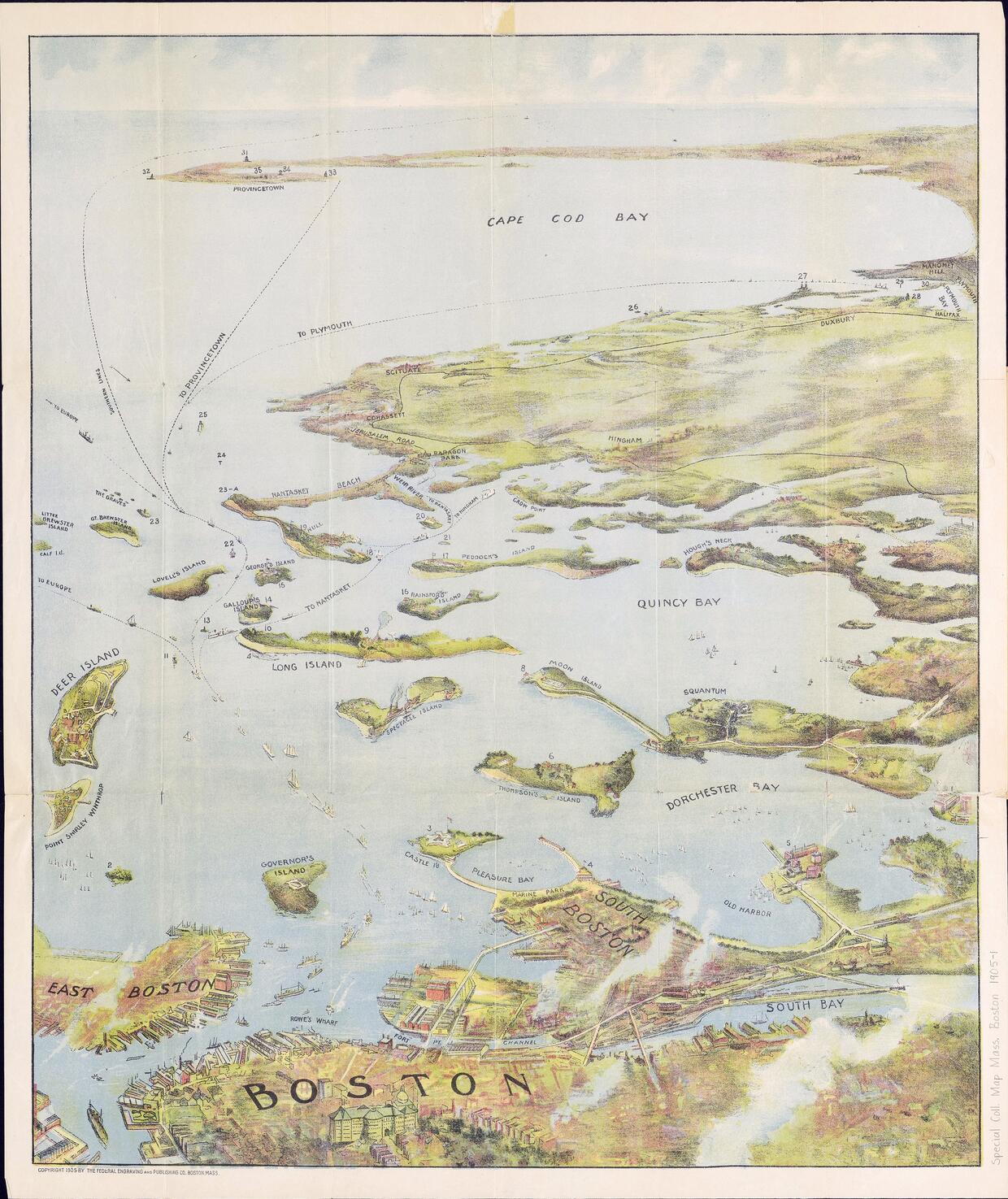
Bird’s Eye View of Boston Harbor and South Shore to Provincetown: Showing Steamboat Routes (map and cover)
(Boston: John F. Murphy, 1905)
A sign that summer is on the horizon is the relaunching of the Boston Harbor Island’s Ferry in mid-May! To coincide with the new schedule, this month our Collection Spotlight case features a bird’s-eye view map of the Harbor Islands and the coastline from Boston to Provincetown. Published in 1905 by John F. Murphy, a news agent with stands throughout the region, this map sold for only 10 cents and provided an overview of the area to locals and visitors alike. A facsimile of the inside cover shows the index that accompanied the map, identifying notable landmarks, buildings, and lighthouses. Read more in this week’s blog post.