- Division of Ecological Restoration
Many lakes and impoundments in Massachusetts have dams at their outlets that can be used to manage lake levels for a variety of reasons, including winter water level drawdowns to control aquatic invasive species and protect infrastructure. Dam management can have varying hydrological, thermal, and biological effects on downstream ecosystems. When lakes are drawn down in the fall, higher sustained flows than normally occur in fall are observed downstream. Conversely, when lakes are refilled in the spring, the high flows that would normally occur in rivers downstream are reduced. Additionally, lack of dam management in the summer months can result in low- and no-flow periods, causing stress to aquatic organisms. DER is working to identify and prioritize lakes and impoundments where dam management can be altered to provide ecological benefit to downstream ecosystems, while balancing in-lake needs.
For the first phase of the project, we conducted a GIS-based prioritization of potential sites. We used the 2921 dams mapped in the DER Restoration Potential Model as the basis for analysis. We narrowed these to a subset of 104 dams that have a history of winter drawdowns. We then assessed sites for potential downstream ecological benefit based on distance to nearest downstream impoundment, BioMap2 Aquatic Core or Buffer habitat, and Coldwater Fish Resources. We eliminated sites with stressors that would conflict with a streamflow release program, such as a lake impaired by poor water quality or an excess of water discharged to the stream system. After these screening steps, we identified and ranked 16 sites as potential candidates for flow releases from managed dams.
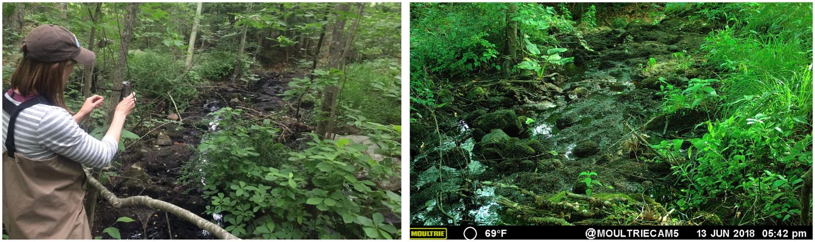
In the second phase, we are evaluating and documenting existing flow conditions at selected sites. To do this, we deployed time-lapse cameras at 4 of the highest ranked sites this June and will be monitoring the sites as the summer and fall progress. Using time-lapse cameras to document low-flow conditions is already done by the Connecticut Department of Energy and Environmental Protection. This novel approach is less time and resource intensive than installing a staff gage and provides additional visual information to assess flows. Based on the assessed conditions, we will conduct further evaluation and modeling in order to pilot changes to dam management at selected sites.
Photo Left: DER staff set up time-lapse camera at stream site downstream of managed lake. Right: Image captured by time-lapse camera at site downstream of managed lake.