- Division of Marine Fisheries
DMF’s Resource Assessment Project is responsible for two long-term, fishery-independent surveys conducted in Massachusetts coastal waters. A seine survey has been conducted every year since 1976 and was designed to monitor young-of-the-year winter flounder recruitment within several estuaries in southern Cape Cod. Spring and fall bottom trawl surveys have been conducted since 1978 to monitor marine resource stocks in offshore waters. Both surveys provide a consistent record of population trends and marine resource presence over time.
Seine Survey
The seine survey is an annual fixed station survey designed to catch newly settled young-of-the-year winter flounder, and is conducted in Great Pond (Falmouth), Waquoit Bay/Eel Pond (Falmouth/Mashpee), Cotuit, North and West Bays (Barnstable), Lewis Bay (Barnstable/Yarmouth), Bass River (Yarmouth/Dennis), and Stage Harbor/Oyster Pond (Chatham) over nine days from mid-June through early July. The number of stations sampled in each estuary is proportional to the total area of each estuary.
Sampling occurs during daylight hours within two hours on either side of high tide. At each station, three replicate seine hauls are conducted using a 21’ x 8’ seine net with 3/16” mesh, set parallel to the shoreline in waist-deep water. Area fished is calculated by using the distance from shore to the net and net width is consistently maintained using a restrictor line extended between the ends of the headrope. Once set, the ends of the seine are pulled toward the beach at a consistent and steady pace until the net is entirely on land. The entire catch is sorted by species, counted, and immediately released back into the water. The next replicate haul is made down the shoreline into the prevailing current. On occasion, factors such as sediment transport, vegetation growth, or anthropogenic disturbance (construction of seawalls and docks, watercraft, dredging, beachgoers, etc.) can interfere with the completion of all three hauls.
Bottom Trawl Survey
The spring and fall trawl surveys are used to monitor fish and invertebrate resources in offshore waters of Massachusetts. The spring survey was designed to intercept adult finfish when they move inshore to spawn, while the fall survey was intended to monitor juvenile finfish prior to their migration beyond state waters. The survey area is separated into five regions and stratified by depth. A stratified random survey design is used to select tow locations and each stratum has an assigned number of tows proportional to its total area. There are 103 stations randomly selected for each survey. The vessel follows the same general pattern to complete all stations, though there is variation due to weather. From 1978–1981, the surveys were conducted aboard the F/V Frances Elizabeth. From 1982–present, the NOAA R/V Gloria Michelle has been used. NOAA officers and contracted crew are responsible for operating the vessel and handling the fishing gear. The fishing gear has been consistent since the beginning of the survey.
Sampling occurs during daylight hours over a three-week span in May and September respectively. The net is towed at a speed of 2.5 knots for a planned 20-minutes at each station. Bottom water temperature is logged on the net for the duration of each tow. At the end of each tow, the net is retrieved, and all catch is separated and enumerated by species. Total collective-weights are recorded for each species and length measurements are recorded from a representative sample. For species subject to fisheries, individual fish are sampled to determine weight, sex, and maturity, and to collect age structures (i.e., scales, otoliths, fin spines). In addition to normal protocols, we also support other researchers by collecting whole animals, tissue and structure samples, or environmental data. Depending on logistics, station locations, and weather, 5–10 sites are completed each day and the surveys are usually completed in 17–18 days.
Importance of Survey Data
Fisheries independent survey data are important to inform assessments because they can differ from fisheries data. Unlike fisheries dependent data, where information can be confined to areas that fishermen are targeting a resource, fisheries independent surveys examine the whole resource area. Because all aspects of our surveys are kept consistent, fluctuations are indicative of changes in resource abundance or biomass within the survey area. The spring and fall trawl surveys are used for stock assessments of both recreationally and commercially important species. Abundance trends from the seine survey are used for winter flounder and summer flounder stock assessments.
Our surveys provide a long time-series with consistent annual timing, and consequently, the data can also be used to inform ocean planning and investigate species shifts over time. Ocean planning projects compile information about which species utilize which habitats. When marine development projects are proposed, the data are reviewed to consider the potential impacts on habitats and fisheries. In addition to ocean planning, there are also inquiries about changes in species habitat preference. There are two common types of requests related to species shifts. One type is looking for evidence of a species shifting habitat preference within our survey area, such as shifting to different strata or regions. The second type is related to new species detection. As ocean waters in our region warm, there are increased requests about occurrence of species traditionally seen elsewhere.
Survey Trends
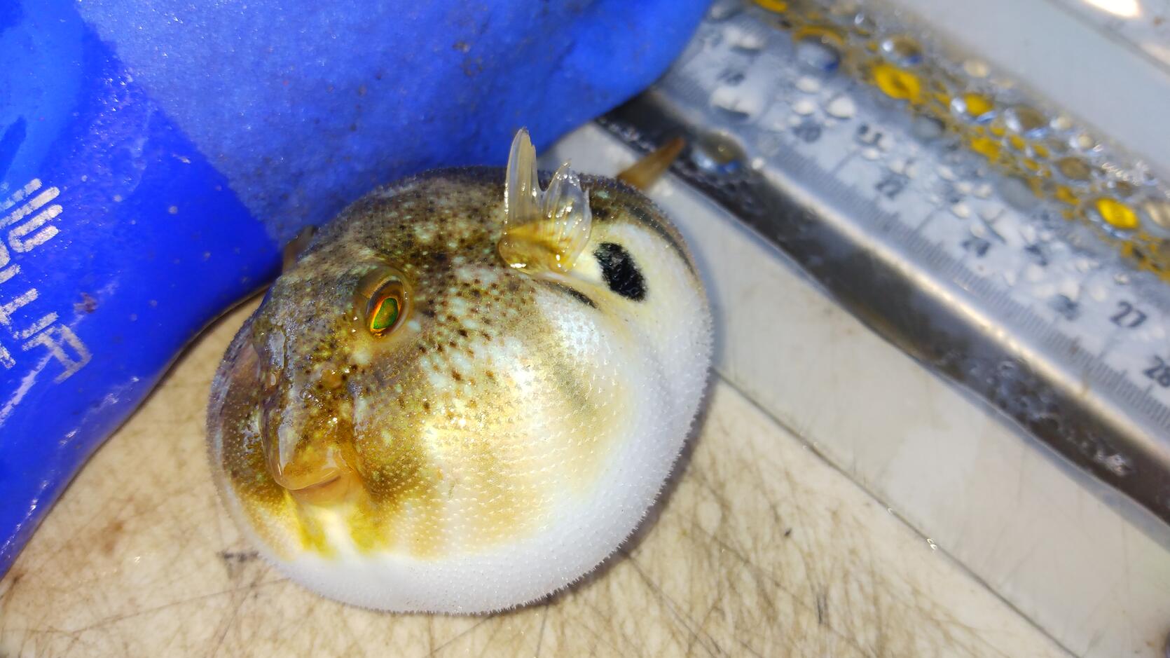
The trawl survey has caught a total of 203 different species in the spring and fall surveys combined. The spring survey has caught 125 different species while the fall survey has identified 196. Over the last decade each survey continues to catch individual species for the first time. In recent years, the new species observed in the spring survey tend to be species that have already been encountered in the fall survey such as clearnose skate, hickory shad, naked goby, Greenland halibut, hogchoker, and spot. The new species encountered in the fall survey over the last decade tend to be species associated with warmer waters. Those species include red snapper, sharksucker, cownose ray, blotched swimming crab, pinfish, northern stargazer, harvestfish, spiny butterfly ray, Atlantic stingray, and smooth puffer.
Following each survey, a series of audits are completed on all recorded observations. By weight and count, scup was the most observed species in both surveys in 2021. Scup has been the most abundant species in the last five completed spring surveys and three of the last five completed fall surveys. In the spring of 2021, the total weight of scup exceeded all other species weights
combined and accounted for approximately two-thirds of all survey biomass. Despite the total observed weight of scup being greater in the spring survey, there were almost seven times more individual scup observed in the fall survey. This is an example of a species that the survey detects the larger spawning fish in the spring survey and the resulting juvenile fish in the fall survey. Recent scup trends have been driven mostly by observations occurring in Nantucket Sound.
Survey Support
To accomplish the surveys each year requires a lot of help and support. In addition to all the staff of the research vessel, research scientists, and technical assistance, we also rely on help from the fishing industry. To aid in site completion of the trawl survey, fixed gear fishermen are notified to relocate their gear prior to the planned survey date at each station. All station locations are posted weeks ahead of each survey. In recent years a live GIS map has been posted on the DMF website. The live map is updated daily with all completed stations removed. As an aid to relocating fixed gear, there is an interactive feature that allows mobile devices to display the current location on the map. This allows users to view where they are in relation to our survey sites while at sea. Once stations are completed, all gear can be returned to the area. In addition to removing completed sites from the live map each day, email updates are sent to anyone interested. This support is critical because dense clusters of fixed gear prevent the survey from towing at planned stations.
By Steve Wilcox and Vincent Manfredi, Resource Assessment
Project