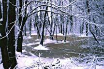
Fowl Meadow and Ponkapoag Bog ACEC Designation Document
Approximate Acreage: 8350 acres
Watershed(s): Boston Harbor (Neponset and Weymouth/Weir) and Charles
Municipalities: Boston, Canton, Dedham, Milton, Norwood, Randolph, Sharon, and Westwood
The Fowl Meadow and Ponkapoag Bog ACEC is approximately 8,350 acres in size and is located in the metropolitan Boston region, in the municipalities listed above. The central resource features of the Fowl Meadow and Ponkapoag Bog ACEC are the Neponset River and the Ponkapoag Pond and Bog. An eight-mile stretch of the Neponset River and its tributaries, the adjacent wetlands and floodplains, the associated aquifers and public water supplies, and the diverse habitats form the core resources of the Fowl Meadow area. Ponkapoag Bog and Pond and the natural communities and wildlife habitats form the core resources of the Ponkapoag Bog area. Historical and archaeological resources and the recreational and educational values of both areas support their overall significance to the people and communities of the area.
The Fowl Meadow area includes the largest wetland and floodplain areas in the Neponset River basin. There are several municipal public wells that provide water to the communities of Canton, Dedham, and Westwood. At least 13 state-listed rare species occur in the ACEC. The northern Fowl Meadow area and Ponkapoag Bog have been designated a National Environmental Study Area by the National Park Service. Approximately 2330 acres of the ACEC are owned by DCR, and are managed as part of the Blue Hills Reservation.
Water Bodies included (partially or entirely) in the ACEC
- Rivers: Blue Hill River (Milton, Randolph); East Branch, Canton River (Canton); Neponset River (Boston, Canton, Dedham, Milton, Norwood, Sharon, Westwood)
- Lakes, Ponds: Ponkapoag Pond (Canton, Randolph); Sprague Pond (Boston, Dedham)
- Brooks, Creeks: Pecunit Brook (Canton); Plantingfield Brook (Norwood); Ponkapoag Brook (Canton); Purgatory Brook (Norwood); Traphole Brook (Norwood)
Maps
Fowl Meadow And Ponkapoag Bog ACEC - Index Map
Fowl Meadow And Ponkapoag Bog ACEC Map 7a
Fowl Meadow And Ponkapoag Bog ACEC Map 7b
Fowl Meadow And Ponkapoag Bog ACEC Map 7c
Fowl Meadow And Ponkapoag Bog ACEC Map 7d
Fowl Meadow And Ponkapoag Bog ACEC Map 7e
Fowl Meadow And Ponkapoag Bog ACEC Map 7f
Fowl Meadow And Ponkapoag Bog ACEC Map 7g
Maps are intended to be used with the written boundary description contained in the ACEC designation document. The mapped boundary is not to be used by itself for definitive ACEC boundary delineation or regulatory interpretation. For review of site-specific projects in or bordering the ACEC, determinations must be made in the field by a certified professional in consultation with the appropriate Conservation Commission(s) and ACEC Program Staff.
