Golden Hills ACEC Designation Document
Approximate Acreage: 500 acres
Watershed(s): North Coastal
Municipalities: Melrose, Saugus, and Wakefield
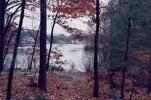
The approximately 500 acres of the Golden Hills ACEC contain an unusual blend of residential and ecological resources within the heavily urbanized Boston metropolitan area. At the time of designation, approximately 300 acres of this land was open space. The terrain of the area is generally hilly, but there are also low, flat areas, as well as three ponds. Wetlands are found in depressions throughout the area. Bedrock outcrops, or ledges, are prevalent throughout the area, especially in hilly sections. The three ponds are owned by the Town of Saugus. Wakefield owns some 50 acres which are mostly town forest, and Saugus owns several acres under the jurisdiction of the Saugus Conservation Commission. The Golden Hills area contains a local historical landmark known as Castel Clare. DCR’s Breakheart Reservation is just to the north of the Golden Hills ACEC.
Water Bodies included (partially or entirely) in the ACEC
- Rivers: none
- Lakes, Ponds: First Pond, Griswold Pond, Spring Pond (Saugus)
- Brooks, Creeks: none
Maps
Maps are intended to be used with the written boundary description contained in the ACEC designation document. The mapped boundary is not to be used by itself for definitive ACEC boundary delineation or regulatory interpretation. For review of site-specific projects in or bordering the ACEC, determinations must be made in the field by a certified professional in consultation with the appropriate Conservation Commission(s) and ACEC Program Staff.