Instructions
- Open MassGIS Oliver. The Oliver webpage shows an interactive map, available data layers, active data layers and legend
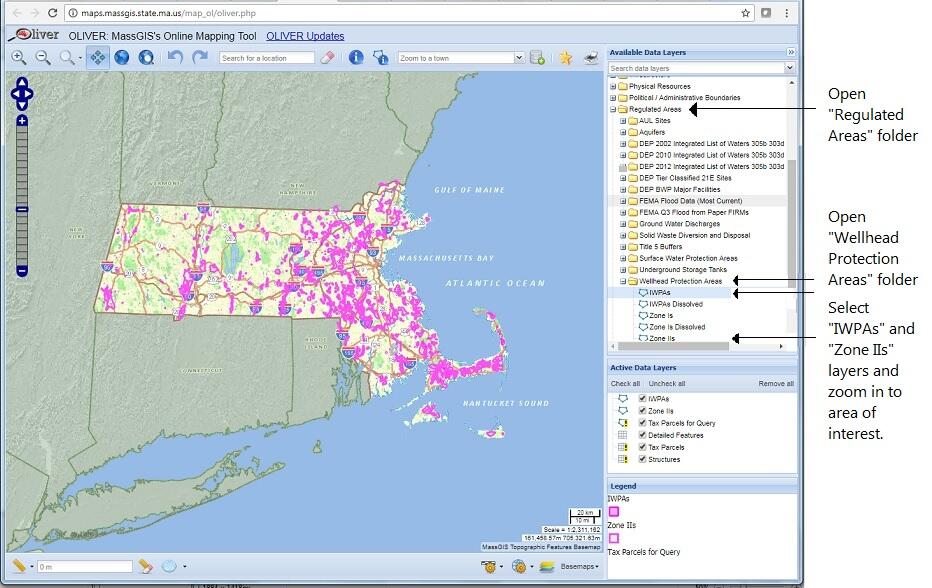
- To select data layers for Zone IIs and IWPAs (see also Fig. 1):
- In the Available Data Layers section, search for or scroll down to the ‘Regulated Areas’ folder
- Open the ‘Regulated Areas’ folder (click on + symbol to the left the folder)
- Scroll down to the ‘Wellhead Protection Areas’ folder and open folder
- Click on ‘IWPAs’ and ‘Zone IIs’ to select these as active data layers. “IWPAs and ‘Zone IIs’ appear as active layers and their legend symbols are shown
- Zoom into the area of interested to view a detailed map of IWPAs and Zone IIs
Figure 1 Oliver map opening page