Inner Cape Cod Bay ACEC Designation Document
Approximate acreage: 2,600 acres
Watershed/subwatershed: Cape Cod/Namskaket Creek
Municipalities (% of ACEC): Brewster (15%), Eastham (56%), Orleans (29%)
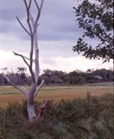
The Inner Cape Cod Bay ACEC was nominated by the Conservation Commissions, Boards of Selectmen, and Planning Boards from the Towns of Brewster, Eastham, and Orleans and was designated as an ACEC in 1985 because of the area’s extraordinary natural resources. The boundary for this ACEC generally follows the 10-foot contour line on the landward side, and the mean low water on the seaward side, and extends from First Encounter Beach south to include Namskaket Creek. Included within the ACEC boundary are hundreds of acres of saltmarsh, highly productive shellfish beds, undisturbed wildlife habitat, barrier beaches, salt ponds, and tidal rivers and creeks. These areas provide flood control, storm damage prevention, improved water quality, and recreation opportunities to surrounding communities.
What coastal resources are included (partially or entirely) in the ACEC?
- Harbors, Sounds, Bays: Cape Cod Bay (Brewster, Eastham, Orleans)
- Rivers: Boat Meadow (Eastham); Herring (Eastham)
- Lakes, Ponds: Cedar Pond (Orleans); Herring Pond (Eastham)
- Brooks, Creeks: Little Namskaket Creek (Orleans); Namskaket Creek (Brewster, Orleans); Rock Harbor Creek (Eastham, Orleans)
- Great Ponds (ponds > 10 acres): Cedar Pond (Orleans); Herring Pond (Eastham)
- Outstanding Resource Waters (ORWs): All waters including rivers, ponds, and creeks except for Cape Cod Bay. (ORWs are waters, such as public water supplies and vernal pools that are protected by the most stringent standards because they constitute an outstanding resource as determined by their socio-economic, recreational, ecological, and/or aesthetic values).
- Barrier Beaches (Massachusetts Barrier Beach Inventory, CZM, 1982): beach south of Namskaket Creek (Brewster); First Encounter Beach/Hatch Beach (Eh-2), beach south of Herring River (Eh-3), beach south of Boat Meadow River (Eh-4), beach north of Rock Harbor (Eh-5) (Eastham); beach between Rock Harbor and Little Namskaket Creek, Skaket Beach (Ol-2), beach north of Namskaket Creek (Ol-3), beach south of Namskaket Creek (Ol-4, connected to Bt-1) (Orleans)
Maps
Inner Cape Cod Bay ACEC - Index Map
Inner Cape Cod Bay ACEC Map 13a
Inner Cape Cod Bay ACEC Map 13b
Inner Cape Cod Bay ACEC Map 13c
Maps are intended to be used with the written boundary description contained in the ACEC designation document. The mapped boundary is not to be used by itself for definitive ACEC boundary delineation or regulatory interpretation. For review of site-specific projects in or bordering the ACEC, determinations must be made in the field by a certified professional in consultation with the appropriate Conservation Commission(s) and ACEC Program Staff.
Additional Resources
-
Open PDF file, 58.62 KB, Inner Cape Cod Bay Area of Critical Environmental Concern (ACEC) (English, PDF 58.62 KB)