Wetlands are areas where water covers the soil or is present either at or near the soil surface for at least part of the growing season. The occurrence and flow of water (hydrology) largely determine how the soil develops and the types of plant and animal communities living in and on the soil. Wetlands may support both aquatic and terrestrial species. The prolonged presence of water creates conditions that favor the growth of specially adapted plants (hydrophytes) and promotes the development of characteristic wetland (hydric) soils. Wetlands vary widely because of regional and local differences in soils, topography, climate, hydrology, water chemistry, vegetation, and other factors, including human disturbance. Indeed, wetlands are found from the tundra to the tropics and on every continent except Antarctica. Two general categories of wetlands are recognized: tidally influenced wetlands and nontidal (or inland) wetlands.
For more on Massachusetts wetlands, see the the Massachusetts Department of Environmental Protection Wetlands Information Guide.
Wetland Types
The Massachusetts coastal zone, which covers the land in the coastal plain immediately adjacent to coastal waters, contains both tidal and nontidal wetlands.
Tidal Wetlands
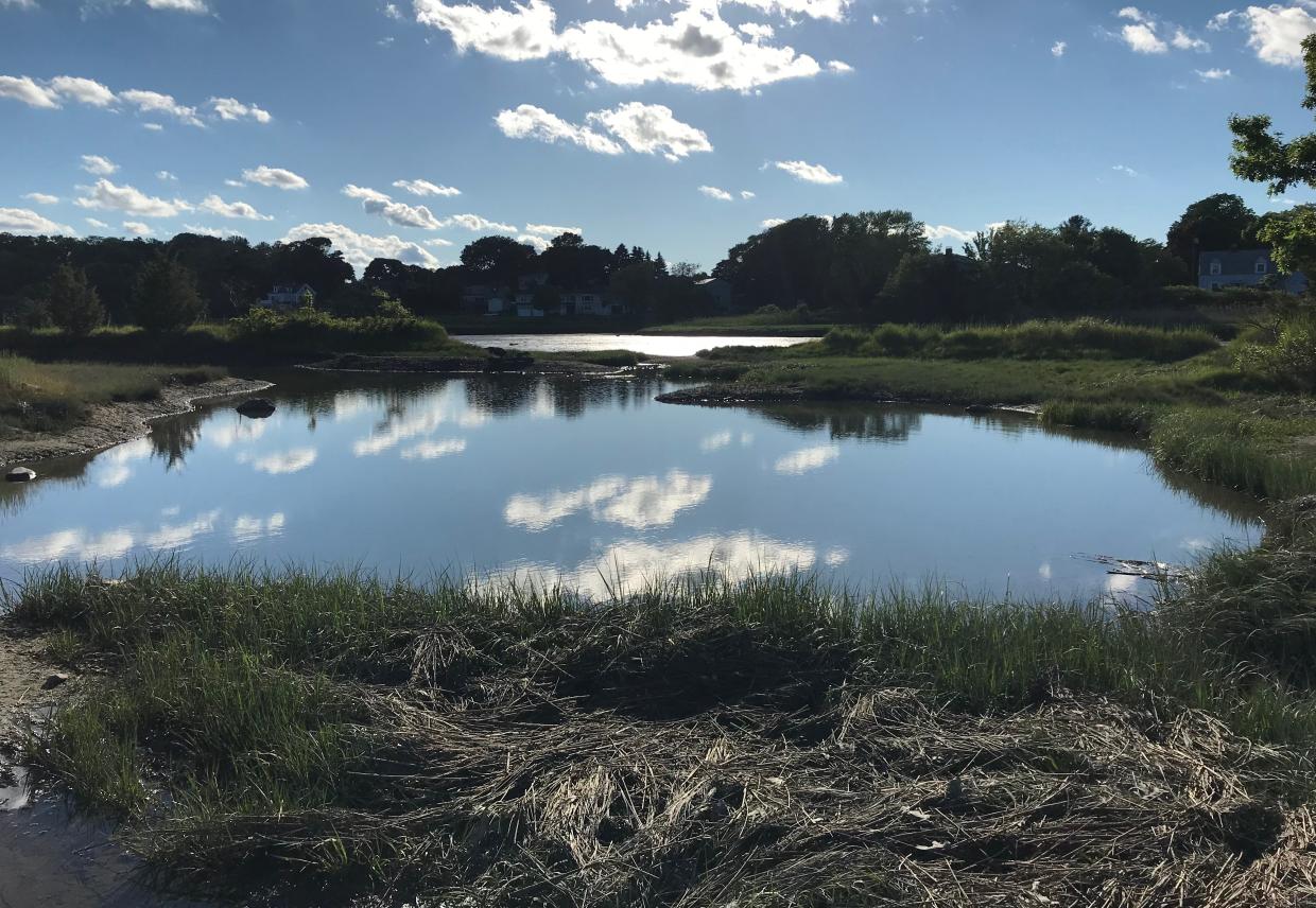
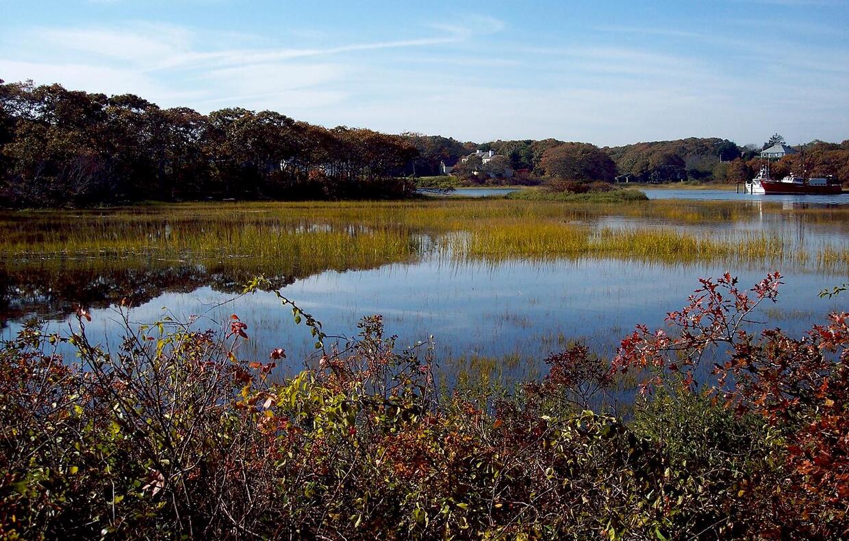
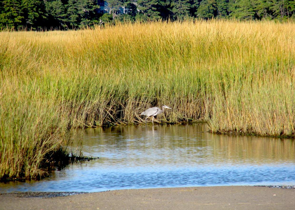
Tidal wetlands occur in areas within the reach of ocean tides. In the United States, tidal wetlands are found along the Atlantic, Pacific, Alaskan, and Gulf coasts. They are often found in estuaries, areas where sea water mixes with fresh water to form an environment of varying salinities. Estuaries are usually somewhat protected from full impacts of ocean waves and are often shallow. The salt water and the fluctuating water levels (due to tidal action) combine to create a constantly varying and challenging environment for most plants. Consequently, many shallow coastal areas are unvegetated mud flats or sand flats due to frequently shifting sand and sediments. Some plants, however, have successfully adapted to this environment. Certain grasses and grass-like plants (or graminoids, including sedges and rushes) that adapt to the saline conditions form the tidal salt marshes found along the Atlantic, Gulf, and Pacific coasts. Mangrove swamps, with salt-loving shrubs or trees, are common in tropical climates, such as in southern Florida and Puerto Rico. Some tidal freshwater wetlands form just beyond the upper edges of the reach of tidal flow, due to the fact that salt water is denser and heavier than freshwater. The freshwater flows of rivers and streams that feed into the ocean are therefore lifted above and flow on top of the incoming salty tidal waters. While water levels in these areas rise and fall with the tides, the plants and life along the river banks only experience fresh water conditions. Specially adapted plants, such as wild rice, thrive in these unique areas that are subject to brackish (partly salty) water on only rare stormy conditions and extreme tides.
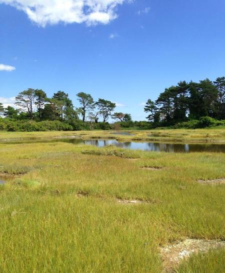
Marine, or salt marsh, wetlands are located along the coastal shoreline. These wetlands can occur as broad meadows where the topography is relatively flat or as narrow fringes adjacent to steep slopes. Salt marshes can be associated with these land forms:
- Barrier Beaches
- Barrier Islands
- Headlands
- Rivers/Estuaries
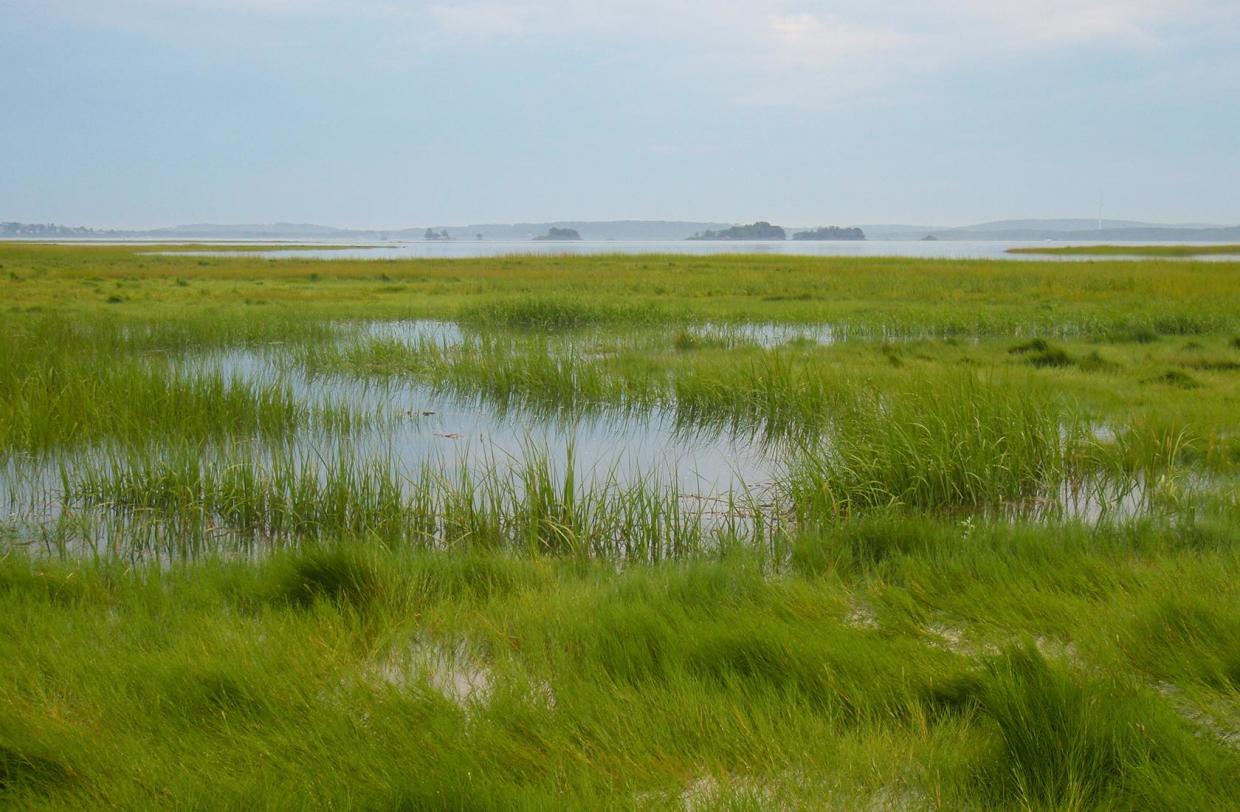
Brackish wetlands are generally located in areas that are influenced both by marine tidal waters and fresh waters. They are typically located at the upper reaches of estuaries but can also be found along the coastal shoreline in areas with significant fresh groundwater seeps. In addition, restrictions to tidal flow, such as berms or roadway culverts, can lead to the transition from a salt marsh wetland to a brackish marsh wetland. The variability in salt content is a critical factor controlling the variability in plant and animal life in coastal systems due to the sensitivity of living things to salt.
Nontidal Wetlands
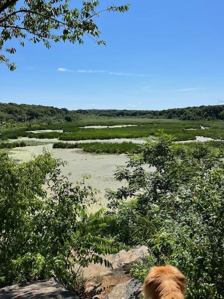
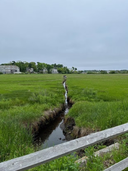
Inland wetlands are most common on floodplains along rivers and streams (riparian wetlands), in isolated depressions surrounded by dry land (for example basins, and "potholes"), along the margins of lakes and ponds, and in other low-lying areas where the groundwater intercepts the soil surface or where precipitation sufficiently saturates the soil (vernal pools and bogs). Inland wetlands include marshes and wet meadows dominated by herbaceous plants, swamps dominated by shrubs, and wooded swamps dominated by trees. Certain types of inland wetlands are common to particular regions of the country: bogs and fens of the northeastern and north-central states and Alaska; inland saline and alkaline marshes of the arid and semiarid west; prairie potholes of Iowa, Minnesota, and the Dakotas; playa lakes of the southwest and Great Plains; and bottomland hardwood swamps of the south.
Many of these wetlands are seasonal and, particularly in the arid and semiarid West, may be wet only periodically. The quantity of water present and the timing of its presence in part determine the functions of a wetland and its role in the environment. Even wetlands that appear dry at times for significant parts of the year, such as vernal pools, often provide critical habitat for wildlife adapted to breeding exclusively in these areas.
The most common nontidal wetlands found in the Massachusetts coastal zone include depressional, riverine, and lacustrine wetlands.
Depressional wetlands are surrounded or nearly surrounded by uplands and lack a channelized stream (small order or intermittent streams may enter or exit this type of wetland, but there is no flow-through channel).
Riverine wetlands are associated with flowing water systems (such as rivers, creeks, perennial streams, intermittent streams, and similar waterbodies) and contiguous wetlands. These wetland types are often fringing wetlands of small widths along river edges or occasionally meadows where slopes flatten out and can be classified as follows according to the river gradient:
- High (rapid water flow)
- Mid (fast to moderate)
- Low (slow)
Dams and other blockages in rivers and streams also contribute to slowing of water flows, which frequently results in broader wetland meadows.
Lacustrine wetlands are associated with large standing waterbodies (such as lakes and reservoirs) and contiguous wetlands formed in the lake basin. Lacustrine wetlands can be:
- Fringe, which are connected to the surrounding upland and form around the edges of lakes and around islands that sit in the middle of a water body.
- Island, which are fringes around the perimeter of an island but not connected to the surrounding upland in the larger landscape.
Wetland Ecology and Functions
Wetlands are among the most productive ecosystems in the world, comparable to rain forests and coral reefs. An immense variety of species of microbes, plants, insects, amphibians, reptiles, birds, fish, and mammals can be part of a wetland ecosystem. Physical and chemical features such as climate, landscape shape (topology), geology, and the movement and abundance of water help to determine the plants and animals that inhabit each wetland. The complex, dynamic relationships among the organisms inhabiting the wetland environment are referred to as food webs.
Wetlands provide great volumes of food that attract many animal species. These animals use wetlands for part of or all of their life cycle. Dead plant leaves and stems break down in the water to form small particles of organic material called "detritus." This enriched material feeds many small aquatic insects, shellfish, and small fish that are food for larger predatory fish, reptiles, amphibians, birds, and mammals.
The biological, chemical, and physical operations and attributes of a wetland are known as wetland functions. Some typical wetland functions include: wildlife habitat and food chain support, surface water retention or detention, groundwater recharge, and absorption and filtering of nutrients and other pollutants. Distinct from these intrinsic natural functions are human uses of and interaction with wetlands. Society's utilization and appraisal of wetland resources is referred to as wetland values, which include: support for commercially valuable fish and wildlife species, flood control, supply of drinking water, enhancement of water quality, and recreational opportunities.
A watershed is a geographic area in which water, sediments, and dissolved materials drain from higher elevations to a common low-lying outlet, basin, or point on a larger stream, lake, underlying aquifer, or estuary. Wetlands play an integral role in the ecology and hydrology of the watershed. The combination of shallow water, high levels of nutrients, and high primary productivity (the transformation of the sun’s energy into a potential food source by plants and algae) is ideal for the growth of organisms that form the base of the food web and feed many species of fish, amphibians, shellfish, and insects. Many species of birds and mammals rely on wetlands for food, water, and shelter, especially during migration and breeding. The microbes, plants, and wildlife in wetlands are part of global cycles for water, nitrogen, and sulfur. Furthermore, scientists are beginning to realize that atmospheric maintenance may be an additional wetlands function. Wetlands store carbon within their plant communities and soil instead of releasing it to the atmosphere as carbon dioxide, helping to moderate global climate conditions.
The specific benefits of wetlands to water quality, flood protection, shoreline erosion, and fish and wildlife habitat are discussed below.
Water Quality
Wetlands have important filtering capabilities, intercepting surface water runoff from higher dry land before the runoff reaches open water. As the runoff water passes through the soil and plants, the wetlands retain excess nutrients and some pollutants and reduce sediment that would clog waterways and affect fish and amphibian egg development. In addition to improving water quality through filtering, some wetlands maintain stream flow during dry periods and many replenish groundwater.
Flood Protection
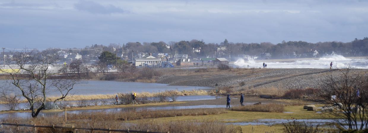
Wetlands function as natural sponges that trap and slowly release surface water, rain, snowmelt, groundwater, and flood waters. Trees, root mats, and other wetland vegetation also slow the speed of flood waters and distribute them more slowly over the floodplain. This combined water storage and braking action lowers downstream flood heights and reduces erosion. Wetlands within and downstream of urban areas are particularly valuable, counteracting the greatly increased rate and volume of surface water runoff from pavement and buildings. The holding capacity of wetlands helps control floods. Preserving and restoring wetlands can often provide a less costly and more permanent level of flood control than otherwise provided by expensive dredge operations and levees.
Shoreline Erosion
The ability of wetlands to control erosion is so valuable that some states are restoring wetlands in coastal areas to buffer the storm surges from hurricanes and tropical storms. Wetlands at the margins of lakes, rivers, bays, and the ocean protect shorelines and stream banks against erosion. Wetland plants hold the soil in place with their roots, absorb the energy of waves, and slow the flow of stream or river currents along the shore.
Fish and Wildlife Habitat
More than one-third of the threatened and endangered species in the United States live only in wetlands, and nearly half require wetlands at some point in their lives. Many other animals and plants depend on wetlands for survival. Estuarine and marine fish and shellfish, various birds, and certain mammals must have coastal wetlands to survive. Most commercial and game fish breed and raise their young in coastal marshes and estuaries. Menhaden, flounder, sea trout, spot, croaker, and striped bass are among the more familiar fish that depend on coastal wetlands. Shrimp, oysters, clams, and blue crabs likewise need these wetlands for food, shelter, and breeding grounds.
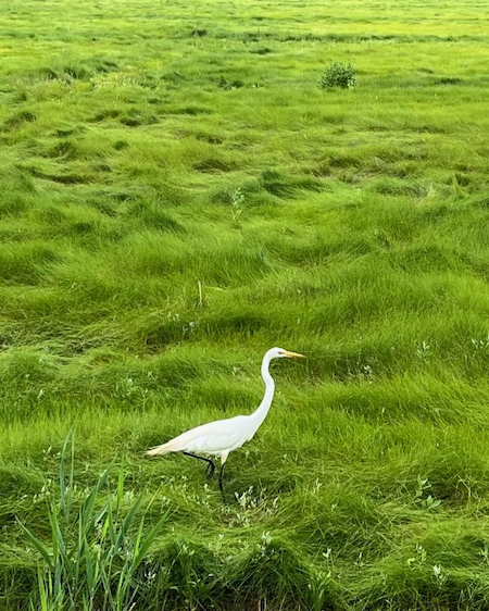
For many animals and plants, like wood ducks, muskrat, cattails, and swamp rose, inland wetlands are the only places they can live. Beaver may actually create their own wetlands. For others, such as striped bass, peregrine falcon, otter, black bear, raccoon, and deer, wetlands provide important food, water, or shelter. Many of the U.S. breeding bird populations—including ducks, geese, woodpeckers, hawks, wading birds, and many songbirds—feed, nest, and raise their young in wetlands. Migratory waterfowl use coastal and inland wetlands as resting, feeding, breeding, or nesting grounds for at least part of the year.
Wetland Loss and Degradation
In the 1600s, more than 220 million acres of wetlands are thought to have existed in the lower 48 states. Since then, extensive losses have occurred, and over half of these wetlands have been drained and converted to other uses. The years from the mid-1950s to the mid-1970s were a time of major wetland loss, but since then the rate of loss has decreased significantly.
In addition to these losses, many other wetlands have been degraded, although assessing the magnitude of the degradation is difficult. These losses, as well as degradation, have greatly diminished U.S. wetlands resources, resulting in significant impacts to the benefits they provided. Recent increases in flood damages, drought damages, declining water quality, and decreasing fish and bird populations are, in part, the result of wetlands degradation and destruction.
Wetland biology has been degraded in ways that are not as obvious as direct physical destruction or alteration. Threats include chemical contamination, increased nutrient inputs and eutrophication (nutrient over-enrichment), hydrologic modification, and sediment deposition from air- and water-borne sources. Global climate change may be affecting wetlands through increased air temperature; shifts in precipitation distribution and quantity; increased frequency of storms, droughts, and floods; increased atmospheric carbon dioxide concentration; and sea level rise. All these impacts can affect species composition and wetland functions.
This section discusses development and landscape alteration of wetlands, as well as impacts to water quality and hydrology and impacts from climate change.
Development and Landscape Alteration
Human alterations to the natural landscape have the potential to exert significant direct and indirect influence on wetland development and processes. Changes to natural hydrological, chemical, and physical regimes have been documented to affect the production and succession of a wetland's ecosystem, and therefore its natural biological functions and values for human populations.
During urbanization or development, pervious areas (i.e., those that permit the infiltration of precipitation through the ground), including vegetated and forested land, are lost to pavement and structures. These natural areas are converted to land uses that increase impervious surfaces, such as roads, parking lots, and buildings. Impervious surfaces transform watershed hydrology by changing the flow rate and volume of runoff and by altering natural drainage features, including groundwater levels, which may no longer be recharged by infiltrating rainwater. The lowering of groundwater levels, in turn, alters wetland hydrology and may cause aquatic and riparian wetland habitat to dry up. Population pressures from urbanization also result in corresponding increases in pollutant loadings generated from a wide array of human activities, including, most frequently, nutrients and chemicals from lawn care and garden activities, pathogens from pet waste, and chemical pollutants from transportation and mechanical sources.
Impacts to Water Quality
Both nationally and in Massachusetts, urban runoff and discharges from stormwater outfalls are some of the largest sources responsible for the non-attainment of water quality standards. The following is a breakdown of the individual pollutants typically found in urban stormwater: pathogens/bacteria, nutrients, sediments (total suspended solids), road salts, biological and chemical oxygen-demanding substances, thermal pollution, metals, synthetic chemicals, and polyaromatic hydrocarbons (PAHs). The principal sources of runoff pollutants are: construction sites; street and parking lot pavement; motor vehicles; dry atmospheric deposition; grass clipping, leaves, and other vegetative waste; domestic animals and wildlife; human wastes (failing septic systems, illegal connections); spills; litter; lawn fertilizers; pesticides/herbicides; and salt, sand, and de-icing chemicals.
Impacts to Hydrology
Urban development of the natural landscape changes both the form and function of the natural downstream drainage system. Data from a host of sources demonstrate that the shift from undeveloped to developed areas results in substantial increases in runoff volume, thereby reducing the amount of rainfall available for groundwater recharge. Increases in peak runoff rates and volumes to stream channels intensifies streambank erosion and alters natural deposition of sediment and organic material. Physical, chemical, and biological data from King County, Washington, demonstrate that consistent thresholds exist for aquatic ecosystem impacts from urbanization. Approximately 10 to 15 percent impervious area in a watershed has been found to be the threshold that typically leads to demonstrable loss of aquatic system functioning, as measured by changes in channel morphology, fish and amphibian populations, vegetation succession, and water chemistry.
Climate Impacts
Climate change, including sea level rise, is a threat to both tidal and nontidal wetlands. Tidal marshes rely on their ability to accumulate inorganic matter (e.g., sediment) and organic matter (e.g., roots and shoots of marsh grasses) to build elevation. If sea level rises faster than marsh elevation, the marsh will begin to break down. While marshes bordering suitable lands may be able to migrate inland in response to sea level rise in a process called marsh migration, in many coastal areas the presence of development such as roads, homes, hardened shorelines, and other structures, along with steep topography, create a barrier inhibiting the ability of marshes to migrate. Sea level rise could also result in the migration of tidal wetlands into adjacent brackish and freshwater wetlands. To explore the current and potential future extent and distribution of Massachusetts coastal wetlands in response to sea level rise, CZM applied the Sea Level Affecting Marshes Model (or SLAMM) for the entire coast of Massachusetts.
Predicted increases in precipitation from climate change could result in both higher freshwater flow and nutrient inputs, altering conditions for both tidal and nontidal wetlands and supporting the persistence and spread of the non-native reed Phragmites australis. Warmer air and water temperatures can result in species shifts, and drought can stress both tidal and nontidal wetlands. Coastal storms, while contributing to lateral erosion of salt marshes, may also support vertical elevation building by bringing sediment to the marsh platform. Large events with associated storm surges may also kick off the process of marsh migration in adjacent forested upland by contributing to tree falls resulting in light and space required for marsh plants to begin to migrate upland.