
In an emergency, every second is crucial. A few seconds can be the difference between life and death, so making emergency response even slightly more efficient can have a major impact.
While it may surprise some, mapping technology plays a big role in the quick coordination and delivery of emergency services. Specifically, the Next Generation 911 (NG911) system gives first responders better and more accurate information. NG911 is powered by a mapping and address database managed by MassGIS — the state’s geospatial data and mapping organization.
This system relies on spatial data that MassGIS manages to route calls to the best possible public safety answering point. This might seem like a straightforward task, but it involved taking a comprehensive look at the addressing information across the state, and building a database that has more powerful and useful data. This included mapping more than 2.2 million address points, or specific building locations, to more than 5 million associated addresses, and mapping more than 400,000 street arcs and their address ranges.
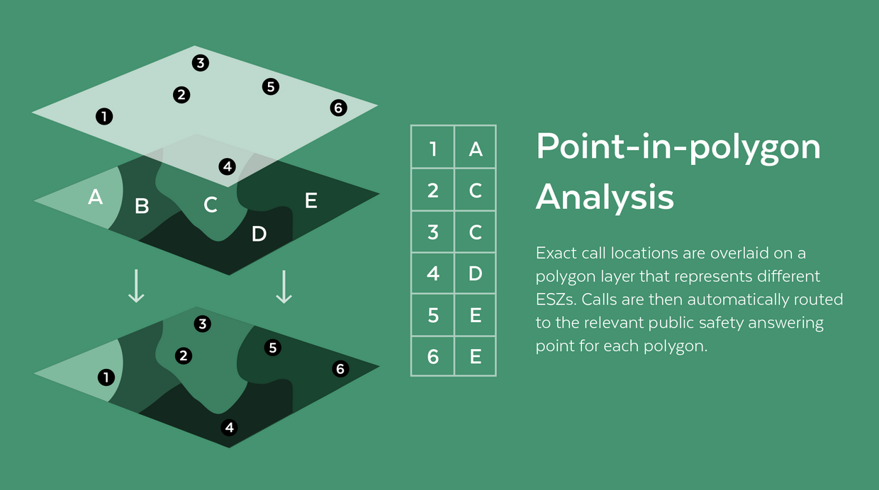
Perhaps the most essential part of MassGIS’ work on NG911 was developing thousands of Emergency Service Zones (ESZs) to clarify and improve where calls from certain areas, streets, and even specific buildings should be routed for the most efficient emergency response. Using “point-in-polygon” analysis, calls from a specific device can quickly be matched to an exact location, address, and ESZ.
The new MassGIS database and methodologies are able to provide map locations for 99.999% of telephone service providers in Massachusetts. MassGIS works closely with local public safety officials across the state to track new addresses, redevelopments, and building demolitions to ensure the database stays up to date.
This new technology is a promising development in the high-stakes world of emergency response, and public officials have already noted that the new mapping is more clear, organized, and useful. It could help reduce emergency response times and misrouted calls in the future, potentially saving lives. NG911 is a great example of how the work at Tech Services and Security touches the lives of every person in Massachusetts.
For questions please contact: notify911address@mass.gov
Peter Grace, GIS Analyst
"Working on the Next Generation 9-1-1 project has been wonderful. The work we do at MassGIS supports dispatch, police, fire, and medical professionals who respond to emergency situations. It could potentially benefit all of those who live, visit, and work within the Commonwealth. As a data person, I can’t imagine a project that is more relevant or impactful. In addition to the work being rewarding, the environment here has been collaborative and supportive."
