Location listing filters
Map for Visit Massachusetts State Parks
Note for screen reader users, we suggest skip the following interactive map and go to the location listing for a better user experience.
Currently, the map is not accessible yet for a comprehensive experience.
skip to the location listing
Location Listing
Showing 89 - 96 of 155 results for Visit Massachusetts State Parks Locations
-

Mount Washington State Forest
545 East St., Mount Washington, MA 01258 DirectionsThe re-grown red oak northern hardwood forest of Mt. Washington State Forest offers more than 30 miles of trails for hiking and mountain biking. Hike the South Taconic Trail to the 2,250 ft. elev. summit of Alander Mountain for a breathtaking view.
Phone(413) 528-0330 -

Myles Standish Monument State Reservation
Crescent St., Duxbury, MA 02332 DirectionsHigh atop Captain's Hill, 200 feet above sea level, stands the Myles Standish Monument, a 116-foot granite shaft crowned by a 14-foot statue of Captain Myles Standish, military leader of Plymouth Colony. When the tower is open, visitors can climb 125 steps to a small viewing area at the top. The monument offers a panoramic view of the South Shore-church spires, several 19th-century lighthouses, Duxbury Beach, Plymouth Harbor, and the Blue Hills.Phone(508) 747-5360 -

Myles Standish State Forest
- Wheelchair Accessible
194 Cranberry Rd., Carver, MA 02330 DirectionsMyles Standish State Forest offers plenty of year-round activities for the entire family. If you’re looking for a place to camp, swim, or explore the outdoors, this southeastern park is for you.Phone(508) 866-2526 -

Mystic Lakes State Park
481 Mystic Valley Pkwy, Medford, MA 02155 DirectionsEnjoy a day by the water at Mystic Lakes. If you're looking for swimming or sunbathing, check out Shannon Beach. Looking for other fun on the water? The lakes are perfect for rowing or sailing.Phone(857) 702-3884 -
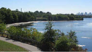
Mystic River State Reservation
Mystic Valley Pkwy, Medford, MA 02155 DirectionsOpen year round, dawn to dusk. The banks of the Mystic River are almost entirely publicly owned, from the Amelia Earhart Dam at the mouth of the Mystic Lakes, making it one of the Commonwealth's best protected streams. The river has been much altered since the 1800's when its shores were largely salt marsh.Phone(617) 727-5380 -

Nantasket Beach Reservation
- Wheelchair Accessible
212 Nantasket Ave., Hull, MA 02045 DirectionsNantasket Beach is popular summer escape from the Boston. The reservation includes a mile of the Atlantic shoreline, and during the summer, you can attend concerts or take public dance lessons.Phone(781) 925-1777 -

Nashua River Rail Trail
- Wheelchair Accessible
Rt. 2A, Ayer, MA 01432 DirectionsExplore the great outdoors along this 11 mile bike trail. During the fall months, enjoy the bright colors as the leaves change. Don't want to bike? The trail is also open to walking, rollerblading and horseback riding.Phone(978) 597-8802 -

Nasketucket Bay State Reservation
Branch Beach Road, Mattapoisett, MA 02739 DirectionsNasketucket Bay State Reservation offers 209 acres of wooded trails, open fields, and rocky shoreline.Phone(508) 992-4524