Guided Educational Field Trip Opportunities in West-Central Massachusetts

For school and other educational groups, scouts, and summer camps.
We create a dynamic, hands-on, minds-on experience where each student is an active participant.
Adult learning groups welcome!
Programs are offered free of charge (Parking fees may apply). Donations are gratefully accepted but not expected.

Table of Contents

Mt. Sugarloaf State Reservation

Mt. Sugarloaf State Reservation 300 Sugarloaf Street, South Deerfield 

Introduction - A View from the Top

Description, format and location - The view from the summit of Mt. Sugarloaf is perhaps the most iconic in all the Connecticut River Valley.  See evidence of ancient geological history, human settlement, agricultural, industrial, recreational, and "knowledge economy" land use as well as examples of conserved land.  The mountain itself has strong connections with cultural history and was once the site of a vacation-style hotel.  Discussion-style format.  Done on the lawn or in the pavilion at the summit of Mt. Sugarloaf.

  • Ages - Grades K through adult
  • Available - Mid-May through mid-October
  • Group size - Up to two classroom size groups (up to  50 students).
  • Length -10 to 20 minutes
  • Curriculum connections - Geologic processes.  Local history.  Resource management

 
Local History, Long Ago  

Description, format and location - This series of short informational programs and hands-on activities highlight various features of the mountain's history.  Select the segments that you want.  Done at the summit. 

 Available - Mid-May through mid-October

  •  What is a Sugarloaf?  Use words and pictures to learn exactly what a “sugarloaf” is.
    • Recommended for preK-1.  Up to two classroom size groups (50 students)Approximately ten minutes.  
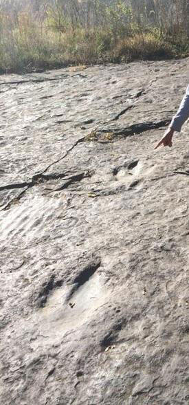
  • The Legend of the Giant Beaver   Hear the story of the Giant Beaver, Hobomuck, and the Pocumtuck people. Learn where to find the Giant Beaver and Hobomuck today. Relate the legend to the landform.
    • Recommended for K-5. Up to two classroom size groups (50 students).  Approximately 15 minutes. 
  • Firefighting Through Time - Fire was an ever-present danger at all mountain-top hotels. The one atop Mt. Sugarloaf burned down in 1966.  What fire-fighting technique was widely available back then?  Why couldn't it save the hotel?  Using pictures and text, students build a timeline that shows changes in fire-fighting technology over the past 400 years. 
    • Recommended for upper elementary.  One classroom-size group (up to 25 students).  Approximately 20 minutes. 
  • Bucket Brigade - Fire was an ever-present danger at all mountain-top hotels.  The one atop Mt. Sugarloaf burned down in 1966.  Why couldn't fire-fighting technology of the time save it?  Would a bucket brigade have helped? Students form two "bucket brigade" teams and compete to "extinguish a fire" in the "hotel."  This just-for-fun program includes a serious discussion about fire safety and the limitations of technology. 
    • Recommended for K-5.  One classroom-size group (up to 25 students).  Approximately 20 minutes. 

Other guided program options include  Guided hike to the summit with a few featured nature stops;  Guided springtime hike to the summit featuring bird-specific adaptations to three habitats.

  • Recommended for K-5.  One classroom-size group (up to 25 students) for best learning outcomes.  Approximately 45 - 60 minutes.

Teacher-Led Options
 
Sum of the Parts 

 Description, format and location - The summit of Mt. Sugarloaf makes a perfect backdrop for this hands-on land-use planning activity.  Students work in small teams or "families" and decide how they want to use a piece of riverfront property.  They present their plans to the other teams.  A subsequent discussion helps everyone understand that we all live downstream.   The Regional Educator can supply materials.  Adapted from Project WET (Watershed Education for Teachers). 

  • Ages - Recommended for upper elementary and middle school
  • Available - Mid-May through mid-October
  • Group size - One classroom-size group
  • Length - Approximately 45 minutes 

 Journaling, poetry, or sketching 

Description, format and location - New England's landscapes have inspired writers, poets and painters from the early 1800's onward.  The same is true for school groups that visit Mt. Sugarloaf’s summit today.  Use a writing prompt, suggest a poem structure, frame a scene, or just let your students' imaginations fly. Done at the summit.

 Logistics and Amenities

For information or to schedule your group, please contact Gini Traub, Regional Educator, 617/699-2387; Gini.Traub@mass.gov  

 Vehicle entrance fee.  Large vans OK.  Full-size buses park at the base of the mountain because of the steep, curving road.  Pavilion rental with advance reservation (wheelchair accessible).  Small picnic grove.  Very small indoor restroom and bubbler(wheelchair accessible).  Viewing tower.

 Auto road to summit is paved with steep sections; approximately 1 mile each way.

 Trail to summit has some steep rocky and heavily eroded section.  One section is not recommended for school groups; we switch to the paved road instead.  Approximately 1 mile each way.

Additional Resources   for Mt. Sugarloaf State Reservation

Mt. Tom State Reservation

Mt. Tom State Reservation  125 Reservation  Road, Holyoke

This Valley Rocks - Geological History and Landforms of the Connecticut River Valley and Hilltowns

Description, format and location - Take a field walk looking for examples of geological processes, rock types, and land forms.   An extra segment can connect field walk observations with a hands-on demonstration of Valley geohistory.   Guided hike with featured stops on the Nature Trail near the pavilion.  The hands-on demonstration is done outdoors in classroom-size groups, sub-divided into small-group learning stations.

  •  Ages - Grades 3-8 
  • Available – Spring through fall
  • Group size – One classroom size group (up to 25 students) for safety on the trail and for better learning outcomes.  The hands-on demonstration is done outdoors in classroom-size groups, sub-divided into small-group learning stations.
  • Length – One-half to three-quarters mile, depending on the route taken.  At least 45 minutes for the walk.  Up to 1.5 hours if the full hands-on demonstration is included
  • Curriculum connections - Geological processes, rock cycle, rock types, landforms.  Can include maps, land use, civics
  • Other  - The walk can be done as a shorter loop (1/2 mile) or a longer one (3/4 mile).  The longer loop has a short, very steep, section, reasonably well graded and has more content (i.e., walking on the top of the lava flow, noticing its massive form, stopping at a west-facing vista to take in the valley and hilltowns, observing the ridge's forest type, and examining talus that could be used as pre-historic tools.) Both trail options are rooty and rocky with uneven footing.

Forest in the Park - Ecology at Bray Lake

Description, format and location - The forest at Mt. Tom's Bray Lake is ever-changing.  See those changes, discover the reasons why, and examine interactions among the components of a forest ecosystem. Notice what it takes to maintain a park environment within this ecosystem.  This short-distance guided hike has featured stops at Bray Lake, traveling out to a former beaver dam and back on easy terrain, approximately 1/2 mile. 

  • Ages - Grades 3-5, adaptable for older and younger students  
  • Available - Early spring - late fall
  • Group size – One classroom size group (up to 25 students) is strongly recommended for best learning outcomes
  • Length  - One-half to three-quarters mile depending on the route taken.  45 minutes minimum.  Up to 1.5 hours for a more in-depth exploration or the full walk around Bray Lake
  • Curriculum connections - Biotic factors - plants and animals; Abiotic factors - soils, water, weather.  Ecology.  Adaptations.  Decomposition.  Succession.  Resource management.
  • Other 
    •  - If a wheelchair-accessible program is required, the walk can be done entirely on the accessible trail.
    •  - If time permits a longer walk, students can make a loop around Bray Lake. The trail beyond the former beaver dam is a bit more difficult because of roots, rocks, cross slope, and mud; but it is not particularly steep.   

Eyrie House "Tour"  

Description, format and location - Mountaintop family vacations became popular in the second half of 1800's.  This guided "tour" of featured stops at the Eyrie House Hotel ruins, supplemented with historic photos and maps, shows what the hotel offered its guests and tells the story of the proprietor's entrepreneurial spirit.  The Eyrie House is reached by walking along the northern stretch of Christopher Clark road, now closed to vehicles, an out-and-back of 3 miles round trip.  The tour is on a combination of well-graded footpath, rock outcrop, and loose rocks.

  •  Ages  - Grades 6 - adult  
  • Available - Spring - fall 
  • Group size – One classroom size group (up to 25 students) is recommended for safety and for best learning outcomes.
  • Length – Three miles round trip.  Two hours includes both the tour and the out-and-back walk. 
  • Curriculum connections - Local history. Historic context and social customs. Technological changes. 
  • Other – Can be a teacher-led tour as part of a round-robin.  The Regional Educator can supply information and materials. 

History of Land Use Along Little Tom Mountain

Description, format and location  - The forest's appearance changes along this walk because of the various ways the land has been used over the past 100+ years. We see highly-managed parklands, less managed forest trails, former pasture, areas overtaken by invasive plants, and a carefully-managed landscape with invasive plants removed.  An expansive vista at the turn-around gives participants the opportunity to see and discuss land use decision making. Guided hike with featured stops, beginning at Bray Lake, along the Little Tom ridge, to the Route 91 overlook and back.

  • Ages  - Grades 6-adult
  • Available - Spring through fall
  • Group Size – One classroom size group (up to 25 students) for safety and for best learning outcomes
  • Length – Two miles.  Approximately two hours
  • Curriculum connections - History.  Resource management.  Ecology.  Invasive plants.
  • Other -
  •  - An out-and-back of one mile each way. One short but extremely steep section. The rest is relatively flat to rolling. Expansive east-facing vista at the turn-around point is a highlight of the walk. 
  •  - Can be lengthened by additional 1.5 mile and one+ hour to include other land use examples (former ski slope and quarry now preserved to protect endangered species; see old-growth trees.) Requires three very shallow stream crossings with no bridges.   

Teacher-Led Round Robin Options

Regional Educator can suggest activities from Project Learning Tree®  to support Forest in the Park at Bray Lake.

If the bus can stay with the group
 - Teachers can lead one of the core programs, including Dinosaur Detective at Dinosaur Footprints, while the Regional Educator leads the other. The Regional Educator can supply information and materials.

Other round robin options
- Self guided hikes near the nature trail and pavilion.  The Regional Educator can make suggestions.

Additional Resources   for Mt. Tom State Reservation

Dinosaur Footprints Reservation

Dinosaur Footprints (a Trustees of Reservations property, two miles south of the Route 5 entrance road to Mt. Tom State Reservation)

dinosaur footprint
Dinosaur footprint

Dinosaur Detective

Description, format and location -   Paleontologists carefully recorded and shared their observations of dinosaur footprints, contributing to our ever-changing understanding of these animals.  Students work in small groups and use the current footprints map to locate different dinosaur species and trails.  They measure track size, stride length, and use comparative anatomy to calculate hip height.  They examine ripple marks to infer environmental conditions 200 million years ago.  At the dinosaur footprints.

  •  Ages - Grades 3-8 (can be adapted for younger children) 
  • Available - April through November
  • Group size -  One classroom size group (up to 25 students) for safety and for best learning outcomes
  • Length - 30 - 45 minutes
  • Curriculum connections - Observation.  Inference.  Measurement.  Comparative anatomy. Constructing explanations.  Using maps.  Historic context. Resource management. 
  • Other - Can be teacher-led as part of a round-robin with other activities at nearby Mt. Tom State Reservation.  The Regional Educator can supply information and materials.

Logistics and Amenities

For information or to schedule your group, please contact Gini Traub, Regional Educator, 617/699-2387;  Gini.Traub@mass.gov

The site is on State Route 5, approximately two miles south of Mount Tom State Reservation's Route 5 entrance. 

Parking is in a small pull-off on the east (northbound) side of Route 5. The trackway is reached from parking lot via a short, graded path and boardwalk downhill to the rock slabs.  It is not wheelchair accessible.  No facilities.

Trackways are on sloping rock slabs, slippery when wet.  Keep groups away from the culvert at the far (north) end of the trackway.  Please do not cross railroad tracks or go to the rock outcrops on the Connecticut River.  To better preserve the footprints, plaster casting is not permitted.

This site is owned and managed by the Trustees of Reservations with assistance from the Department of Conservation and Recreation.  An agreement between TToR and DCR permits DCR to lead programs at the site.

Skinner State Park

Skinner State Park   10 Skinner State Park Road, Hadley

A Meaningful (Over)view at Mt. Holyoke's Summit

  • Description, format and location - Proclaimed as "The finest cultivated view in New England," the vista from the summit of Mt. Holyoke at Skinner State Park made it one of the most popular tourist destinations in the United States in the early 1800’s. What did the view mean to visitors back then?  What does it mean to us today?  Welcome and introduction on the Summit House deck or in the picnic grove.  
  •  Ages - Elementary grades through adult
  • Available - Mid-May through mid-October
  • Group size - One classroom size group (up to 25 students) is recommended for better learning outcomes and space limitations. 
  • Length - Ten minutes.  Can be lengthened to introduce other topics such as geology or the history of tourism and vacations.
  • Curriculum connections - Local and national history.

 This Valley Rocks: Geological History and Landforms of the Connecticut River Valley and Hilltowns

Description, format and location - Take a field walk, looking for examples of geological processes, rock types, and land forms.  Put observations together in an optional hands-on demonstration of Valley geohistory.  Guided hike with featured stops between the Halfway Area and the summit of Mt. Holyoke, typically along the auto road and with two short side trails to significant geological features.  An optional hands-on demonstration at the summit connects examples seen on the walk with geological history and processes.

  • Ages - Grades 3-8  
  • Available - Mid-May through mid-October
  • Group size - One classroom size group is strongly recommended for safety concerns and for best learning outcomes.  The guided hike portion can accommodate two classroom size groups when teachers and chaperones actively participate and help facilitate learning.  The hands-on demonstration is done at the summit in classroom-size groups, sub-divided into small-group learning stations.
  • Length - Guided hike to the summit with featured stops is approximately 2.3 miles round trip and takes one to 1.5 hour.  Hands-on demonstration is approximately 30-40 minutes per group. 
  • Curriculum connections - Geological processes, rock cycle, rock types, landforms.  Optional: Maps, land use, civics.
  • Other
    •  - The walk to the summit is typically along the paved auto road, steep in places.  Side trails to two significant geologic features are on short and somewhat graded trails.  Moderate pace with stops.

The House on the Hill

Description, format and location - Mountain top hotels were popular vacation destinations during the second half of the 1800's and into the early 1900's. John and Fannie French built the Summit House Hotel in 1850 and ran it until they died in the 1890’s. This tour touches on John's entrepreneurial spirit and the changes he made to keep the hotel a popular destination. We look at the context for its decline, the period of conservation efforts, the hotel's subsequent restoration, and on-going issues of land protection.  Guided tour is conducted in a question and answer format inside the summit house on the first and second floors

  • Grades - 3 - 8  
  • Available - Memorial Day through mid-October
  • Group size - One classroom size group (up to 25 students) for best learning outcomes.  For larger groups, please see "Summit Scholar" below, or select a round robin option.
  • Length - 30-45 minutes  
  • Curriculum connections - Local history, social customs, technology, entrepreneurship, civics.
  • Other  - The deck and first floor are wheelchair accessible; second floor is not.  

Semi-Guided Field Trip Programs
Summit Scholar

Description format and location - Students become anthropologists looking at objects and displays inside the Summit House.  They find answers and make inferences about the building and about family vacations at the Summit House during its years as a hotel. Semi-guided program; students work in small groups on the Summit House’s first and second floors. The Regional Educator can help with questions during the program. Time permitting, we debrief answers at the end.

  • Ages - Grades 4-8 
  • Available - Memorial Day through mid-October
  • Group size  Up to two classroom size groups, with students working in small teams with a teacher or chaperone. 
  • Length - 30-45 minutes.  For best learning outcomes, include several minutes debriefing the activity. Can be done in less time with fewer questions.
  • Curriculum connections   Observation and inference.  Reading for information.  Technology.  Social customs/popular culture.  
  • Other  - The deck and first floor are wheelchair accessible; second floor is not. 

“Three Things” Summit House Tour

Description, format and location - Students look through the first and second floor of the Summit House.  They find three “interesting” items, sketch the items and describe them in as much detail as they can in their notebook.  Next, they think of three questions, or three things that they are curious about and write them down.  They hypothesize answers and list how they would find the answer to these questions. If time permits, the Regional Educator is available to answer questions.  Otherwise, debriefing is a post field trip activity back at the classroom.

  •  Ages – Grades 4 and up
  • Group size – Up to two classroom size groups if chaperones and teachers help facilitate the experience.
  • Available – Memorial Day through mid-October 
  • Length – Approximately 30 minutes.  More for a deeper discussion about conducting historic research
  • Curriculum connections – Local history.  Making and recording observations.  Using observations to make inferences.  Asking questions. Conducting research.
  • Other - The deck and first floor are wheelchair accessible; second floor is not. 

 
Teacher led Options  also suitable for round-robin activities
 
Journaling, Poetry, or Sketching

Description, format and location - From the early 1800's onward, writers, poets, and painters found inspiration for their work on the summit of Mt. Holyoke.  The same is true for students who visit the summit today.  Use a writing prompt, give a poem structure, frame a scene, or just let your students' imaginations fly.  On the Summit House deck or in the picnic grove

  • Ages - All 
  • Available - Mid-May through mid-October 
  • Length - Variable, as time permits.

What Do I See? 

Description, format and location - Use the view to point out different towns, cities, infrastructure, landforms and land use.  Do this as a discussion or as a “fill-in-the-map” activity.  Please speak with the Regional Educator for examples.  On the Summit House deck or in the picnic grove.

  • Ages - Grades K and up
  • Available - mid-May through mid-October
  • Length - variable, as time permits

Map and Compass

Description, format and location - Use the view to reinforce map and compass skills or to illustrate the concept of magnetic declination. On the Summit House deck

  • Grades - 4 and up
  • Available - mid-May through mid-October
  • Group size -  One classroom-size group (up to 25 students) because of space limitations
  • Length - variable, as time permits
  • Other
  • - Requires prior learning of map and compass basics; please bring your own compasses. Laminated color copies of U.S.G.S. maps can be borrowed from the park.

Logistics and Amenities

The year-round contact is Gini Traub, Regional Educator, 617/699-2387; Gini.Traub@mass.gov  

From mid-April through mid-October, you can also contact the Skinner State Park Interpreter, 413/586-0350, Holyoke.Range@mass.gov

Vehicle entrance fee (varies by days and season).  Cars and vans can drive to the summit.  Full-size buses can drop off and pick up groups at the Halfway Area and park outside of the park's main gate.  Because of the road's narrow width and steep pitch, they cannot drive to the summit.

Students arriving by bus access the summit via the paved auto road or trails.  Steep sections; most are reasonably well graded.  One-half to one mile each way, depending on route selected.

The deck, first floor of Summit House  and restrooms/bubbler are wheelchair accessible.  Small picnic grove. 

Additional Resources   for Skinner State Park

Help Us Improve Mass.gov  with your feedback

Please do not include personal or contact information.
Feedback