Letter from the Director
Dear friends and colleagues,
Our Division continues to ramp up its work to help communities respond to the challenges of climate change. The heavy rain we’ve been experiencing puts significant stress on aging infrastructure such as dams and culverts and highlights the importance of wetland restoration to absorb flood waters. This issue of Ebb & Flow highlights some of our recent work, but first I wanted to share two items that are helping to build momentum for nature-based solutions to climate change:
First, we are thrilled to expand our popular Culvert Replacement Municipal Assistance Grant Program from $750,000 in awards per year to $2.75 million. This program helps municipal road managers replace undersized culverts with larger, safer structures that provide passage for fish and wildlife and are resilient to large storms. This year, we awarded twice as many grants to municipalities, and were able to more fully meet the need of each successful applicant. Read more about the grant program below.
Second, a few weeks ago, we helped Channel 5’s show the Chronicle develop an episode on dams, including the Tel-Electric dam removal project in Pittsfield. The show will air on Wednesday, September 22, at 7:30 p.m. If you’re unable to catch the show, you can also view the segment online either live or after the fact.
Fall is almost here and is a perfect time to get outside. I’ll see you (safely) on the river!
Beth Lambert, Director
Smalls Dams Have Large Impacts on Water Quality
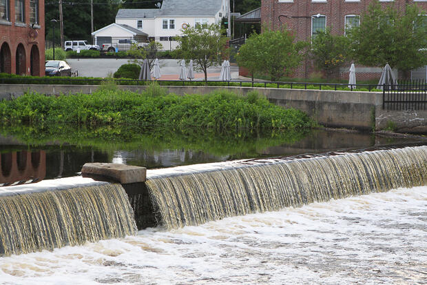
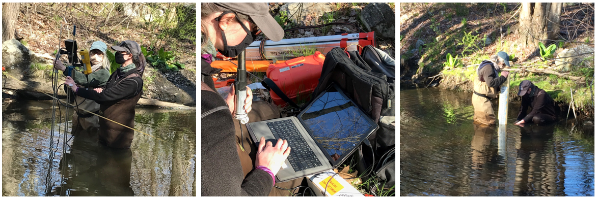
Dams and their impoundments (the body of water created behind a dam) can impact water quality of the streams on which they are located. Good water quality is essential for a healthy stream, and too-high temperatures and too-low oxygen levels can cause substantial harm to important stream wildlife. As climate change inflicts higher temperatures and longer periods of drought on Massachusetts, species that rely on cool, clean water are under increased threat. To better understand how small New England dams in particular might impact water quality, DER-supported scientists at UMass Amherst conducted a study from 2014 to 2016. This work aimed to better understand the implications of small dams on water quality and inform future stream restoration efforts.
The results of this effort provide a piece of this puzzle. As researchers measured temperature and dissolved oxygen upstream and downstream of select dams, a few key takeaways became clear. In this study, dam impoundments consistently had lower water quality compared to their adjacent upstream and downstream waters. The negative effects from dam impoundments continued downstream, with two-thirds of studied sites having warmer stream temperatures downstream of dams and one-third having lower dissolved oxygen levels. In addition, dams with the largest negative impacts on water quality were found on coldwater streams in small watersheds with a steep slope and rapid flow of water. UMass is continuing this research in 2021 to better quantify the impact of dams on temperature and dissolved oxygen.
For more information and detail, check out DER’s new webpage, Small Dams Have Large Impacts on Water Quality.
Ground Penetrating Radar: A “Berry” Important Tool
by Eric Ford, DER Ecological Restoration Specialist
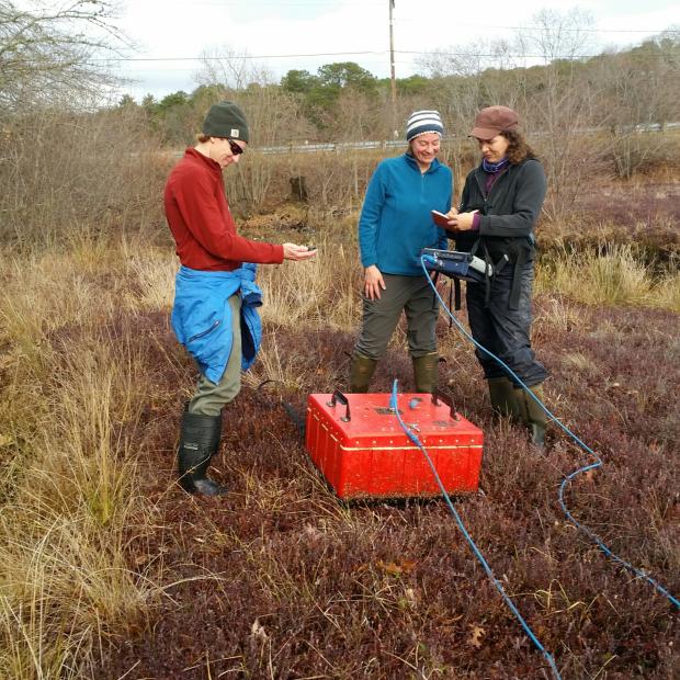
There are many occasions where restoration project teams need to understand subsurface conditions to determine where and how to intervene at a particular site. In some cases, manual sampling via a bucket or Dutch auger is sufficient. In others, we need specialized technology to help us understand what is happening under our feet. Ground Penetrating Radar (GPR) is one such method frequently pulled from DER’s toolbox.
This technology uses radar to create images of subsurface environments. A typical GPR survey consists of an antenna being pushed or pulled along several pre-determined transects. The antenna sends a pulse of energy into the ground, which is reflected back to the antenna. The GPR unit records the strength of the return signal as well as the amount of time it takes for the return signal to reach the antenna. The strength of the return allows us to identify variation between materials in the subsurface, while the time allows us to determine the location (depth) of those materials. The collected data are displayed on images called reflection profiles (an example can be seen in the image below), and can even be used to create subsurface topographic maps of specific layers or materials of interest.
GPR has many different applications in the earth/environmental sciences, archaeology, engineering, and even forensics. At DER, GPR is a common tool used in our Cranberry Bog Program. Most cranberry bogs in Massachusetts were constructed on former wetlands known to contain “peat,” which is simply a collection of partially-decomposed organic material. At active farms, sand is placed over this native soil material on a regular basis (typically every 2-5 years) to stimulate cranberry root and shoot growth while suppressing disease and insect populations. Over time, the sand builds and can reach depths of 1-3 feet or more. GPR can help us identify the depth of sand, as well as the depth of peat and any other subsurface anomalies (such as buried objects), allowing us to determine the locations of former wetlands, and where/how to target restoration interventions.

Example of a GPR reflection profile from the Holmes Bog in Plymouth, MA. Profile courtesy of the USDA-NRCS.
DER Awards $2.75 Million to Support Culvert Replacement Projects
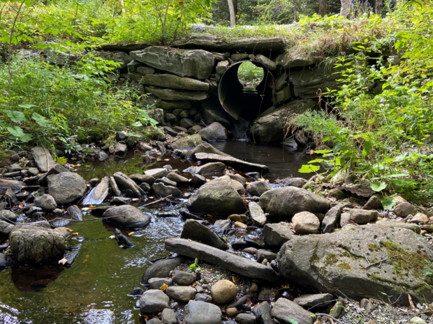
Climate change is bringing larger, more frequent storms to the Commonwealth, placing more stress than ever on outdated culverts and bridges. To address this widespread need, DER is excited to announce that 26 municipalities are receiving awards through this year’s Culvert Replacement Municipal Assistance (CRMA) Grant Program. These awards, totaling $2.75 million, support culvert replacement projects that improve river health and municipal roads in communities across the Commonwealth. DER is awarding more than double the amount of funds available in previous years and is supporting twice as many municipalities compared with a typical year.
Nearly half of Massachusetts’ estimated 25,000+ small bridges and culverts act as barriers to fish and wildlife because they are undersized or poorly positioned. DER’s CRMA Grant Program helps municipalities replace undersized and deteriorating culverts with crossings that meet improved design standards for fish and wildlife passage, river health, and storm resiliency. The grants also help municipalities deal with the ever-growing cost of aging road infrastructure.
This year’s awards recipients are:
-
Town of Agawam ($61,643): field data collection and analyses as well as preliminary engineering tasks for a culvert replacement on May Hollow Brook, a cold water fisheries stream
-
City of Attleboro ($49,270): final engineering and permitting for a culvert replacement on Chartley Brook
-
Town of Becket ($75,165): final engineering and permitting for a culvert replacement on Center Pond Brook
-
Town of Belchertown ($92,000): field data collection as well as design and engineering for a culvert replacement project on Hop Brook
-
Town of Buckland ($88,700): field data collection and analysis, design and engineering, and permitting for the replacement of a culvert on Taylor Brook
-
Town of Colrain ($95,500): field data collection and analysis, design and engineering, and permitting for the replacement of a culvert on a tributary to Taylor Brook
-
Town of Cummington ($88,282): final engineering and permitting tasks for the culvert replacement on the North Branch of the Swift River
-
Town of Dartmouth ($37,185): field data collection and analysis for a culvert replacement on a tributary to the Slocums River
-
Town of East Bridgewater ($27,985): final engineering and permitting for the replacement of a culvert on the Satucket River
-
Town of Essex ($83,500): final engineering and permitting for the replacement of a culvert on a tributary to the Essex River
-
Town of Gardner ($123,400): field data collection as well as design and engineering for a culvert replacement on Wilder Brook
-
Town of Hadley ($67,682): field data collection as well as design and engineering for a culvert replacement on a tributary to the Fort River
-
Town of Hampden ($34,040): field data collection and analysis as well as preliminary engineering for the replacement of a bridge on East Brook
-
Town of Heath ($100,000): field data collection as well as design and engineering for a culvert replacement on Avery Brook
-
Town of Leyden ($395,000): replacement of a severely undersized culvert on Glenn Brook with a bridge
-
Town of Merrimac ($26,028): final engineering and permitting for the replacement of a culvert on Cobbler Brook
-
Town of Middlefield ($70,000): field data collection, analysis and design, and engineering for a culvert replacement on Glendale Brook
-
Town of Montague ($25,000): field data collection and analysis for the culvert replacement on a tributary to the Sawmill River
-
Town of Orange ($25,000): field data collection and analysis for the replacement of a culvert on a tributary to the Swift River
-
Town of Pepperell ($373,000): replacement of the failing Heald Street culvert on Sucker Brook
-
Town of Plymouth ($100,000): field data collection as well as design and engineering for a culvert replacement project on a tributary to Beaver Dam Brook
-
Town of Southwick ($80,000): field data collection and analysis, design and engineering, and permitting for the replacement of a culvert on Shurtleff Brook
-
Town of Topsfield ($367,000): replacement of undersized culverts at the outlet of Hood Pond on a tributary to Pye Brook
-
Town of Westborough ($57,500): field data collection and analysis for multiple culverts at the Upton Road and Morse Street intersection on Jackstraw Brook
-
Town of Whately ($57,120): field data collection and analysis as well as design and engineering for the replacement of a culvert on Great Swamp Brook
-
Town of Windsor ($150,000): replacement of an undersized and deteriorated culvert on a tributary to the East Branch of the Westfield River
For more information, see the associated press release.
Project in Planning Highlight: Broad Meadow Brook Restoration, Worcester
The Broad Meadow Brook Restoration Project in Worcester was designated as a DER Provisional Priority Project in early 2021. This project focuses on an area within Mass Audubon’s Broad Meadow Brook Wildlife Sanctuary—the largest urban wildlife sanctuary in New England—where project partners aim to restore Broad Meadow Brook at the headwaters of the Blackstone River. Broad Meadow Brook and the surrounding neighborhood, within the urban setting of southeast Worcester, are subject to a variety of stressors including chronic flooding, stormwater runoff, nonpoint source pollution, and invasive species. In the northern section of the site, a 2,500-foot long elevated causeway divides the 40-acre wetland complex, preventing hydrological connection across the wetland. In the southern section of the site, a 500-foot buried culvert constrains the brook, preventing connection of the brook to its banks and floodplain.
DER is working with Mass Audubon and the City of Worcester to restore the natural flow and function of Broad Meadow Brook, which will ultimately provide both ecological and social benefits to the region. Anticipated benefits include improved and enhanced flood storage, floodplain connection, wetland and stream habitat, water quality, ecological function, and recreational and educational opportunities that are invaluable within an urban setting.
This project is currently in the data collection and planning phase. This part of the process is critical for ecological restoration projects, as it allows partners to assess the specific needs of the site and to determine the most effective means of pursuing restoration options. Streamflow monitoring is currently underway at the site, including the collection of temperature and water level data, and hydraulic and hydrologic modeling is being pursued through grant funding. Following this data collection phase, restoration approaches will be explored with consideration of the data and community input.
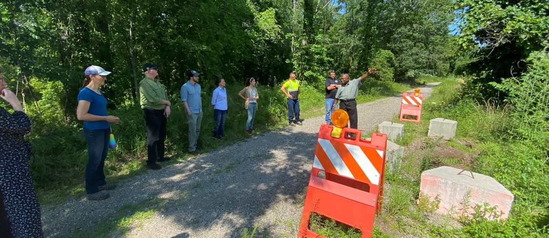
Project in Construction Highlight: Parkers River Bridge Restoration, Yarmouth
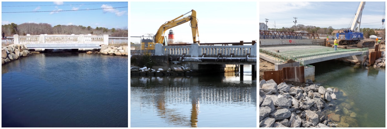
Photo Credits: DER (1st & 2nd image); Gerald Beetham for the Association to Preserve Cape Cod (3rd image)
Ecological restoration projects often go through many stages before completion. This may include data collection, analysis, engineering, design, and other planning activities. However, it’s always very exciting to see a project finally go to construction.
The Parkers River Bridge and Seine Pond Restoration Project has been underway for several years. This project is located in the Town of Yarmouth and focuses on the replacement of the Parkers River Bridge on Route 28. Replacing the 18-foot original bridge with a 30-foot replacement creates a larger opening to improve tidal flows, water quality, fish passage, and ecosystem health, and especially improves water quality in close-by Seine Pond, as well as restoring almost 220 acres of habitat.
Following the planning phases and working around the busy summer traffic months on the Cape, this project underwent its first phase of construction which was completed in the spring of 2020. Construction for the second and final phase of the project began in the fall of 2020. This phase was mostly completed prior to the Cape’s summer season and will pick up and finish site work this fall.
Partners for this project include the Town of Yarmouth, National Oceanic and Atmospheric Administration, Natural Resources Conservation Service, and U.S. Fish and Wildlife Service.