Downloads
Overview
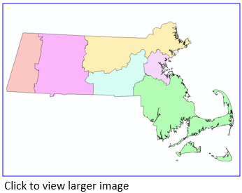
The MA HazMat Districts were created by the Department of Fire Services organized under the Executive Office of Public Safety, and overseen by the State Fire Marshal. The 6 divisions are strategically located to be able to respond anywhere in the state within 1 hour. The HazMat teams assigned to each district support the local fire departments with technical information, expertise and specialized equipment. The district layer was created by coding each town with numbers 1-6 and then dissolving the town boundaries.
This layer is stored in ArcSDE and distributed as DFS_HMD_POLY.
Updated in August 2021 to be based on the Survey Towns Boundaries (previously based on the USGS-based town boundaries).
Attributes
The polygon attribute table contains the following field:
| Field | Description |
|---|---|
| HAZMATDIST | State HazMat District Number |
Maintenance
The Massachusetts Department of Fire Services will provide any updates to MassGIS.
Updated in April 2022 to reflect recent edits to the Municipalities layers.