Downloads
Overview
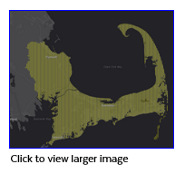
The SSA protection program is authorized by section 1424(e) of the Safe Drinking Water Act of 1974 (Public Law 93-523, 42 U.S.C. 300 et seq.). This program is designed to protect drinking water supplies in areas with few or no alternative sources to the ground water resource, and where, if contamination occurred, using an alternative source would be extremely expensive. EPA defines a sole or principal source aquifer as an aquifer that supplies at least 50 percent of the drinking water consumed in the area overlying the aquifer. These areas may have no alternative drinking water source(s) that could physically, legally and economically supply all those who depend on the aquifer for drinking water. For convenience, all designated sole or principal source aquifers are referred to as "sole source aquifers."
The SSA designation protects an area's ground water resource by requiring EPA to review certain proposed projects within the designated area. All proposed projects receiving federal funds are subject to review to ensure that they do not endanger the water source. Information on sole source aquifers is widely used in assessments under the National Environmental Policy Act and at the state and local level. A national SSA geospatial data set is available through Data.gov for use by government agencies, private organizations, and the public. MassGIS extracted the data for Massachusetts from the national layer, projected it to the NAD 1983 Mass. State Plane Mainland Meters coordinate system, and modified the attribute table.
The layer is named AQSOLE_POLY.
Attributes
This datalayer's polygon attribute table has the following fields:
| Field name | Description |
|---|---|
| SSA_ID | Character string of the form "SSA_##" providing an identifier for the SSA designations. Since a given SSA can be located in more than a single county, a concatenation of the SSA_ID and the FIPS code are needed to establish a unique database key. |
| SSA_NAME | The name of the SSA taken from the Federal Register and corresponding to a given SSA. The name will contain information related to the streamflow zone or other special features related to a specific polygon. |
| FR_ID | Federal Register ID. Character string of the form "## FR #### (YYYY)" providing an identifier for the Federal Register citation for the SSA designations. Computed based on SSA_IDs developed for the Drinking Water Mapping Application and information in Federal Register Notices and GIS attributes in polygons supplied from the EPA Regions. |
| COORDINATO | The sole source aquifer coordinator for that aquifer's region. |
| PHONE | The phone number of the sole source aquifer coordinator for that aquifer's region. |
| The email address of the sole source aquifer coordinator for that aquifer's region. | |
| SQ_MI | Area in square miles, calculated by MassGIS in ArcMap 10.8.1. |
Maintenance
The U.S. EPA, Office of Water maintains this datalayer. MassGIS will download updates as needed. The September 2020 update replaced an older version of the data.