Downloads

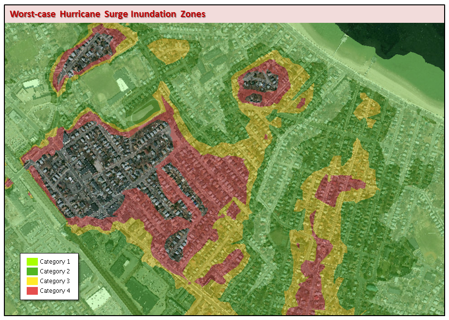
The legend used for Hurricane categories 1-4 in the web tile service.
For tile services that symbolize successive categories with one color, see:
Overview

Developed to assist emergency management officials in hurricane preparedness and operations, this layer represents worst-case Hurricane Surge Inundation areas for Category 1 through 4 hurricanes striking the coast of Massachusetts. Hurricane surge values were developed by the National Hurricane Center using the PV2 basin SLOSH (Sea Lake and Overland Surge from Hurricanes) Model data.
This Surge Inundation layer was created by the U.S. Army Corps of Engineers, New England District. Using ArcInfo's Grid extension, LiDAR bare earth elevation data were subtracted from the worst-case hurricane surge values to determine which areas could be expected to be inundated.
The layer is named HURR_INUN_ZONES_POLY.
Additional Resources
Production
See the metadata attached to the downloadable data for complete processing details and specific data sources used by the ACOE for each county.
MassGIS received the data from the ACOE and clipped any data that overlapped adjacent counties on a county-by-county shapefile basis. Each county shapefile was converted from multipart to singlepart. All singlepart county-based shapefiles were merged into a single shapefile, which was then projected from NAD1983 Mass. State Plane Feet to Meters.
Attributes
The HURR_CAT field indicates what storm category (1, 2, 3, 4) would be expected to cause a given area to inundated, based on the data process steps.
Maintenance
See the metadata in the download at the top of this page for contact information at the U.S. Army Corps of Engineers, Geospatial Systems POC, New England District.
Also see the Hurricane Evacuation Zones layer.