Downloads
Download these layers (ESRI Shapefiles):
- 1-minute graticule
Overview

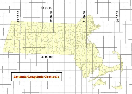
Two layers are available that represent the graticule of latitude and longitude linework covering Massachusetts:
- MINLL1_ARC - 1-minute latitude-longitude lines
- MINLL10_ARC - 10-minute latitude-longitude lines
These two layers are meant to be used for general planning, cartographic display and educational purposes.
Production
MassGIS used Arc/Info Workstation to GENERATE lines in NAD83 Decimal-Degrees coordinates using the FISHNET option, which were then projected to the Mass. State Plane NAD83 Meters Mainland coordinate system.
Attributes
The MINLL10_ARC attribute table contains these items:
| Field name | Description |
|---|---|
| LATITUDE | Latitude value of the line ("NA" if line is longitudinal) |
| LONGITUDE | Longitude value of the line ("NA" if line is latitudinal) |
| LINE_0 | Indicates whether the line is a 00 seconds line (i.e. 44 00 00) |
The MINLL1_ARC attribute table does not contain any items other than those standard in an arc attribute table.
Maintenance
MassGIS is maintaining these layers.