Downloads
Overview
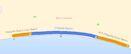
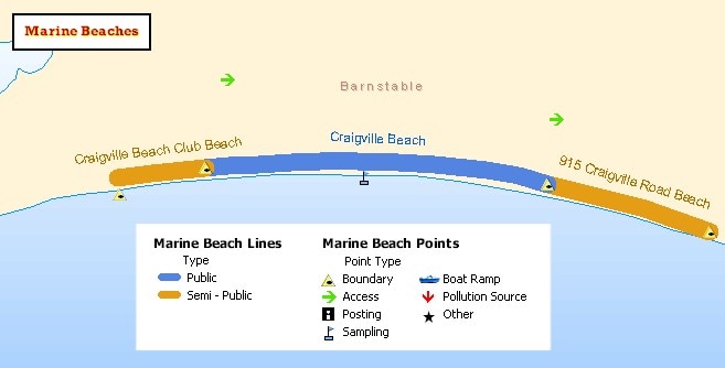
The Massachusetts Department of Public Health (MDPH), Center for Environmental Health (CEH), Environmental Toxicology Program (ETP) has developed two marine beach data layers, an arc feature class representing the linear extents of each beach, and points marking beaches' boundaries and access, sampling, and other locations. Data were collected from 7/20/2003 to 10/20/2003 for public and semi-public beaches in Massachusetts' oceanfront communities as part of the BEACH Act, as administered by the U.S. Environmental Protection Agency. The beach points (based on GPS) are accurate to within 10 meters.
The layers are stored in ArcSDE as MARINEBEACHES_ARC and MARINEBEACHES_PT.
Production
All data were produced by MDPH/CEH/ETP staff, in conjunction with the MDPH/Division of Community Sanitation. Point data were collected in the field by MDPH beach inspectors using global positioning system (GPS) units. To aid in locating the points, the inspectors used as reference MassGIS 1990's and 2001 aerial images, street maps, and sandy coastline maps produced by Applied Geographics, Inc. These coastline maps had previously been mailed to local boards of health and state agencies for mark-up of appropriate beach boundary and sampling locations.
Boundary points were then used to manually delineate beach extent lines in ESRI's ArcMap software.
Attributes
The layer MARINEBEACHES_PT contains the following attributes:
| Field name | Description |
|---|---|
| BEACHNAME | Name of beach |
| TOWNNAME | Name of town in which the beach is located |
| BEACHTYPE | Type of beach: Public or Semi-Public (privately owned but open to the public) |
| EPA_ID | ID of beach assigned by US EPA |
| COUNTYNAME | Name of county in which the beach is located |
| LATITUDE | Latitude of point |
| LONGITUDE | Longitude of point |
| POINTTYPE | Type of point: Boundary, Sampling Point, Access Point, Posting Point, Pollution Source, or various combinations of these |
| POINTCODE | Numeric code that combines several POINTTYPE values to facilitate symbolization, with priority assigned according to the numbers (with 1 having top priority) when more than one type was included in the POINTTYPE field: 1 - Boundary 2 - Sampling 3 - Posting 4 - Access 5 - Pollution 6 - Boat Ramp 7 - Other |
The layer MARINEBEACHES_ARC contains the following attributes:
| Field name | Description |
|---|---|
| EPA_ID | ID of beach assigned by US EPA |
| TYPE | Type of beach: Public or Semi-Public |
| LENINMILES | Length of beach lines in miles |
| BEACHNAME | Name of beach |
| TOWNNAME | Name of town in which the beach is located |
Maintenance
These data are evaluated for accuracy on an on-going basis as MDPH beaches staff visit marine bathing beaches in the course of their overall duties. Updates are coordinated with MassGIS by MDPH. For questions or concerns regarding the data please contact:
Massachusetts Department of Public Health
Center for Environmental Health, Environmental Toxicology Program
250 Washington St., 7th Floor
Boston, MA 02108
Phone (617) 624-5757, Fax (617) 624-5777