Downloads
Overview
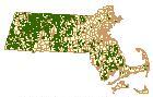
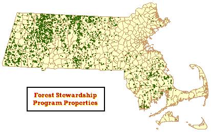
The Massachusetts Forest Stewardship Program Properties datalayer contains the boundaries of all properties which have plans under the Massachusetts Forest Stewardship Program (for more information on the program, please visit this webpage . The associated database contains relevant information about each property parcel, including the plan number, two values for acreage, and plan date information categories.
This datalayer includes only active Stewardship properties, which are properties that have not expired or been withdrawn. Once the plan is submitted to the Department of Conservation and Recreation and accepted, it will be active for 10 years. If the plan is not recertified after the ten year period, it is automatically withdrawn and would require a new plan application for reinstatement as a Stewardship property. This datalayer contains all plans that had been received and approved by a DCR Service Forester as of October 1, 2007.
The layer is named STEWARDSHIP_POLY.
Production
The data source for the digitized Forest Stewardship Program Properties is the set of approved Stewardship Plans on file with DCR, where maps of the property are provided. These maps include a locus map and a property boundary map with metes and bounds. The majority of the locus maps were hand drawn by the plan preparer on a paper version of the USGS Topographic Quadrangle Image without the benefit of GPS. In some cases, an additional map with property bounds set against a Digital Ortho Image was also available. The metes and bounds found on the property boundary map were sometimes derived from a registered survey. In most cases, they were generated by the plan preparer in the field, and are approximate. Prior to 2003, locus maps were the only source for digitizing the property boundaries.
Generation of this datalayer is attributed to two different digitizing methods. They are listed as follows:
- Properties approved for Stewardship Plans before August, 2002 were digitized by scanning the locus maps provided in the Stewardship Plan, which display property boundaries against a 1:25,000 USGS Topographic Quadrangle Image. These scanned maps were then geo-registered and rectified on Quad maps downloaded from MassGIS. The RMSE of this process with respect to control points was 0.010. The land boundaries from the scanned maps were then digitized and assigned associated attribute information.
- Properties approved for Stewardship Plans in August, 2002 to the present were digitized using the survey tool “NWF Data Editing Extension Using ArcView GIS”, which is available for download on the Department of Conservation GIS webpage. Property boundaries were delineated by entering metes and bounds identified in the property boundary map. Once the survey tool created the polygon, the associated attribute information was entered. Property location was referenced by either a USGS Topographic Quadrangle or a 1:5,000 Color Digital Ortho Image.
In the final stages of production, all of the Forest Stewardship Program Properties in this datalayer were scrutinized against existing digital data relevant to the project and adjusted to conform for connectivity and adjacency issues. Digital data relevant to this project include the Massachusetts Open Space and Chapter 61 layers. When boundary conflict has occurred between the two layers, adjustments were made to the Stewardship layer to conform. Adjustments were also made to the Stewardship property boundaries as they were digitized when conflict occurred with previously digitized properties within the same layer.
The final layer was dissolved at MassGIS on PLAN_NUM and the three date fields, with sums of the acreage fields. Multi-part polygons represent non-contiguous properties with the same PLAN_NUM.
Attributes
The polygon attribute table contains the following items:
| Field name | Description |
|---|---|
| PLAN_NUM | Represents an assigned number for each property that is in Stewardship. Numbers are a combination of Town ID and a property owner identifier. |
| PLANBEGIN | The year in which the plan initially became active. |
| AMEND_DATE | The year in which any plan amendments are activated. |
| REPLANBEG | The year in which the plan has been recertified. |
| ACRES | Acreage covered by the Stewardship Plan. |
| AREA_ACRES | Property acreage as calculated from the digitized parcel. |
Note that the plan date categories refer to the year in which a plan or plan change becomes active, which always occurs on the first day of January of the year following plan application approval.
Maintenance
DCR will provide any updates to MassGIS.