Downloads
Overview
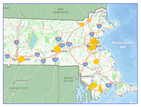
This layer depicts the portion of the Riverfront Area (RFA) located in Massachusetts that is known as the “Densely Developed Area” (DDA). The DDA is a 25-foot wide RFA located adjacent to both sides of a river established through the Massachusetts Rivers Protection Act, Acts of 1996 Chapter 258, that is regulated through the Massachusetts Wetlands Protection Act, Massachusetts General Law 131 § 40. The RFA, including the DDA, was established to protect the following interests: private and public water supply, groundwater, flood control, storm damage prevention, pollution prevention, land containing shellfish, wildlife habitat and fisheries.
DDAs were established directly by the Rivers Protection Act, the Massachusetts Department of Environmental Protection (MassDEP) through regulation upon initial adoption of the regulations implementing the Rivers Protection Act in 1996, and thereafter by the Massachusetts Secretary of the Executive Office of Environmental Affairs (now Energy and Environmental Affairs or EEA). The DDA designation recognizes the RFA is narrow in established densely developed areas.
The layer is named DDA_POLY.
Methodology
The DDA were digitized on screen with a 2011 orthophoto base map, Massachusetts State Plane Mainland NAD 83 meters, using data from several references. Together these polygons compose the DDA data layer. The references were:
The Massachusetts Rivers Protection Act, Acts of 1996, Chapter 258, which designated specific locations in the Town of Milton and City of Waltham as being DDA’s.
310 Code of Massachusetts Regulations (CMR) 10.58(2)(a)3, which specified DDA boundaries in the following 14 municipalities: Boston, Brockton, Cambridge, Chelsea, Everett, Fall River, Lawrence, Lowell, Malden, New Bedford, Somerville, Springfield, Winthrop, and Worcester. The DDA boundaries apply to all rivers located within these municipalities.
EEA Secretary written designation. The boundaries developed are based on at least one of the following: descriptions of simple street-based limits; descriptions of river and nearshore features; sketches and maps referenced by the Secretary’s designation or integrated directly into the Secretary’s designation; and maps prepared for the Town of Palmer showing tax parcels, water features, and outlines of the DDA.
MassDEP sent this data to MassGIS in June of 2025.
Attributes
The polygon attribute table contains the following fields:
| Field | Description |
|---|---|
| TOWN | Actual town or city where the Densely Developed Area is located. |
| NAME | Document based name of each specific river based extent, or town name if townwide extent. |
| DESIGNATN | Describes whether the designation was made through the Massachusetts Rivers Protection Act of 1996 Chapter 258, Massachusetts Wetlands Protection Act regulation 310 CMR 10.58(2)(a)3, or by EEA Secretary written designation. |
| EXTENT_TYP | Describes whether the extent of the DDA is for all rivers townwide, or just the river itself. |
| DDA_NUM | Cites the numerical designation made by the EEA Secretary, when the Secretary established a numerical designation for DDA determinations. Numerical designations were not established for designations made in Revere, Foxborough, and the Mill River DDA in Taunton. All areas in the Town of Palmer fall under the same number (DDA-005) although they are not geographically contingent. |
| DESIG_DATE | Date the DDA was approved by the EEA Secretary. This is not applicable to the DDAs established directly by the Rivers Protection Act or through the Wetlands Protection regulations. |
| MONITR_DSG | Date that the notice was published in the Environmental Monitor announcing that the Secretary of Energy and Environmental Affairs has designated the Densely Developed Area. |
Maintenance
The Massachusetts Department of Environmental Protection (MassDEP) will provide any updates to MassGIS.
For any GIS related questions regarding this layer, please contact MassDEP GIS Director Kashif Rashid (kashif.rashid@mass.gov).
| Date published: | June 27, 2025 |
|---|