Downloads
Overview
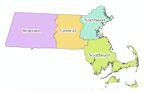
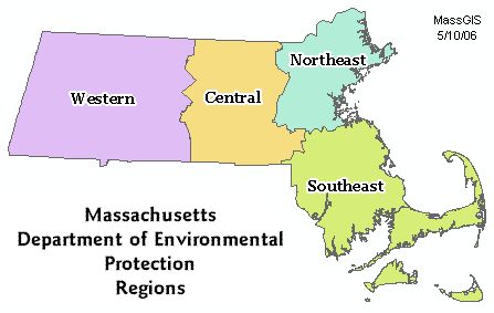
The DEP Regions layer represents boundaries used by the Massachusetts Department of Environmental Protection for planning and administrative purposes
The layers are named REGDEP_ARC (lines), REGDEP_POLY (polygons), and REGDEP_ANNO_REG (annotation, for region name labeling).
The polygon feature class was updated in August 2021 to be based on the Survey Towns Boundaries (previously based on the USGS-based town boundaries).
Attributes
The polygon attribute table contains the following items:
| Field name | Description |
|---|---|
| REGION | DEP Administrative Region |
| DEP_ID | DEP Region Identifier |
Codes are as follows:
| REGION | DEP-ID | Description |
|---|---|---|
| WEST | 1 | Western region - Springfield headquarters |
| CEN | 2 | Central region - Worcester headquarters |
| NE | 3 | Northeast region - Woburn headquarters |
| SE | 4 | Southeast region - Lakeville headquarters |
The arc attribute table contains the item OUTLINE, where 1 = state borders, 4 = coastline, and 14 = DEP region boundaries.
Maintenance
MassDEP maintains this layer. Boundaries were modified in May, 2006, to reflect the re-assignment of some towns to other regions by MassDEP.
Updated in May 2022 to reflect recent edits to the Municipalities layers.