Downloads
Overview
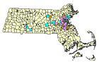
This polygon datalayer shows the areas across the commonwealth with water and sewer service as provided by the Massachusetts Water Resources Authority. Most of the service areas are based on city and town boundaries, but some municipalities are split for different types of service.
Previously the MWRA Service area data was stored in the table TOWNS_POLY_MWRATOWN, which could be joined to the Town boundaries layer. The splitting of some towns invalidated the one-to-one table join approach and necessitated a separate layer.
The layer is stored in ArcSDE and distributed as MWRASERVICE_POLY.
Production
Using ArcGIS software, MWRA GIS staff edited a version of the Massachusetts Towns layer and coded the polygons for type of service. In cases where service differs within a town, the original Towns polygon was split and coded as necessary. The MWRA made the layer available to MassGIS.
Attributes
The datalayer's point attribute table has the following items:
| Field Name | Description |
|---|---|
| CODE | Type of service: WS - Water and sewer service W - Water service only S - Sewer service only N - No service |
| TOWN_ID | Town ID (1-351) |
| TOWN | City or Town name |
Maintenance
MassGIS will make updates available when provided by MWRA.