Downloads
Overview
The Registries receive and record hundreds of thousands of documents each year, and are basic resources for title examiners, mortgage lenders, municipalities, homeowners, and others with a need for secure, accurate, and accessible historical and modern land record information. Documents stored at the Registries include titles, deeds, mortgages, releases, and liens, etc.
The layer is stored in ArcSDE and distributed as REGDEEDS_POLY.
Updated in August 2021 to be based on the Survey Towns Boundaries (previously based on the USGS-based town boundaries).
Production
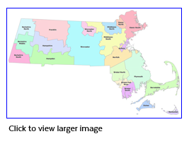
This layer was created by MassGIS from the Municipalities layer. Each town was assigned a REGDIST code, which corresponds to the Registry of Deeds to which the town belongs. Then towns boundaries with the same Registry were dissolved to create the 21 districts. All unnecessary fields were deleted and several fields subjective to the Registries were added. In January 2019, the district boundaries were modified to move the Town of Orange from Worcester to Franklin.
Attributes
The datalayer's polygon attribute table has the following fields:
| Field name | Description |
|---|---|
| DISTRICT | Full name of district |
| REGDIST | Abbreviation of full DISTRICT name |
| REGISTER | Name of Register |
| ADDRESS | Street address of Registry |
| TOWN | Municipality in which the Registry is located |
| ZIP | ZIP Code of address |
| TYPE | Identifies whether Registry is administered by the Secretary of State ("S") or the County ("C") |
| WEBSITE | URL of Registry Web site |
Maintenance
MassGIS maintains this datalayer. Updates will be made after election results are complete and members are sworn in.
Updated in April 2022 to reflect recent edits to the Municipalities layers.