Downloads
Overview
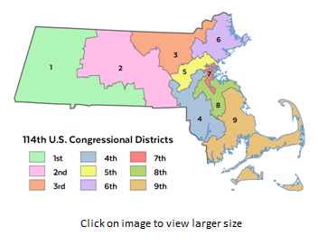
These boundaries took effect in January 2012. The name of the statewide datalayers are CONGRESSMA_POLY and CONGRESSMA_ARC.
Production
Staff at the Massachusetts General Court Special Joint Committee on Redistricting developed this layer with its contractor, Caliper Corp. (Newton, MA), using Maptitude for Redistricting software. MassGIS appended the 1:100,000 coastline and state outline and added the Representatives' name and party attributes.
In March 2018 MassGIS made minor edits to boundaries in Boston to reflect corrected data from the City of Boston. In November 2018 MassGIS made minor edits to boundaries statewide where they were offset enough from survey-based municipal lines to result in address points being assigned to the wrong district. These boundary changes have not been incorporated into U.S. Census geography that forms the basis for this layer. In January 2021, the layer was updated to reflect the results of the latest elections.
Attributes
The CONGRESSMA_POLY attribute table has the following fields:
| FIELD NAME | WIDTH / TYPE | DESCRIPTION |
|---|---|---|
| DIST_NUM | 2 / I | Unique number for each district |
| DISTRICT | 50 / C | District name |
| REP_FIRST | 16 / C | First name of representative |
| REP_LAST | 16 / C | Last name of representative |
| REP_PARTY | 1 / C | Political party of representative ((D) = Democrat) |
| REP | 25 / C | Rep.'s full name and party |
| URL | 50 / C | Web address for Representative |
| DISTRICT | 3 / I | Meeting number of the current Congress (116) |
In the CONGRESSMA_ARC attribute table, the field OUTLINE is coded as follows:
- 0 = internal district boundaries
- 1 = state
- 2 = coastline
Maintenance
*** These data layers have been superseded by the 118th Congressional districts.
MassGIS maintains the layer. In January 2015 the polygon attributes were updated with the information for members of the 114th Congress. Additionally, the layers were renamed, the CD113 field was renamed DIST_NUM, and the DISTRICT field was added to the polygon feature class. In January 2021, the layer was updated with the results of the November 2020 elections.