Downloads
(Downloads includes ArcGIS 10.4 layer files)
Overview
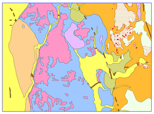
These data layers are part of a comprehensive study by the U.S. Geological Survey (USGS) to produce a statewide digital map of the surficial geology at a 1:24,000-scale level of accuracy. This compilation of surficial geologic materials defines the areas of exposed bedrock, and the boundaries between glacial till, glacial stratified deposits, and overlying early-postglacial and postglacial deposits. The database defines the distribution of nonlithified earth materials at the land surface and differentiates surficial materials of Quaternary age on the basis of their lithologic characteristics, constructional geomorphic features, stratigraphic relationships, and age. The purpose of this study is to provide fundamental geologic data for the evaluation of natural resources, hazards, and land information within the Commonwealth of Massachusetts.
The database contains these three polygon datasets:
- Map Units (SURFGEO24K_MAPUNIT_POLY) - This feature class contains non-overlapping ("surface only") map unit polygons, generalized from SURFGEO24K_MAPUNITOVERLAY_POLY, in which geologic polygons have been clipped through from top to bottom (youngest to oldest) without overlaps; some small sliver polygons have been eliminated.
- Areas of Abundant Outcrop or Shallow Bedrock (SURFGEO24K_OVERLAY_POLY) - This feature class contains areas of abundant outcrop or shallow bedrock overlay polygons and should be displayed with the "surface only" Map Units layer to see underlying geologic features.
- Map Units with Outcrop and Bedrock Overlays (SURFGEO24K_MAPUNITOVERLAY_POLY) - This feature class contains "stacked" (overlapping) map units and shallow bedrock overlay polygons (combining the features from the two layers listed above). The polygons are arranged in order according to superposition. The polygons for till and bedrock are on the bottom and are overlain by the succeeding stratified deposits; these materials are shown everywhere they occur, including beneath postglacial deposits such as swamp deposits, and also beneath water bodies. The postglacial deposits are on top because these materials overlie the other, older deposits. The ArcGIS layer file included with the downloads uses symbol levels to display the components in the correct order.
A fourth dataset, SURFGEO24K_DATASOURCE_POLY, represents the data sources for the map units overlays, by 7.5-minute quadrangle and other geographic areas.
MassGIS also distributes these two tables:
- SURFGEO24K_TBL_DATASOURCES - Detailed data sources
- SURFGEO24K_TBL_DESCOFMAPUNITS - Description of map units
This study, "Scientific Investigations Map 3402," supersedes USGS Open-File Reports 2006–1260–A, –B, –C, –D, –E, –F, –G, and –I, which did not cover the entire state.
Production
Multiple agencies and individuals contributed to this data layer. This map product was prepared in cooperation with the Commonwealth of Massachusetts, Massachusetts Geological Survey and Executive Office for Administration and Finance. U.S. Geological Survey personnel compiled and digitized the geologic units to create the geodatabase.
MassGIS downloaded the data from the USGS site. To improve display performance, MassGIS split the thin till polygons in the Map Units and Map Units with Overlays feature classes by USGS quad and rebuilt the spatial index on each.
Suggested citation:
Stone, J.R., Stone, B.D., DiGiacomo-Cohen, M.L., and Mabee, S.B., comps., 2018, Surficial materials of Massachusetts—A 1:24,000-scale geologic map database: U.S. Geological Survey Scientific Investigations Map 3402, 189 sheets, scale 1:24,000; index map, scale 1:250,000; 58-p. pamphlet; and geodatabase files.
See the complete documentation and the detailed Report Pamphlet (22.4 MB pdf).
Attributes
The polygon attribute tables of SURFGEO24K_MAPUNIT_POLY and SURFGEO24K_MAPUNITOVERLAY_POLY contain the MAPUNIT (Short plain-text identifier of the map unit, and foreign key to DescriptionOfMapUnits table.) and NOTES (longer description of the map unit) fields. Values are as follows:
| MAPUNIT | NOTES |
|---|---|
| af | artificial fill |
| al | flood-plain alluvium |
| alf | alluvial-fan deposits |
| bd | beach and dune deposits |
| bk | bedrock outcrops |
| cb | cranberry bog deposits |
| cph | glacially modified coastal-plain hill deposits |
| d | inland-dune deposits |
| em | end moraine deposits |
| ff | valley-floor fluvial deposits |
| rs | marine regressive deposits |
| sb | areas of abundant outcrop or shallow bedrock (only in the MAPUNITOVERLAY layer) |
| sd-c | glacial stratified deposits, coarse |
| sd-f | glacial stratified deposits, fine |
| sd-fm | glacial stratified deposits, glaciomarine fine |
| sid | stagnant-ice deposits |
| sm | salt-marsh deposits |
| st | stream-terrace deposits |
| sw | swamp deposits |
| t | thin till |
| ta | talus deposits |
| tm | thrust moraine deposits |
| tt | thick till |
| tvt | thick valley till and fine deposits |
Other fields include:
| Field name | Description |
|---|---|
| IDECONF | Identity Confidence. Identity of a feature can be determined using relevant observations and scientific judgment; therefore, one can be reasonably confident in the credibility of this interpretation. |
| LABEL | Plain-text equivalent of the desired annotation for a feature. Same as MAPUNNIT. |
| SYMBOL | Reference to a point marker, line symbol, or area-fill symbol that is used on the map graphic to denote the feature; use with sim3402.style file. Same as MAPUNNIT. |
| DATSRCID | Data Source ID |
| MUPS_ID MUNOVEPOL_ID | Unique polygon ID |
The SURFGEO24K_OVERLAY_POLY table contains the TYPE field, all coded 'sb'. All other fields match those of the two MAPUNIT layers (plus OVEPOL_ID, a unique polygon ID field).
The SURFGEO24K_DATASOURCE_POLY table includes these fields:
| Field name | Description |
|---|---|
| DATASOURCEID | Source of data; foreign key to the SURFGEO24K_TBL_DATASOURCES table. |
| NOTES | Additional information specific to a particular feature or table entry. |
| DATASOURCEPOLYS_ID | Primary key |
The SURFGEO24K_TBL_DATASOURCES table includes these fields:
| Field name | Description |
|---|---|
| SOURCE | Plain-text short description that identifies the data source. |
| NOTES | Additional information specific to a particular feature or table entry. |
| URL | Uniform Resource Locator (URL) or Document Object Identifier (DOI), identifies a document on the World Wide Web. |
| DATASOURCES_ID | Primary key |
The SURFGEO24K_TBL_DESCOFMAPUNITS table includes these fields:
| Field name | Description |
|---|---|
| MAPUNIT | Short plain-text identifier of the map unit. |
| NAME | Name of map unit. Identifies unit within its hierarchical context. |
| FULLNAME | Name of map unit including identification of containing higher rank unit(s). |
| AGE | Geologic time scale age, or may be interpreted (preferred) age calculated from geochronological analysis, not necessarily the date calculated from a single set of measurements. |
| HIERARCHYKEY | String that records hierarchical structure. Has form nn-nn-nn, nnn-nnn, or similar. Numeric, left-padded with zeros, dash-delimited. Each HierarchyKey fragment of each row MUST be the same length to allow text-based sorting of table entries. |
| PARAGRAPHSTYLE | Token that identifies formatting of paragraph(s) within traditional Description of Map Units that correspond to this table entry. |
| LABEL | Plain-text equivalent of the desired annotation for a feature. |
| SYMBOL | Reference to a point marker, line symbol, or area-fill symbol that is used on the map graphic to denote the feature. |
| AREAFILLRGB | {Red, Green, Blue} tuples that specify the suggested color (e.g., "255,255,255", "124,005,255") of area fill for symbolizing MapUnit. Each color value is an integer between 0 and 255, values are zero-padded to a length of 3 digits, and values are separated by commas with no space: NNN,NNN,NNN. |
| AREAFILLPATTERNDESCRIPTION | Text description (e.g., "random small red dashes") provided as a convenience for users who must recreate symbolization. |
| DESCRIPTIONSOURCEID | Source of map-unit description; foreign key to the SURFGEO24K_TBL_DATASOURCES table. |
| GEOMATERIAL | Categorization of map unit based on lithologic and genetic character, term selected from NGMDB standard term list defined in Appendix A of GeMS documentation. |
| GEOMATERIALCONFIDENCE | Describes appropriateness of GeoMaterial term for describing the map unit. |
| DESCRIPTIONOFMAPUNITS_ID | Primary key |
| DESC_BRIEF | MassGIS added this shortened version of the original DESCRIPTION field, which was of type NCLOB, a data type not supported in DBF exports. MassGIS distributes an Excel file that contains the original fields. |
Displaying the Data

MassMapper includes the Map Units (SURFGEO24K_MAPUNIT_POLY) and Areas of Abundant Outcrop or Shallow Bedrock (SURFGEO24K_OVERLAY_POLY) layers, which should be displayed together (with the OVERLAY layer on top). The group layer files included in the downloads at the top of this page display the data in this way.
When displaying the Map Units with Outcrop and Bedrock Overlays (SURFGEO24K_MAPUNITOVERLAY_POLY) layer in ArcGIS, use the layer file MassGIS includes in the downloads. The .lyr uses symbol levels to display the components in the correct order.
For better context, USGS recommends displaying the data with this basemap with features such as roads, elevation contours, shaded relief, hydrography, and geographic annotation. At map scales of 1:15,000 or larger (i.e., more zoomed in), USGS recommends overlaying images of 1:24,000 topographic quadrangle basemap features. These images were scanned specifically for this surficial geology project and were used as the base for on-screen digitizing of geologic map units. See the web service MassGIS created with these images.
>> View the data in ArcGIS Online and MassMapper.
Maintenance
The USGS maintains the data.
These data layers replace the four feature classes that MassGIS previously distributed: SURFGEO24K_EPG_POLY, SURFGEO24K_PG_POLY, SURFGEO24K_SD_POLY, and SURFGEO24K_TB_POLY.