Downloads
Overview

MassGIS had received quarterly updates of these data as part of its license for the HERE (Navteq) core map release (streets and related data); however, that license has expired. These ZIP Code boundaries are aligned to the street centerlines of the Q2 2018 HERE product (with a release date of April 1, 2018) and use a then-recent USPS source file.
In March 2024, MassGIS modified the boundaries for all ZIP Code areas in Boston based on the U.S. Postal Service's ZIP Code Look Up by Address website. MassGIS also added polygons for ZIP Codes 02199 and 02203.
These ZIP Code boundaries are provided as delivered by HERE (with two minor edits by MassGIS, as discussed below). MassGIS makes no claims to the accuracy of the information in this file. These ZIP Code boundaries do not topologically align with MassGIS' Level 3 parcel data and are frequently revised and subject to change. These boundaries should not be confused with ZIP Code Tabulation Areas (ZCTA) provided by the U.S. Census Bureau.
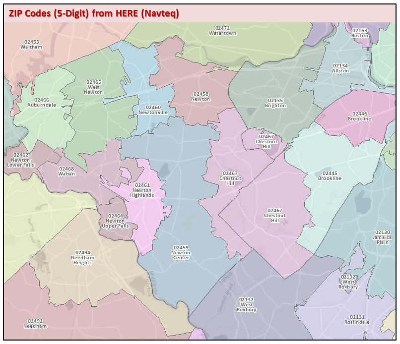
The layer is named ZIPCODES_NT_POLY.
Important notes regarding the geographic nature of ZIP Codes:
Five-digit ZIP Codes were developed by the USPS and first introduced in 1963 for efficient mail delivery (the term ZIP stands for Zone Improvement Plan) but are difficult to map with complete certainty. In most cases, addresses in close proximity to each other are grouped in the same ZIP Code, which gives the appearance that ZIP Codes are defined by a clear geographic boundary. However, even when ZIP Codes appear to be geographically grouped, a clear ZIP Code boundary cannot always be drawn because ZIP Codes are only assigned to a point of delivery and not the spaces between delivery points. In areas without a regular postal route or no mail delivery, ZIP Codes may not be defined or have unclear boundaries.
The USPS does not maintain an official ZIP Code map. The Census Bureau and many other commercial services will interpolate the data to create polygons to represent the approximate area covered by a ZIP code, but none of these maps are official or entirely accurate. Please see this good discussion of the issues of mapping ZIP Codes.
Production
HERE (the company that now includes data products that were formerly branded as "Navteq") maintains several versions of postal code data. The version distributed by MassGIS is an extract of HERE's nationwide "Un-generalized, without water holes, with County" layer. This dataset displays water features on coastlines but does not include water holes, and includes ZIP Code boundaries split at County boundaries. The HERE Postal Code Boundaries product does not have void areas in postal coverage, even if such non-delivery areas exist in reality (such as a remote mountainous area). This is by design, for aesthetic purposes and to ensure that a postal code is assigned to all geographic areas.
MassGIS added the 02222 ZIP Code in Boston and made minor edits to the boundary of the 02108 and 02114 ZIP Codes in Boston based on ancillary address data. MassGIS also projected the data into the Massachusetts State Plane Mainland coordinate system.
Attributes
The layer's polygon attribute table has the following fields:
| Field | Type/Size | Description |
|---|---|---|
| POSTCODE | C/10 | 5-digit ZIP Code |
| PC_NAME | C/35 | Name of postal (ZIP) code - for non-unique and PO box postal codes this represents the post office name and for unique organizations postal codes this represents the company or large user name |
| PC_TYPE | C/19 | Postal code classification for each postal code reference. NON UNIQUE - General delivery postal code PO BOX - Post Office box postal codes UNIQUE ORGANIZATION - Company or campus postal code |
| PA_NAME | C/35 | Postal area name (Last line city name from USPS sources) |
| PA_FIPS | C/5 | Postal Area (Last Line City) Federal Information Processing Standards (FIPS) code |
| CITY_TOWN | C/80 | Primary municipality of the ZIP Code polygon. (A single ZIP Code may overlap multiple cities and towns) |
| COUNTY | C/35 | County name within which the applicable postal code falls |
| AREA_SQMI | Double | Area in square miles |
Maintenance
Because MassGIS has not maintained the licensing, the data may be outdated in some parts of the state.