Town: Fall River, Freetown
Acreage: 13,600
Wildlife Management Zone: 11
Description
The 13,600-acre Southeastern Massachusetts Bioreserve combines the Freetown State Forest, Copicut Wildlife Management Area, TTOR’s Copicut Woods, and eastern parts of the city’s watershed lands, including the Copicut Reservoir. The Bioreserve is managed in a cooperative and consistent manner that preserves the functionality of a large-scale ecosystem and promotes biodiversity, conservation, water supply protection, sustainable forest management, as well as scientific, educational, and recreational opportunities. For further information on public access to Bioreserve lands, please contact the appropriate landowner as depicted on the map:
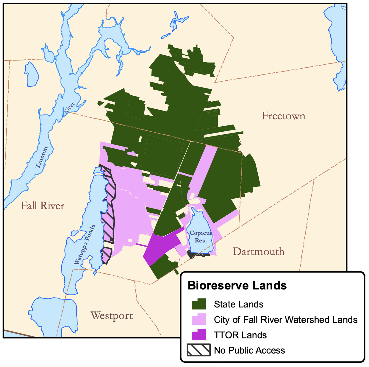
- MassWildlife Southeast District office: (508) 759-3406
- Mass. Department of Conservation and Recreation: (508) 644-5522
Freetown-Fall River State Forest - Trustees of Reservations: (508) 679-2115
Copicut Woods - City of Fall River Water Department: (508) 324-2749
Recreation
This table shows which activities are allowed on each property type within the Bioreserve. Activities marked with an "X" are permitted.
| Activity | City of Fall River | Trustees | State Lands (State Forest and WMA) |
|---|---|---|---|
| Hiking | X | X | X |
| Cross country skiing | X | X | X |
| Horses | – | – | X (except near water supply areas) |
| Dirt bikes | – | – | X (in State Forest on designated trails only) |
| ATVs | – | – | – |
| Camping | – | – | – |
| Snowmobiles | – | – | X (on existing roads) |
| Hunting | X (in designated areas with some limitations) | X (on Shockley Lot west side of Yellow Hill Rd) | X |
| Fishing | X (Copicut Reservoir shoreline fishing only. No access on Copicut Dam. No fishing or public access in North Watuppa Pond.) |
N/A | X |
| Sports dog training | X | – | X |
| Special events | – | X (special permit required) | X (special permit required) |
| Dog walking | – | X | X (see WMA regulations) |
About Wildlife Management Areas
WMAs are intentionally wild, visitors will find natural landscapes rather than maintained trails.
MassWildlife owns and manages over 220,000 acres of land to conserve fish and wildlife habitats and provide access for outdoor recreation. All WMAs are open to hunting, fishing, trapping, and other outdoor recreation activities. Visit the MassWildlife Lands Viewer for an interactive map of MassWildlife properties.
You can support land protection in Massachusetts. Contributions to the Wildlands Fund help pay for the cost of acquiring wildlife habitat. Learn more about the Wildlands Fund.