- Division of Fisheries and Wildlife
Media Contact
Media Contact, MassWildlife
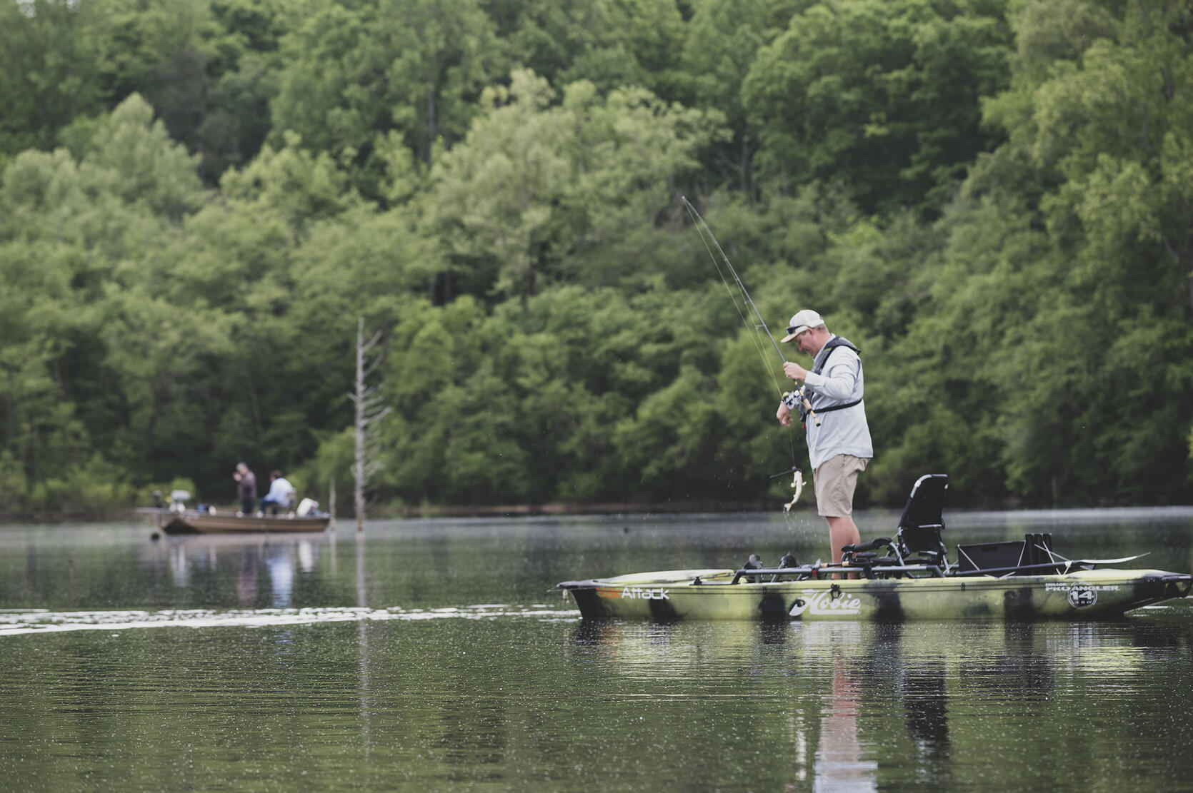
Paddling a kayak or canoe is a great way to experience the outdoors—whether you're seeking solitude, watching for wildlife, or casting for a keeper. In an ongoing effort to improve fishing resources for anglers in the Commonwealth, MassWildlife has upgraded the Go Fish MA! digital fishing map. We’ve added hundreds of new cartop boat launch locations, making it easier than ever to find places to kayak or canoe and enjoy a day on the water.
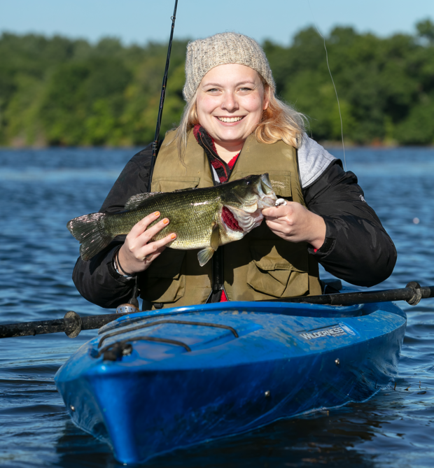
Paddling provides a unique opportunity to experience nature from the water, giving you close-up views of birds and other wildlife in their natural habitats. For anglers, canoeing and kayaking opens up even more possibilities. These small, maneuverable boats allow you to reach hidden fishing spots on lakes and ponds that larger boats can’t access, increasing your chances of a good catch. Whether you’re chasing bass in a quiet cove, casting for trout in the deep water, or fishing from a remote shoreline, paddling gives you a versatile platform to pursue your favorite pastime.
More about Go Fish MA!
The Go Fish MA! digital fishing map helps you discover waterbodies across Massachusetts that are perfect for small boat adventures. Map features include cartop and trailered boat launch locations, directions, links to waterbody descriptions, bathymetric maps (depth), trout stocked waters, and bait shops. You can filter the map to fine tune your search. Visit Go Fish MA! to start planning your next trip.
Top 10 fishing spots to explore by boat
Dark Brook Reservoir, Auburn
Dark Brook Reservoir is a 243-acre warmwater impoundment split into two basins by the Massachusetts Turnpike. The shallow southern basin and deeper northern basin are connected by a culvert you can paddle through. Both basins have parking and cartop boat launches. The reservoir offers excellent fishing for largemouth bass and chain pickerel, along with bluegill, black crappie, white perch, and yellow perch. Learn more about Dark Brook Reservoir.
Holland Pond, Holland
Also known as Lake Siog, Holland Pond is a 70-acre impoundment of the Quinebaug River. It averages 10 feet deep with a maximum depth of 24 feet; visibility is typically 4 to 5 feet. Much of the shoreline is undeveloped. Lake Siog Park, on the southern shore, offers a swimming beach and picnic areas. Canoes and kayaks can launch from three locations. Despite its small size, Holland Pond produces northern pike, largemouth bass, chain pickerel, common carp, and black crappie. Largemouth bass in the 1–2 pound range are common, with occasional catches nearing 5 pounds. Carp up to 15 pounds have also been reported. Trout fishing is best in early spring and fall, coinciding with annual stockings. Learn more about Holland Pond.
Moosehorn Pond, Hubbardston
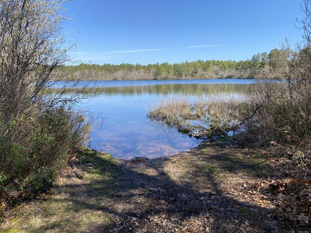
Moosehorn Pond is a 110-acre undeveloped great pond surrounded by conservation land. The northern section is a bog with multiple islands. The average depth is 8 feet, with a maximum depth of 21 feet. Channels in the northern bog offer canoe access for observing unique plant life and wildlife. MassWildlife manages a gravel ramp for cartop boats and a 10-car parking area. Largemouth bass, pickerel, yellow perch, and black crappie are abundant. Learn more about Moosehorn Pond.
Knops Pond/Lost Lake, Groton
Knops Pond and Lost Lake are connected waterbodies popular for fishing, boating, water skiing, and swimming. The maximum depth is just over 30 feet, but the average depth is less than 10 feet. The water is clear and aquatic vegetation is abundant in the large shallow sections. A concrete boat ramp and parking area are located on the northeast side of Lost Lake. The lake is stocked with trout in spring and fall and also offers excellent fishing for largemouth bass and panfish. Learn more about Knops Pond and Lost Lake.
Watershops Pond, Springfield
Also known as Lake Massasoit, this 180-acre impoundment of the Mill River provides a quiet paddle near downtown Springfield. The city manages shoreline access at Alden Street for canoeing, kayaking, and shore fishing. Additional cartop access is available at Thomas J. Sullivan Park and from Wilbraham Road. While water clarity is low and weeds can be challenging, patient anglers will find success with bass, carp, and panfish. The shoreline has excellent structure—downed trees and rocks—supporting plentiful 1–2 pound largemouth bass. Carp over 20 pounds have been caught. Learn more about Watershops Pond.
Agawam Mill Pond, Wareham
Agawam Mill Pond is a 145-acre impoundment of the Agawam River, with an average depth of 4 feet and a maximum of 13 feet. At the southern tip of the pond there is a concrete boat ramp suitable for trailered craft, along with parking and shore fishing access. Additional cartop access is available at Whitlock’s Landing off Glen Charlie Road. The pond supports largemouth and smallmouth bass, chain pickerel, common carp, black crappie, white and yellow perch, bullhead, and sunfish. Learn more about Agawam Mill Pond.
Cheshire Reservoir, Cheshire and Lanesborough
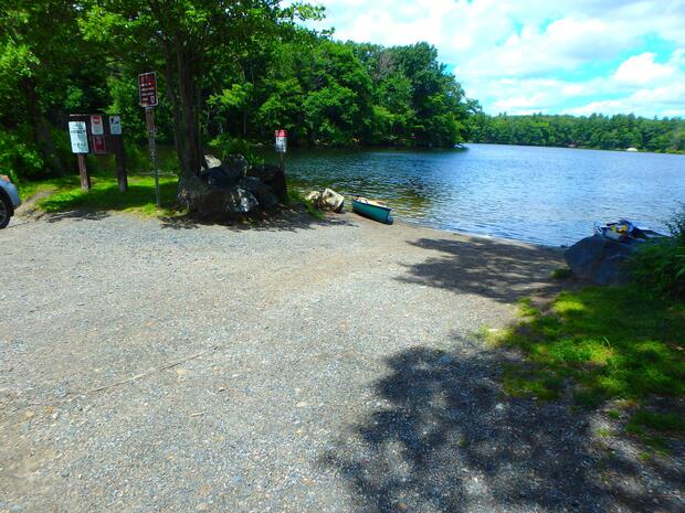
Cheshire Reservoir is a 575-acre impoundment of the Hoosic River with three basins separated by causeways. The northern basin is 295 acres (avg. depth 7 ft, max. 14 ft), the middle basin is 187 acres (avg. depth 5 ft, max. 10 ft), and the southern basin is 93 acres and very shallow. Aquatic vegetation becomes dense in summer, especially in shallower areas. The MA Department of Conservation and Recreation (DCR) manages a concrete boat ramp and dock on the north basin and a gravel ramp on the middle basin. Additional shore fishing is available along the rail trail on the eastern shore of the northern and middle basins. The reservoir is known for its quality largemouth bass, yellow perch, and northern pike. Learn more about Cheshire Reservoir.
Otis Reservoir, Otis and Tolland
Otis Reservoir is a 1,036-acre great pond located on the Otis/Tolland town line, averaging 18 feet deep with a maximum depth of 52 feet. Water clarity is 8–10 feet, and vegetation is limited to coves. Much of the northern shoreline is surrounded by homes; the southern portion lies within Tolland State Forest and is undeveloped. DCR manages a large concrete boat ramp near Tolland State Forest Campground. Two dirt access points for cartop boats are available—one on the north shore of the eastern bay and another at the southern tip. The reservoir is popular for trout fishing, but also holds chain pickerel, crappie, sunfish, white perch, and yellow perch. Learn more about Otis Reservoir.
Ashland Reservoir, Ashland
Ashland Reservoir is a 173-acre impoundment of Cold Spring Brook located within Ashland State Park. It has an average depth of 24 feet and a maximum of 50 feet. The undeveloped shoreline provides a natural setting for recreation. DCR manages a small gravel ramp on the southern tip suitable for trailered and cartop boats. Additional access is available from the western shore. Trout are caught year-round, especially in spring and fall. Largemouth bass in the 10–14 inch range are abundant near the drop-offs along the western shore. Learn more about Ashland Reservoir.
Rico Lake, Taunton
Rico Lake is a 195-acre impoundment of Furnace Brook, and lies almost entirely within Massasoit State Park. The shoreline is forested, and motorized boats are prohibited. DCR manages two dirt/gravel launches for cartop boats on the northern end. The lake features many small bays and islands with excellent structure. Anglers frequently catch largemouth bass, chain pickerel, yellow perch, black crappie, sunfish, and bullhead. Learn more about Rico Lake.