Project Description
Location: Ipswich
Purpose:
- Demonstrate the benefits of combining a wide range of low-impact development (LID) principles and techniques into a single development.
- Provide a model for developers and municipal officials looking for creative approaches to stormwater management.
- Monitor and measure the runoff from the demonstration site.
- Reduce nonpoint source pollution and increase base flow to nearby streams.
Details: Partridgeberry Place was constructed as a new 20-lot subdivision on 38 acres in the Ipswich River watershed. One of the first projects to be built in Ipswich under the town's Open Space Preservation (Cluster) Zoning bylaw, this project preserves 74 percent (28 acres) of the 38-acre site as open space. LID features include :
-
compact site design, with single-family houses clustered on lots less than 0.2- acres in size
-
minimization of land disturbance
-
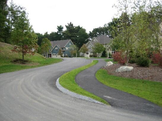
reduced pavement areas, including an 18-foot-wide subdivision road
-
reduced setbacks, resulting in shorter driveways and smaller yards
-
grass pavers for overflow parking*
-
an open grass swale that drains to a central rain garden
-
rain gardens on some individual house lots
-
reduced lawn areas
-
use of native, drought-resistant vegetation for landscaping
-
infiltration of roof runoff through drywells.
A shared septic system makes possible the smaller lot sizes while still allowing on-site recharge of wastewater. Collectively, these LID techniques were designed to retain, naturally filter, and infiltrate stormwater on site and improve the quality of the runoff that does occur.
* After the conclusion of the monitoring study, the grass pavers were replaced with a road border of loosely-packed river stone, which drains to the central rain garden.
Developer: The Martins Companies, Danvers, MA
Design/Engineering: Meridian Associates, Beverly, MA
Original Cluster Site Plan: Randall Arendt, Greener Prospects, Narragansett, RI
Monitoring and Modeling Study: Geosyntec Consultants, Acton, MA
Photos and Site Plan
Milestones
- Subdivision construction completed, November 2006
- The following LID features were incorporated into the original subdivision design, with funding from DCR under the EPA grant:
-
Five rain gardens (four on individual lots and one large central one)
-
Grass pavers along the edge of the loop road, lining the grass swale that drains to the central rain garden*
-
Grass pavers at the entrance to the shared septic area to prevent compaction by equipment
-
- The following LID features were incorporated into the original subdivision design, with funding from DCR under the EPA grant:
- Runoff monitoring and modeling study conducted April through September 2008.
* After the conclusion of the monitoring study, the grass pavers were replaced with a road border of loosely-packed river stone, which drains to the central rain garden.
Costs
Design and installation of the additional LID features incorporated into the original cluster subdivision design: $90,000
Monitoring and modeling study: $95,250
Data Collection and Analysis
Geosyntec Consultants conducted a study to characterize runoff patterns on the developed portion of Partridgeberry Place and in an undeveloped area of forest, during different storm sizes and intensities. These patterns helped calibrate a hydrologic model, which was developed to compare simulated runoff between four alternative development conditions on the same site:
- Partridgeberry Place as constructed
- A conventional subdivision (the conventional layout came from original plans submitted for the property before the project was redesigned as a cluster development).
- A cluster subdivision with the same layout as Partridgeberry Place but with conventional stormwater management
- A fully forested site
Key Results and Conclusions
-
Total runoff and peak runoff from all development scenarios were higher than from the forested condition.
-
Among the three development scenarios, runoff patterns from the LID Subdivision (Partridgeberry Place, as constructed) most closely mimicked those of the forested condition.
-
Runoff patterns from the LID subdivision and the cluster subdivision (which preserved open space but used conventional stormwater management) were similar to each other, and were both more similar to runoff from the forested condition than to runoff from the conventional development.
-
Preservation of open space was found to be the driving factor in reducing peak and total runoff.