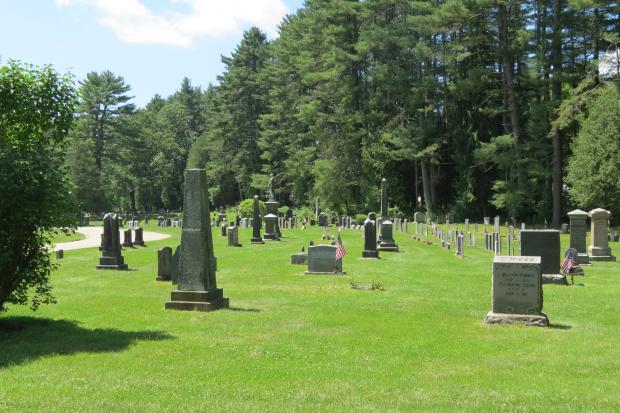
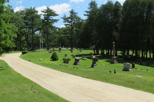
About the Cemetery
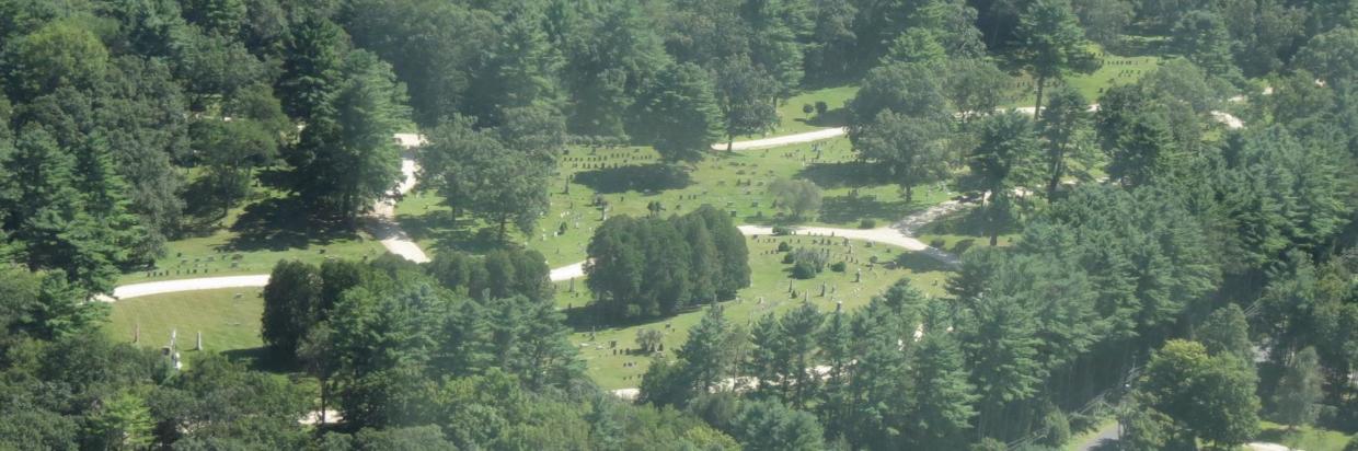
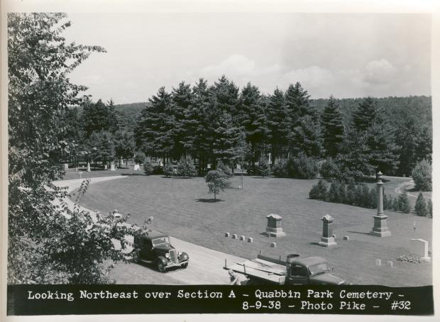
The Quabbin Park Cemetery (QPC) was built as part of the Quabbin Reservoir project. It was developed between 1931 and 1932 by the Metropolitan District Water Supply Commission (MDWSC) to receive the remains of 6,601 graves removed from the Swift River Valley.
Altogether, 7,613 graves were moved from 34 cemeteries scattered throughout eight towns. A majority of these were moved to the QPC, while some graves were relocated to cemeteries in other towns by choice of families. This site was developed on 82 acres of former farmland and woodland south of Route 9 in Ware on land outside of the Quabbin Reservoir watershed. Descendants are able to access their ancestors’ gravesites at this site which is easily reached and is outside of the flooded valley.
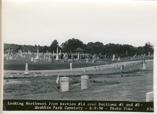
Prior to moving any graves, the MDWSC plotted and mapped all the known cemeteries on the 81,000 acres of land bought for the project. Photographs were taken of every gravestone and all data was recorded. Families with recorded deeds were contacted and asked where they wanted to have their ancestors’ remains reburied. If the family chose Quabbin Park Cemetery the bodies were reburied by the MDWSC in new lots in the same position as their original lot layout. Residents were not charged for reburial at the new cemetery. If they chose to have family members reburied at other cemeteries, they were not charged for the transport, although they would have had to purchase burial lots there. Additionally, if a family owned unused burial lots at the former cemeteries they were entitled to lots in the new cemetery.
Along with graves, the MDWSC moved War Memorials and markers from the former Swift River valley towns of Dana, Enfield, Greenwich, and Prescott to the QPC. These monuments greet visitors as they enter the cemetery grounds. They have come to memorialize the four towns themselves and are an integral part of the Memorial Day Services at Quabbin Park Cemetery, held the Sunday before the observed Memorial Day holiday. In addition to honoring Veterans and those who lost their lives in service to our country, the ceremony also recognizes the sacrifices made by former residents of the Swift River Valley so that the Quabbin Reservoir could be built.
The entrance to Quabbin Park Cemetery on Route 9 is marked by two stone columns that include stones from the foundation of every church in the valley. Bronze plaques were also placed on these columns, listing the name of every cemetery removed for the reservoir project.
It is still an active cemetery, however purchase of burial lots is restricted to former residents of the four towns, their direct descendants, or employees and former employees of DCR.
Vital records for the four disincorporated towns are housed at the DCR Quabbin Administration Building in Belchertown. Additional information about the Quabbin Park Cemetery and the location of gravesites is available to the public on request through the Quabbin Visitor Center. The Center is located within the Administration Building which can be accessed through the Main (or West) Entrance, three miles west on Route 9 from the Quabbin Park Cemetery.
Quabbin Cemetery Guided Tour
The Quabbin Visitor Center has developed an on-line guided tour of Quabbin Cemetery. This interactive program provides a history of the cemetery and the Swift River Valley along with details at 27 individual places within the cemetery.
There are also instructions on how to use an app on your cell phone to use while visiting the cemetery.
Quabbin Park Cemetery Map
Click here for the Quabbin Park Cemetery Map.
To find a particular lot, refer to the three or four digit location number which can be obtained from the Quabbin Visitor Center. The first one or two digits refer to the Section. The last two digits refer to the lot number within that Section (e.g., #545 would be Lot 45 within Section 5; #1473 would be Lot 73 within Section 14).
Use the Quabbin Park Cemetery Interactive Web App to further explore this map and lots more information.
Additional Resources
-
Open PDF file, 2.86 MB, Quabbin Park Cemetery Map (English, PDF 2.86 MB)
Quabbin Park Cemetery Interactive Web App

DCR has digitized a vast amount of information related to the Quabbin Park Cemetery and is making it available to the public through an online program. The Quabbin Park Cemetery ArcGIS Experience is a comprehensive collection of cemetery data.
In this app, you can:
- Move around the cemetery on an interactive map.
- Search gravesites by Name.
- Search gravesite ownership.
- Create tables of information.
- Search for ownership of deeds and lots.
- Search for burials by name and display the original burial card and map of grave location.
- Search for burials transferred from the 37 former cemeteries to locations other than Quabbin Park Cemetery.
- Apply for permit to clean cemetery stonework.
- Find additional history and contact information.
Quabbin Park Cemetery Rules and Regulations

Please be respectful of this cemetery and the gravesites within its boundaries.
- Dogs and pets are prohibited
- Headstone rubbings are prohibited except by direct descendants
- All flower containers left on any burial lot may be removed by cemetery staff when they become unsightly
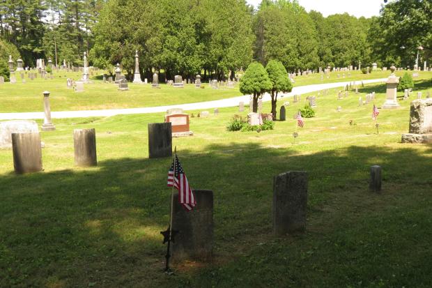
- The Ware American Legion Post 123 ensures that flags are in place on veteran's gravesites and will replace any flags as needed throughout the year. Please contact the Post Commander at 413-967-9762 with questions about this service.
The following are prohibited except by prior written approval of the DCR Quabbin Regional Director:
- Trees, shrubs, or flowers planted upon any burial lot
- Curbing, projecting corner posts, foot stones, fences, hedges, walks, artificial steps and mounds about or on any burial lots
- Monuments, effigies, cenotaphs, or other structures (e.g. wooden crosses, cement benches) upon a burial lot
Additional Resources
-
Open PDF file, 4.5 MB, Quabbin Park Cemetery Management Plan (English, PDF 4.5 MB)
Historic Cemetery Photographs
The Massachusetts Department of Conservation and Recreation's Archives and the Massachusetts Water Resources Authority Library, in cooperation with the Massachusetts State Archives, and DCR's Office of Watershed Management, have worked with the Boston Public Library to make thousands of historic photographs from the construction of the water supply system available online.
One collection consists of 2,083 photographic prints (5 x 7 inches) and 26 engineering plans of the former Swift River Valley cemeteries and the current Quabbin Park cemetery.
Click here for Quabbin Cemetery Historic Photograph Collection
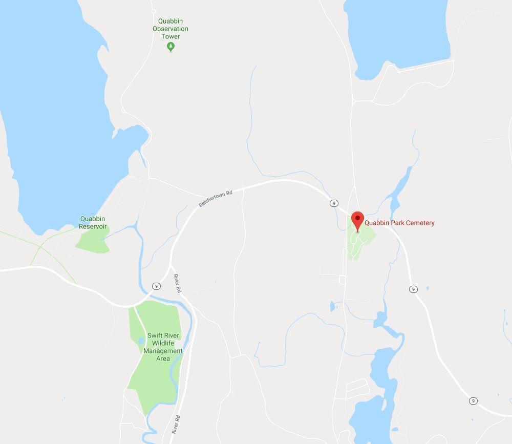
Directions
The Quabbin Park Cemetery is on Rt. 9 in the town of Ware.
Click here for google map directions.
Lat/Long coordinates: 42.281794, -72.308542