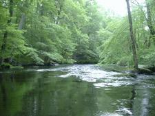
Three Mile River Watershed ACEC Designation Document
Approximate Acreage: 14,276 acres
Watershed(s): Taunton River
Municipalities (acres; % of ACEC): Dighton (125; <1%), Norton (5,400; 38%), and Taunton (8,751; 61%)
The resources of the Three Mile River Watershed ACEC are located in portions of two sub-watersheds – the Three Mile River sub-watershed, located principally in Norton, which includes portions of the Wading River and the Rumford River, and in Taunton and Dighton; and headwaters of the Segreganset River sub-watershed in Taunton. Including the adjacent Canoe River Aquifer and Hockomock Swamp ACECs, designated previously in Norton, Taunton, and seven other towns, these three ACECs create the second largest contiguous area to receive this special state recognition. Combined, they cover a total of 48,425 acres. The area is part of the proposed Taunton Wild and Scenic River federal designation.
The area provides important surface water and ground water inputs to public drinking water supplies to local and downstream waters and communities. Rare species habitats for 12 state-listed species (including one federally designated as Threatened and several considered globally rare) are located throughout the ACEC. Priority Habitats for rare species cover approximately 1,999 acres or 14% of the area. A total of 13,486 acres (nearly 95%) of the ACEC are comprised of the habitats designated by the Division of Fisheries & Wildlife’s Natural Heritage & Endangered Species Program (NHESP) as BioMap Core Habitat and Supporting Natural Landscapes, and as Living Waters Core Habitat and Critical Supporting Watersheds. The Three Mile River watershed contains a large hydrologically connected area of small tributaries, forested wetlands, and unique and valuable wetlands of rare floodplain and riparian forests.
Public municipal and private non-profit open space (including conservation and agricultural preservation restrictions) totals approximately 1,642 acres, or 12% of the ACEC (818 acres in Norton, 803 acres in Taunton, and 22 acres in Dighton). The largest of these is the Boyden Wildlife Refuge in Taunton. Approximately 10,878 acres or 77% of the ACEC is comprised of forest, non-forested wetlands, and open lands and farmland according to the state’s 1999 Land Use data. More than 150 historic sites and districts and numerous important archaeological sites also are within the ACEC.
Water bodies included (partially or entirely) in the ACEC
- Lakes, Ponds: Goose Branch Pond (Norton); Meadow Brook Pond (Norton); Mount Hope Mill Pond (Taunton); Oakland Pond (Taunton); Segreganset River Pond (Taunton); Three Mile River Impoundment (Taunton); and Willis Lake/Pond (Taunton).
- Rivers, Streams, Brooks, Creeks: Fall Brook (Taunton); Meadow Brook (Norton, Taunton); Three Mile River (Dighton, Norton, Taunton); Wading and Rumford Rivers (Norton); and other unnamed streams and brooks.
Maps
Three Mile River Watershed ACEC
Maps are intended to be used with the written boundary description contained in the ACEC designation document. The mapped boundary is not to be used by itself for definitive ACEC boundary delineation or regulatory interpretation. For review of site-specific projects in or bordering the ACEC, determinations must be made in the field by a certified professional in consultation with the appropriate Conservation Commission(s) and ACEC Program Staff.
