An important tool in assessing statewide forest health is aerial survey mapping. The DCR’s Forest Health Program conducts as annual aerial survey of the state's forests. This entails a fly over of the entire state during which forest health issues are visually detected and digitally mapped by forest health specialists. All mapped areas are then ground surveyed to determine the primary cause of forest damage.
The primary agents causing damage to trees across the state can dramatically change from year to year; the aerial survey provides us with vital datasets that allow us identify our greatest threats and concerns for forest health. Forests are dynamic systems and forest health is strongly influenced by many external factors. Weather and climate conditions can cause direct damage to trees, as well as, indirectly altering forest insect and disease populations. Additionally, forests are impacted by a multitude of anthropogenic disturbances: changes in land use, alteration to forest composition, and the introduction of non-native species.
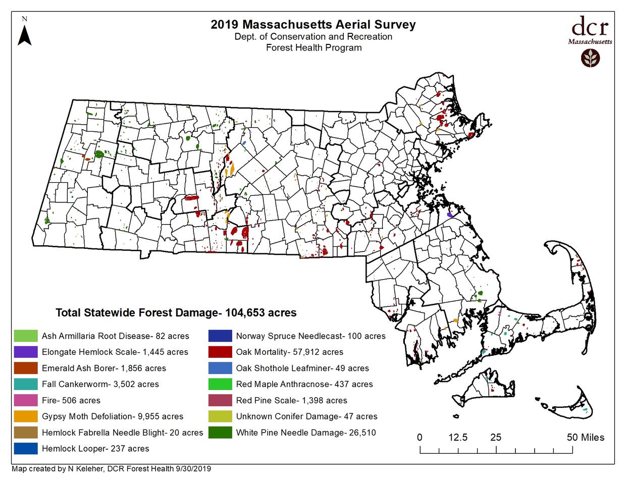
2019 Annual Aerial Survey
Below are the results of the 2019 aerial forest health survey. The greatest amount of damage observed was oak mortality and decline caused by the severe gypsy moth feeding in 2016-2018. Additionally, there was a high instance of white pine needle damage across the state caused by multiple native fungal pathogens.
Additional Resources
-
Open PDF file, 959.21 KB, 2019 Aerial Survey (English, PDF 959.21 KB)
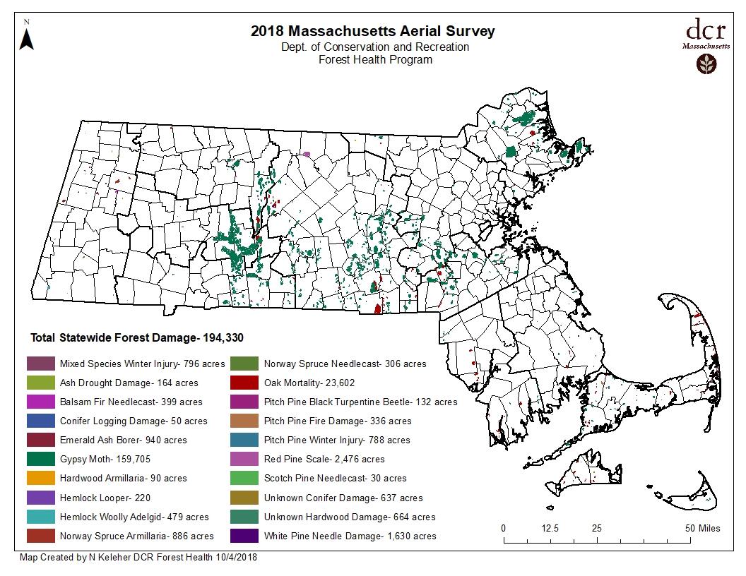
2018 Annual Aerial Survey
Below are the preliminary results of the 2018 aerial forest health survey. The greatest amount of forest damage in 2018 was caused by gypsy moth defoliation of oaks and other hardwood tree species. Additionally, the compounded stress factors of drought and multiple years of defoliation have caused pockets of tree mortality across the state. The acreage numbers shown may differ from final reported acreage damage.
Additional Resources
-
Open PDF file, 179.06 KB, Spongy Moth Survey 2022 (English, PDF 179.06 KB)
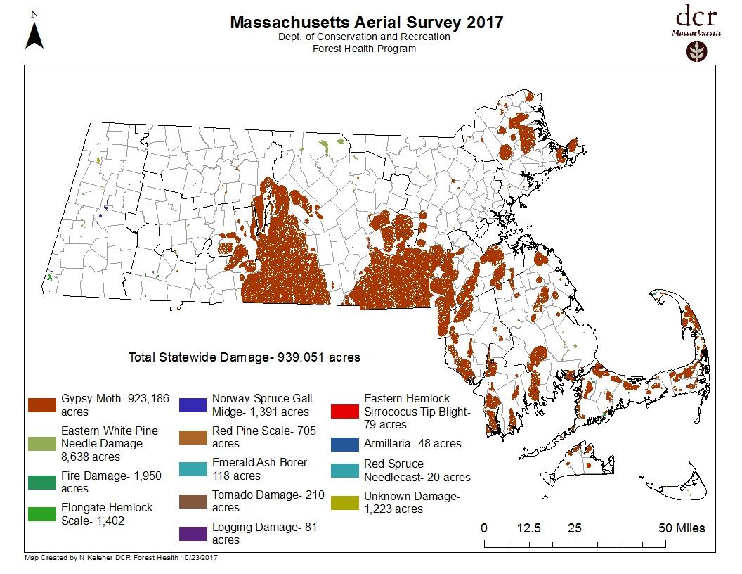
2017 Annual Aerial Survey
Below are the map results of the 2017 aerial survey, forest damage is presented in acres by damage causing agent. In 2017, the greatest damage was caused by the gypsy moth, which had a population boom that result in the defoliation of over 923,000 acres.
Additional Resources
-
Open PDF file, 847.97 KB, 2017 Forest Health Aerial Survey (English, PDF 847.97 KB)