Downloads
Download the imagery:
Raster Catalog inside a File Geodatabase (2.69 GB)
(for use in ArcGIS 9.2 and beyond, from MassGIS).
Original georeferenced tiff images (from UMass)
Overview
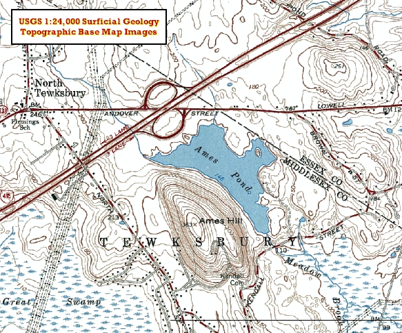
The image layer was created for the purpose of displaying basemap features (roads, elevation contours, water and cultural features, and labels) atop the geology data at medium and large scales. Dates of the paper maps that were used to create this layer range from 1944 to 1977, statewide, as 188 maps across the state were scanned. Imagery in MassGIS' layer is available for quad sheets for which the USGS has published 1:24,000 surficial geology data, as indicated in that layer's status map.
MassGIS stores the data in an ArcSDE Raster Catalog named IMG_USGSQUAD_SGBASE. When the tiff images downloaded from the USGS were loaded into the catalog, index value 1 (the white background -- RGB 255,255,255) was set to be Nodata.
Production
Unfolded copies of the paper maps were scanned at 400 dpi as a 24-bit color map and saved as a jpeg. Marginalia was cropped to the map border in Adobe Photoshop. The raster image was processed using the Auto Level, Gaussian blur (radius = 0.5 to 2 pixels), and unsharpen mask tools in Adobe Photoshop then converted to a 256 color index RGB image. Unwanted colors such as pink urban areas and green forests were removed using the Color Range tool in repeated trials. The cleaned image was saved in tiff format.
The cropped and cleaned tiff image was loaded into ArcGIS 9.1 and georeferenced to the interior and exterior latitude and longitude tick marks on the map. This included approximately 6 to 9 reference points per map. A second order transformation was performed. An RMS of <6 meters was specified for georeferencing. Images were rectified. All maps are georeferenced to Mass State Plane coordinates, North American Datum of 1983. Details regarding the scanning and georeferencing process are available upon request.
Most quads were processed by staff at the University of Massachusetts Amherst, Department of Geosciences. Others were processed by staff at MassGIS and the USGS. Quads in area A (see status map) were further processed by USGS to set all white background pixels to have the same red/green/blue (RGB) values, so that a single color index value could be converted to nodata in the SDE version of the data; this allowed the background to be transparent and the geology data to appear underneath the imagery. When importing data into ArcSDE, only one color index value may be set to be transparent nodata.
Displaying the Data
In order for the basemap features on the imagery to properly overlay the surficial geology features, the white "background" on the maps must be displayed transparently. When using the SDE layer, this is set automatically. If you choose to use the original tiff images, available by quad in ArcMap, be sure to use the layer file, if included.
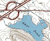
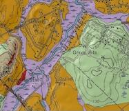
The layer file sets the background pixels to be displayed with no color. If no layer file is included, users will need to go to the layer's properties, Symbology tab, Show: Colormap, and change symbol 1 (or any other white background symbol) from white to No Color and apply the change. The imagery will then lay over any other vector data as a transparent base map. The imagery appears best at scales of 1:15,000 and larger (more zoomed in). At right is an example of the imagery displayed transparently atop vector surficial geology data (click on the image at right to enlarge).
Maintenance
USGS maintains the data and MassGIS will add to the IMG_USGSQUAD_SGBASE raster catalog as new geology data become available. The most recent update to this layer was in August 2015. Review more information.